~~~~~~~~~~~~~~~~~~~~~~
TABLE OF CONTENTS
* Daily Celestials (Sun/Moon Data)
* Weekly Weather Nutshell
* Morning Discussion
* TIP: Scroll below for sections, or read all
~~~~~~~~~~~~~~~~~~~~~~
YOUR DAILY CELESTIALS
~~~~~~~~~~~~~~~~~~~~~~
STAR:
–OUR STAR ROSE AT: 5:56am this morning
–OUR STAR SETS AT: 7:41pm this evening
–TOTAL DAYLIGHT TIME: 13 hours and 45 minutes
MOON:
–OUR MOON RISES AT: 7:40pm this evening
–MOON RISE DIRECTION: East-Southeast
–OUR MOON SETS AT: 6:00am tomorrow morning
–MOON SET DIRECTION: West-Southwest
–MOON PHASE: FULL PINK MOON TONIGHT
~~~~~~~~~~~~~~~~~~~~~~
A NOTE FROM OUR SPONSOR
~~~~~~~~~~~~~~~~~~~~~~
Dave Hayes The Weather Nut is Sponsored by Individual Community Members, Patrons, and Tandem Bagel Company… No matter the weather, Tandem Bagel is always there for you at several valley locations to make your mornings brighter! With *New Pizza Bagels(!)*, along with bagels baked fresh daily (including Gluten-Free options), house-whipped cream cheese, coffee, and tons of lunch options, Tandem is the perfect quick stop for lunch, breakfast, or a coffee and bagel to go. Find them in Easthampton, Northampton, Hadley, Florence, and West Springfield, or use their super-streamlined online ordering tool by visiting their website.
~~~~~~~~~~~~~~~~~~~~~~
YOUR WEEKLY WEATHER NUTSHELL
~~~~~~~~~~~~~~~~~~~~~~
–Frosty start this morning with temps in the 20s and 30s
–Sunshine with a higher sun angle and southerly flow as a high passes south of us brings highs into the low/mid 60s
–Clouds build tonight with lows in the low 40s, a few showers possible pre-dawn
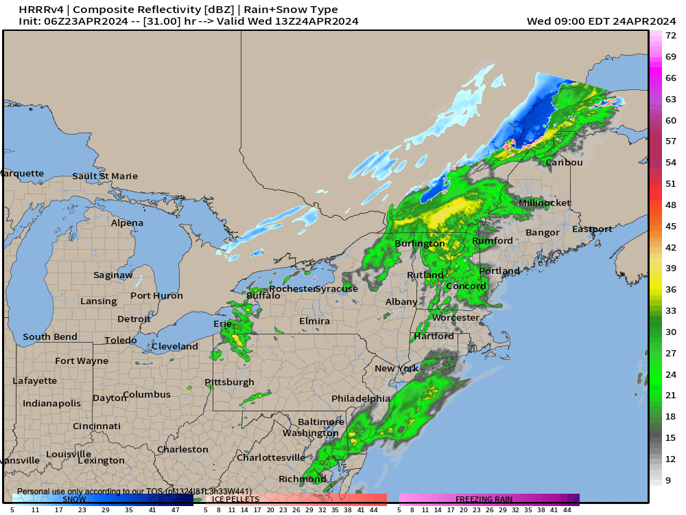
–Scattered showers tomorrow as a cold front works thru the region
–An isolated thunderstorm is possible, highs in the 50s
–Cooler northwest flow exhausts into the region late week
–Lows Wednesday night plummet into the mid to upper 20s for more frost concerns, headlines likely
–Sunny Thursday, northwest breezes, highs in the 50s with cold lows under clear skies in the upper 20s to low 30s for one last frost potential early Friday morning
–Sunny Friday and Saturday as high pressure passes into and south of our region (lows mid to upper 30s Friday night)
–Highs low to mid 60s both days, with some clouds moving in late on Saturday
–Some warm frontal showers expected on Sunday with highs well into the 60s, possibly hitting 70º in some spots
–Early next week has potential to be quite warm, well into the 70s, in fact, but we’ll have to see if the front firmly clears the region or dawdles about like Dave Hayes did back in his college daze
~~~~~~~~~~~~~~~~~~~~~~
YOUR MORNING DISCUSSION
~~~~~~~~~~~~~~~~~~~~~~
Good morning folks, got frost where you are?
Our temps will come up quickly in the house of the rising Sun, with high pressure begetting mostly sunny skies and highs in the low to mid 60s today, just a lovely day ahead!
This is an easy day to raise the ‘brows and don the semi-smiles simultaneously whilst you cast your collective gaze upon your local environs, and take a deep breath and (hopefully) feel good for a minute.
When I get good moments in my aging middle-aged body and mind, I deeply appreciate them when they show up, because they can leave as quickly as they came.
As far as our weather is concerned, we’ve got a lot of fair weather coming in the short term, with one hydrometeorological fly in the ointment, that being tomorrow / Wednesday with some showers moving through, along with the potential for an isolated thunderstorm.
But, that cold front will keep on truckin’, and pull one last blast of frosty air for a couple of frost early morning periods on Thursday and Friday mornings with lows in the mid 20s to low 30s.
As for our days, Thursday through Saturday look mostly sunny and increasingly milder, with Saturday definitely being the weekend pick!
The high pressure responsible for such sunny sweetness will give way and track southeast of us, allowing for a warm front to move into the region with Sunday showers.
It should be milder behind the front, with highs well into the 60s, and the early-next-week period holds a good chance for highs climbing well into the 70s!
However we’ll have to see if that front lays about, because if it does it could not only sag back south as a cold front and bring cooler temps to part of our region (mainly eastern areas), but could also focus some more scattered showers across the region, so stay tuned for updates as we get closer.
Have a great day and enjoy tonight’s Full Pink Moon which rises at 7:40pm in the east-southeast sky!
>>> BE KIND <<<
“Hello babies. Welcome to Earth. It’s hot in the summer and cold in the winter. It’s round and wet and crowded. On the outside, babies, you’ve got a hundred years here. There’s only one rule that I know of, babies: Goddamn it, you’ve got to be kind.”
–Kurt Vonnegut
