
~~~~~~~~~~~~~~~~~~~~~~
TABLE OF CONTENTS
* Daily Celestials (Sun/Moon Data)
* Weekly Weather Nutshell
* Morning Discussion
* TIP: Scroll below for sections, or read all
~~~~~~~~~~~~~~~~~~~~~~
YOUR DAILY CELESTIALS
~~~~~~~~~~~~~~~~~~~~~~
STAR:
–OUR STAR ROSE AT: 6:01am this morning
–OUR STAR WILL SET AT: 7:37pm this evening
–TOTAL DAYLIGHT TIME: 13 hours and 36 minutes
MOON:
–OUR MOON WILL RISE AT: 4:33pm this afternoon
–MOON RISE DIRECTION: East
–OUR MOON WILL SET AT: 5:02am tomorrow morning
–MOON SET DIRECTION: West
–MOON PHASE: Waxing Gibbous (89.1%)
~~~~~~~~~~~~~~~~~~~~~~
>>> A NOTE FROM OUR SPONSOR <<<
Dave Hayes The Weather Nut is Sponsored by Individual Community Members, Patrons, and Gerard, Ghazey & Bates, P.C. GGBPC is a Northampton-based law firm regarded as the voice of pragmatic and well-reasoned estate planning, elder law and tax guidance in Western Massachusetts. The firm specializes in estate planning law, and expertly handles other matters such as Elder Law, Tax Law, as well as Real Estate purchase, sales, and refinance transactions. Contact GGBPC today to see how they can help!
~~~~~~~~~~~~~~~~~~~~~~
YOUR WEEKLY WEATHER NUTSHELL
~~~~~~~~~~~~~~~~~~~~~~
–Last weekend we had Flood Warnings, this weekend the CT River continues to recede well below flood stage, thankfully
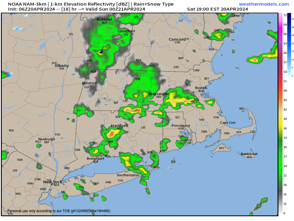
–We’ve had a bit of rain this morning, which continues over eastern Hampden/Hampshire Counties, CMass, and northeast CT
–Areas west and northwest of there have a few scattered lighter showers, but many areas are just cloudy
–A cold front is moving through the region today, and will bring a wind shift later today with gusts 15-25mph later this afternoon and evening
–We’ll see highs in the mid 50s to low 60s, which is predicated on getting some sunny periods by this afternoon, which is expected
–We’ll also have colder air working in aloft, which will produce some instability showers this later afternoon into early evening
–Some areas may see graupel mixed in
–Any late day showers clear the region overnight, and skies will clear, with wind lightening up
–This should allow temps to dip into the upper 20s to mid 30s with patchy frost possible
–Sunday through Tuesday are yummy with sunshine, westerly breezes Sunday and Monday and southerly breezes Tuesday
–Highs should reach the upper 40s to upper 50s Sun/Mon, and upper 50s to mid 60s by Tues as southerly flow brings milder air
–Tuesday morning may see patchy frost, and an increased risk of fire spread is more likely than not as we dry out sufficiently by Monday
–Another front moves through Wednesday with a period of showers, but no big whoop
–Showers clear by Wednesday night and we get cold overnight with a widespread frost possible
–Lows by early Thursday morning are into the upper 20s to low 30s
–Thursday and Friday look sunny and seasonable, which may last into Saturday before more showers are possible by next weekend’s end
~~~~~~~~~~~~~~~~~~~~~~
YOUR MORNING DISCUSSION
~~~~~~~~~~~~~~~~~~~~~~
Good morning folks, the bottom line to our weather story is that we have substantially more dry and sunny days on the way than not, so that’s something to look forward to!
Today contains a mix of showers, clouds and sunny periods, with morning showers and clouds leading to some drying and sunny periods, followed by some late day scattered instability showers with westerly wind gusts up to 25mph picking up behind the frontal passage.
We calm things down after midnight and watch temps drop to the 30-35º range, with patchy frost in spots.
Then we’re onto (the way it looks now) at least a 5 out of 6 day sunny period with sunshine Sunday, Monday, Tuesday, Thursday and Friday and possibly even into the start of next weekend.
This also means that pollen counts are going to be high starting tomorrow.
Also, since we are still pre-greenup and pre-leaf-out, this means that with breezy conditions Sunday through Tuesday that fire spread risk is increased, and we will also see two additional frosty mornings: Tuesday morning and especially Thursday morning, behind another cold front.
Speaking of that other cold front, that’s the one day this upcoming week that looks cloudy and showery: Wednesday.
Today and Tuesday will be the mildest days with highs in the mid 50s to low (and possibly mid) 60s, otherwise we’re in the 45-50º range high terrain and 50s in the valley.
There’s a chance for more showers by later next weekend, but that’s a long way off.
For now, enjoy the fact that abundant sunshine is imminent along with seasonable temperatures: Spring!
Hope you have a great day!
>>> BE KIND <<<
“Hello babies. Welcome to Earth. It’s hot in the summer and cold in the winter. It’s round and wet and crowded. On the outside, babies, you’ve got a hundred years here. There’s only one rule that I know of, babies: Goddamn it, you’ve got to be kind.”
–Kurt Vonnegut