
SECURELY BECOME A 2023 MEMBER OR SUPPORTER AT ANY LEVEL TODAY(Options include Cards, PayPal, Venmo, or Check)
~~~~~~~~~~~~~~~~~~~~~~
TABLE OF CONTENTS:
–Weekly Nutshell (Quick impact list)
–Sponsor Note (Tandem Bagel Co.)
–NWS Alerts (Advisories, Warnings, Watches)
–Celestial Data (Sun/Moon info)
–Regional Summaries (quick in and out details)
–Morning Discussion (Longer-form explanation)
~~~~~~~~~~~~~~~~~~~~~~
DAVE’S WEEKLY WEATHER NUTSHELL
–The bulk of the snow is through the region with a number of 4-6″ reports shared, how much did you get?
–We can expect periods of light to at times moderate snow today as the parent low tracks northeast into Quebec
–Highs will reach the low to mid 30s, with an additional coating to 1″ or so in the valley, and 1-4″ additional in the eastern Berkshires, western hills, southern Greens and northern CMass
–Snow quits between 5-8pm, with high pressure moving in Wednesday
–Partly sunny start for Wednesday, with a cloudy finish
–Mixed showers Wednesday night turn to rain showers Thursday with a weak wave moving north of us
–Colder air works in Thursday night into Friday with a large storm tracking northeast toward New England
–A front end thump of snow looks probable Friday afternoon, but may change to sleet and freezing rain at night, ending as snow Saturday
–The weekend looks mostly cloudy and cool, with snow showers on Sunday, and colder times next week, but before we jump into the weather discussion/details below, let’s check a note from our local and delicious sponsor, #TandemBagelCo, with their newest location in West Springfield, MA.
~~~~~~~~~~~~~~~~~~~~~~
A NOTE FROM OUR SPONSOR:
Dave Hayes The Weather Nut is Sponsored by Individual Community Members, Patrons & Tandem Bagel Company… No matter the weather, Tandem Bagel is always there for you at several valley locations to make your mornings brighter! With bagels baked fresh daily (including Gluten-Free options), house-whipped cream cheese, coffee, and tons of lunch options, Tandem is the perfect quick stop for lunch, breakfast, or a coffee and bagel to go. Find them in Easthampton, Northampton, Hadley, Florence, and West Springfield, or use their super-streamlined online ordering tool by visiting their website.
~~~~~~~~~~~~~~~~~~~~~~~~~~~~~~~~
***DHTWN DAILY WEATHER REPORT***
~~~~~~~~~~~~~~~~~~~~~~~~~~~~~~~~
NATIONAL WEATHER SERVICE ALERTS
–Winter Storm Warnings are continued for southern VT
–NOTE: While Winter Storm Warnings continue for WMass, CMass and much of northern CT, this is not due additional warning-level snow accumulations today, but for consistency in messaging
–Winter Weather Advisories are up for the Berkshires, Litchfield County CT
DHTWN REMINDER
–It doesn’t take much to do a nice thing for somebody that you don’t know.
DAILY CELESTIAL (STAR):
–OUR STAR ROSE AT: 6:27am this morning
–OUR STAR WILL SET AT: 5:38pm this evening
–TOTAL DAYLIGHT TIME: 11 hours and 11 minutes
NIGHTLY CELESTIAL (MOON):
–OUR MOON WILL RISE AT: 11:03am this morning
–OUR MOON WILL SET AT: 3:20am tomorrow morning
–MOON RISE DIRECTION: Northeast
–MOON SET DIRECTION: Northwest
–MOON PHASE: Waxing Gibbous (61.3%)
~~~~~~~~~~~~~~~~~~~~~~~~~~~~~~~~
DAILY TERRESTRIAL
ZONE 1 – Northern Region
(Southern VT, Southwest NH)
–High Temps: Upper 20s to Low 30s
–Low Temps: Upper Teens to Low 20s
–Winds: Easterly gusts to 20mph tamp down later
–Sky Cover: Overcast
–Precipitation: Periods of light to moderate snow, brief bursts to heavy, additional 1-4″
ZONE 2 – Central Region
(Western MA, North-Central MA, Northern Litchfield CT)
–High Temps: Low to Mid 30s
–Low Temps: Low 20s
–Winds: Easterly gusts to 20mph tamp down later
–Sky Cover: Overcast
–Precipitation: Periods of light to moderate snow, brief bursts to heavy in the high terrain, additional Coating to 1″ or in the valley, 1-4″ additional in the high terrain
ZONE 3 – Southern Region
(South-Central MA, Northern CT)
–High Temps: Mid 30s
–Low Temps: Low to Mid 20s
–Winds: Easterly gusts to 20mph tamp down later
–Sky Cover: Overcast
–Precipitation: Periods of light to moderate snow, additional Coating to 2″ possible
~~~~~~~~~~~~~~~~~~~~~~~~~~~~~~~~
MORNING DISCUSSION
Good morning everybody, how much did you get overnight? What’s it doing by place this morning? Many of us gone into a lull, but it sure did snow with vigor at times last night. Many areas have woken up to 3-6″ of snow, but please do let me know what you have at the moment.
Additional light accumulations are expected by the end of today, with light to moderate snow at times, and lulls at others.
This will cause additional accumulations to vary widely, mainly based on terrain.
Again the bulk of the accumulation is on the ground, but another coating to an inch or so in the valley is possible, and 1-4″ in the high terrain of the Berkshires, northern Litchfields, western hilltowns, southern VT, northern CMass and into the Monadnock Region of NH.
Our coastal storm east of Delaware pulls east today, and primary low tracks northeast into Quebec bringing the periods of light snow through the region today as wind dies down (some gusts got up to 30mph or so last night in the mountains).
Highs will be in the low to mid 30s, with snow quitting by dinner time, and lows in the low to mid 20s, with some upper teens in SVT/SWNH.
For Wednesday, high pressure nudges in for a minute, but another weak wave will be tracking zonally (i.e. west to east) through northern New England on Thursday, so clouds will increase in the afternoon with highs in the low 40s and lows near freezing with showers late, and some snow may mix in over the high terrain at night.
On Thursday, any mixed showers turn to scattered rain showers with southerly flow and highs well into the 40s.
The weak northern wave will drag a cold front through the region and drop temps into the low to mid 20s as showers quit.
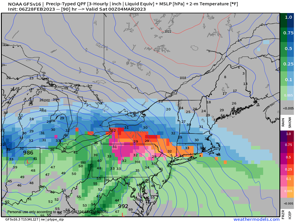
No rest for the Nut, as another substantial storm is set to run through New England Friday afternoon into Saturday morning.
——————-
IF YOU FEEL SIMILARLY #2023MemberDrive
“Dave is constantly reviewing and updating with attention to all of our different little weather zones which can vary drastically. Plus, I love that the community of followers help each other know what road conditions and weather effects are in each location in real time! A truly community-centered service!!” –Taiko C.
–> Your Contributions Help Sustain this Community Resource
–> Click this secure link, many options to choose from
——————-
It will be colder, in the 30s on Friday, and any preciptation that arrives should be in the form of snow, or perhaps a mix changing to snow for a time into Friday night with accumulation.
However, there is still a lot of uncertainty as to how this storm is going to track, secondary development, where, and other details, but for now it does look like we could go from snow to sleet or freezing rain for another mess storm, but I will keep you updated as we get closer
The weekend looks mostly cloudy at this point with highs in the 30s and lows in the 20s with some snow showers possible to end the weekend.
March begins tomorrow and continues to look colder than average. That combined with what appears to be a much later start of the winter pattern in recent years, combined with some of the most powerful winter storms to affect New England (Blizzard of 1888, The Superstorm of 1993 to name two) means winter may still have some gas in the tank yet.
Have a great day, I will update again by early afternoon, and if you appreciate and value my work, please consider supporting it via my 2023 Member/Support Drive… any monthly or one-time amount is helpful, thank you:
2023 MEMBER/SUPPORT DRIVE SECURE LINK.
Let’s Stay Together (click for options).
AND REMEMBER…
“Hello babies. Welcome to Earth. It’s hot in the summer and cold in the winter. It’s round and wet and crowded. On the outside, babies, you’ve got a hundred years here. There’s only one rule that I know of, babies: Goddamn it, you’ve got to be kind.”
–Kurt Vonnegut