TABLE OF CONTENTS
* Daily Celestials (Sun/Moon Data)
* Sponsor Section
* Morning Discussion
* TIP: Scroll to your section, or read more
~~~~~~~~~~~~~~~~~~~~~~
YOUR DAILY CELESTIALS
~~~~~~~~~~~~~~~~~~~~~~
STAR:
–OUR STAR ROSE AT: 6:35am this morning
–OUR STAR SETS AT: 7:14pm this evening
–TOTAL DAYLIGHT TIME: 12 hours and 39 minutes
MOON:
–OUR MOON ROSE AT: 7:02am this morning
–MOON RISE DIRECTION: East-Northeast
–OUR MOON SETS AT: 9:11pm tonight
–MOON SET DIRECTION: West-Northwest
–MOON PHASE: Waxing Crescent (1.7%)
~~~~~~~~~~~~~~~~~~~~~~
>>> A NOTE FROM OUR WEEKEND SPONSOR <<<
Dave Hayes The Weather Nut is Sponsored by Individual Community Members, Patrons, and Gerard, Ghazey & Bates, P.C.
GGBPC is a Northampton-based law firm and is the area’s premier estate and tax planning provider. The firm specializes in Estate Planning, Elder Law, and Tax Law, so be sure to contact GGBPC today to see how they can help you.
Simply click the following link to their secure website.
~~~~~~~~~~~~~~~~~~~~~~
YOUR MORNING DISCUSSION
~~~~~~~~~~~~~~~~~~~~~~
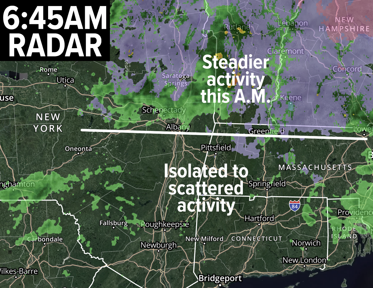
Good morning folks, we are waking up to about 1000 outages in southern VT and about 500 in southwest NH, with almost 10000 in central VT and central NH combined, so the coldest air mostly stayed just north of the northern part of the greater WMass region.
Please post any icing reports below, if you have any icing on trees and/or on surfaces/roads. I have heard of quarter-inch ice accretion in western Franklin County and southwest NH, but none higher than that as of this writing.
The icing threat will continue in SVT and SWNH through mid to late morning, but should abate as precipitation decreases in those areas, and temps start to come up.
For today, morning showers will abate to periods and areas of patchy drizzle and patchy fog with a few isolated showers here and there during the day.
Watch your surfaces early if you are north of the Pike, especially in CMass, and any higher terrain areas of WMass.
Otherwise, temps seemed to have held just above freezing overnight for many of us in the CT River Valley in VT, MA and CT, which is a good thing.
Any Ice Storm Warnings, Winter Storm Warnings or Winter Weather Advisories will expire before noon.
Highs today will reach the mid 30s to low 40s from north to south under cloudy skies, and it will be a raw, damp day with light wind.
For tonight, our warm front lifts northeast and through our region and should bring another batch or two of rain showers with no icing expected. Lows should hang about where our highs are expected to reach this afternoon. Patchy fog and drizzle is possible.
On Monday, we will full be in the warm sector with highs in the mid 50s to mid 60s as southerly winds begin to gust 20-30mph by afternoon ahead of an incoming cold front for Monday night into Tuesday morning.
An isolated shower is possible through mid-afternoon, and we may even see some sunny breaks, but a mostly cloudy day is expected.
By later in the afternoon, however, we have our first chance at some isolated strong thunderstorms for Spring, which may develop out ahead of the main cold frontal wall of heavier showers that are expected to move through Monday night into early Tuesday morning.
If any storms do kick up, it’s most likely to impact the Berkshires, northwest CT or southwest VT with some strong wind gusts and heavy rainfall.
After that, the rain moves in Monday night, falling heavily at times, with lows in the low 30s to low 40s. A low potential exists for the Berkshires region to end with a few wet snowflakes in the pre-dawn hours of Tuesday morning.
Tuesday and Wednesday continue to look lovely, with sunshine developing as high pressure works into our region. Highs both days should reach the 40s to low 50s with lows in the 20s Tuesday night.
By Wednesday night, we’re clouding back up as yet another warm front presses toward our region with lighter precipitation overnight into early Thursday morning. With lows in the 30s, we may see some icy precipitation in the high terrain before changing to light rain showers for much of Thursday, when highs should rise into the upper 50s to mid 60s after the warm front passes northeast of us.
For now, Friday and Saturday looks to feature fair weather with mostly seasonable temps in the low to mid 50s, but I will update that period as we get closer.
I hope you have a great day, and that something good happens in your life by the time your next sleep rolls around.
“Follow your bliss and the Universe will open doors for you where there were only walls.”
― Joseph Campbell
