
Good morning folks, we’ve got some patchy fog noted at Chicopee and southwest NH into southeast VT, and while a few spot showers are possible today and tomorrow, we’re going to be mostly dry through the weekend before potential showers from Ian’s rainy remnants next week, but before we get into all of the substantial weather changes on our doorstep, let’s check a note from our local and delicious sponsor, #TandemBagelCo, with their newest location in West Springfield, MA.
——————–
A NOTE FROM OUR SPONSOR:
DHTWN Is Sponsored by Members, Patrons & Tandem Bagel Company: No matter the weather, Tandem Bagel is always there for you at several valley locations to make your mornings brighter! With bagels baked fresh daily, house-whipped cream cheese, coffee, and tons of lunch options, Tandem is the perfect quick stop for lunch, breakfast, or a coffee and bagel to go. Find them in Easthampton, Northampton, Hadley, Florence, and West Springfield, or use their super-streamlined online ordering tool by visiting their website.
——————————————-
***DHTWN DAILY WEATHER REPORT***
——————————————-
NWS ALERTS
–None
DHTWN REMINDER
–The odds of being a human is 1 in 400 trillion… make it count, even in a small way (see Kurt Vonnegut quote at end of post)
DAILY CELESTIAL (STAR):
–OUR STAR ROSE AT: 6:43am this morning
–OUR STAR WILL SET AT: 6:38pm this evening
–TOTAL DAYLIGHT TIME: 11 hours and 55 minutes
DAILY CELESTIAL (MOON):
–OUR MOON WILL SET AT: 7:38pm this evening
–OUR MOON WILL RISE AT: 9:36am tomorrow morning
–MOON SET DIRECTION: West-Southwest
–MOON RISE DIRECTION: East-Southeast
–MOON PHASE: Waxing Crescent (2.7%)
———————-
DAILY TERRESTRIAL (ZoneCast)
ZONE 1 (Northern Region)
Southern VT, Southwest NH, N. Taconics NY
–High Temps: Mid to Upper 60s
–Low Temps: Mid to Upper 40s
–Humidity: Low, dewpoints in the 40s/50s
–Wind: Southwest wind gusts to 20mph
–Skies: Clouds early, then increasing sunshine
–Precipitation: Isolated showers possible late today, especially west of the CT River
ZONE 2 (Central Region)
WMass, N. CMass, N. Litchfield County, C./S. Taconics NY
–High Temps: Mid 60s to Low 70s
–Low Temps: Mid to Upper 40s
–Humidity: Low, dewpoints in the 40s/50s
–Wind: Southwest wind gusts to 20mph
–Skies: Clouds early, then increasing sunshine
–Precipitation: Isolated showers possible late today, especially west of the CT River
ZONE 3 (Southern Region)
S. CMass, S. Litchfield County, NC.CT, & NE.CT
–High Temps: Upper 60s to Low 70s
–Low Temps: Upper 40s to Low 50s
–Humidity: Low, dewpoints in the 40s/50s
–Wind: Southwest wind gusts to 20mph
–Skies: Clouds early, then increasing sunshine
–Precipitation: Isolated showers possible late today, especially west of the CT River
———————-
WEATHER REPORT
Good morning everybody, I must admit I’m pining for winter a bit this morning. I love the thrill of seeing a big snowstorm come together and investigating all of its components and distilling those down into a narrative for you to read and detailing potential impacts.
But as Aragorn said completely out of context of this post, that day is not this day. Today we stand, and…. are bored, lol.
But a BoringCast(TM) is also most welcome in some ways, because if you look at what folks may be dealing with down in western FL, you remind yourself that boring is just fine, and that we’re lucky to have boring weather for the foreseeable future, which is very much the case.
Allow me to illustrate our mostly calm and tranquil atmospheric fate over the next 7 days with the most non-flowery digital type characters available to mankind: the double–dash.
Without further adieu…
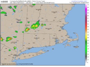
–We’ve got some patchy fog out there this morning, but this will dissipate with time
–We’ve also got an old upper low in the process of dying out over the Great Lakes that keeps spinning like a top to our west
–It’ll continue to send bits of energy and notably, parcels of cooler air aloft later on today
–This process will generate clouds over NY state, as well as some scattered showers
–After a morning cloud deck streams northeast through the greater WMass region, we should see developing sunshine as the day wears on
–Highs will reach mid 60s to low 70s and it will a pleasant feel for sure
–Southwest winds may gust up to 20mph at times
–In addition, with the cooler air aloft moving overhead, we’ll also watch the Hudson Valley region of eastern NY as some scattered instability showers may spill east out of there into northwest CT, WMass and SVT later this afternoon and early evening
–Any activity dies out tonight and lows will drop into the mid to upper 40s under partly cloudy skies
–For Wednesday, we’ll start off mostly sunny, but a few clouds should build toward the afternoon with a cold frontal passage, and we can’t rule out a few spot showers in spots
–Highs will climb into the low to upper 60s, and lows will sit down into the mid 40s
–Thursday and Friday are drier and sunnier, as high pressure moves into position, with highs reaching the upper 50s to mid 60s on Thursday, and then the low to mid 60s on Friday
–Lows Thursday night will dip into the upper 30s with lows in the low to mid 40s Friday night
–Another reinforcing area of high pressure moves overhead this weekend, which will be GORGEOUS
–Expect abundant sunshine and highs in the mid to upper 60s and lows in the 40s, and similar conditions are likely for Monday, too
–After that, we’ll have to watch how a big area of high pressure in the northern U.S. interacts with the remnants of Hurricane Ian
–At this point, it may completely squash any rainfall to our south, but we can’t rule out some showers from that system reaching northern CT up to near the Springfield/Worcester latitude by mid week
–Temps will be seasonable still, in the 60s for highs and 40s for lows, most likely
Have a great day!
Did you know that you can also follow me on Twitter?
AND REMEMBER…
“Hello babies. Welcome to Earth. It’s hot in the summer and cold in the winter. It’s round and wet and crowded. On the outside, babies, you’ve got a hundred years here. There’s only one rule that I know of, babies: Goddamn it, you’ve got to be kind.”
–Kurt Vonnegut