Good morning everybody, we’ve had another chilly night, and a bit colder than anticipated with some lows in the upper 30s once again. With our new sub-7pm sunsets, Autumn is incoming, but we’ve got at least a couple of summer tastes to savor over the next 7 days.
Today is pleasant, tomorrow is warmer and more humid with showers and a few thunderstorms mostly midnight to midnight Monday to Tuesday with mid-week fair weather, which will be followed by an increase in humidity, wind, and the potential for strong/severe t-storms the 1st day of Autumn on Thursday with a subsequent late-week cool down, but before we dive into all of the weather details below, let’s check a note from our local weekend sponsor, #YankeeMattressFactory, with their main headquarters in Agawam, MA along with stores located around the valley.
——————–
A NOTE FROM OUR WEEKEND SPONSOR:
DHTWN is sponsored by members, patrons, and Yankee Mattress Factory. Yankee Mattress is employee-owned, and mattresses are handmade locally in Agawam, MA. Several years ago I purchased a Yankee mattress and was very pleased with their quality and the buying experience, which was friendly and low pressure. Starting on September 1st and running through October 31st, Yankee Mattress will be partnering with the American Cancer Society to raise money to support breast cancer research and local services. A portion of each mattress sale will go towards their goal of donating $10,000 towards this cause. Visit the Yankee Mattress store closest to you in Agawam, Springfield, Northampton, or Greenfield, or click for more info: https://yankeemattressfactory.com/
——————————————-
***DHTWN DAILY WEATHER REPORT***
——————————————-
Good morning everybody, we start the day with some patchy fog, notably at Orange, MA and in southwest NH, although many of us have 10-mile visibility, meaning zero fog. We also have a general mix of clouds and sun east across the greater WMass region.
These ground and sky clouds should generally evaporate and reveal a nice day as high pressure is parked right over us, and normally that leads to light winds, mostly sunny skies, and pleasant conditions.
Highs will reach the low to mid 70s with some upper 60s possible in parts of the mountains in SVT. Lows tonight will hang in the mid 50s or so, and as dew points rise on southwest flow, patchy fog will develop for some.
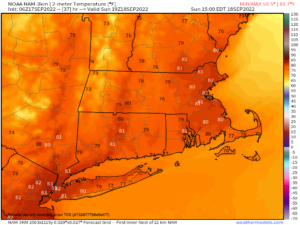
On Sunday, we get a fleeting taste of late-summer! Skies should be partly to mostly sunny as high pressure kicks east off of the coastline, and develops a stronger land-based southwesterly flow that will run temps up and into the upper 70s to mid 80s!
Southwest winds may gust up to 20mph at times, and we also could transition from mostly sunny skies in the morning to partly sunny by afternoon, with a few isolated showers not out of the questions as a cold front starts tracking in from our north and northeast.
By evening, clouds will build in our northern zones (northern MA, SVT and SWNH) and we’ll see a better chance for scattered showers around or after midnight. Lows will only drop into the low 60s for many.
Monday looks to feature more clouds than sun and will be showery at times, depending on exactly where the cold front sets up. Highs will reach the mid to upper 70s with lows either side of 60º.
Essentially, at the moment, it looks like a pulse of scattered showers very late Sunday night, and then again later on Monday night, with a few isolated showers at times for the day Monday, and Tuesday morning, but I will try to refine it better for you by tomorrow.
The front never really makes it through the region, however, so temps won’t take a nosedive until late week.
Tuesday will feature improving conditions with increasing sunshine with highs in the low to mid 70s and lows in the mid 50s.
Wednesday could be the pick of the week, with sunshine and highs highs in the mid to upper 70s with a few showers at night as a stronger cold front pushes its pre-frontal trough into the WMass region. Lows will be in the upper 50s.
By Thursday, the first day of Autumn, we have a big transition we’ll be moving through.
Southwest winds will gust 20-30mph out of the southwest ahead of our cold front, and if things line up, we could have some very humid conditions, with showers, downpours and thunderstorms, and one or two may be strong to even severe. Highs will reach the mid 70s.
This will precede the coolest air of the incoming cold season yet, with a big push of cooler, drier, northern Canadian air.
#TheWhoosheningIsReal
Highs on Friday will only be in the low to mid 60s, and it will blustery with northwest wind gusts 20-30mph, the way it looks now, and those cool conditions should last into and possibly through the weekend.
As for Fiona next weekend, it likely stays out to sea away from us, but there is still a very low-chance path to New England, and more so for Nova Scotia, which some models are showing a total pasting of NS, so stay tuned for updates.
Have a great day!
Remember that you can also follow me on Twitter.
AND REMEMBER…
“Hello babies. Welcome to Earth. It’s hot in the summer and cold in the winter. It’s round and wet and crowded. On the outside, babies, you’ve got a hundred years here. There’s only one rule that I know of, babies: Goddamn it, you’ve got to be kind.”
–Kurt Vonnegut
