TABLE OF CONTENTS
* Celestials (Sun/Moon Info)
* Weekly Nutshell
* Morning Discussion
* Scroll below for your sections, or read all
~~~~~~~~~~~~~~~~~~~~~~
YOUR DAILY CELESTIALS
~~~~~~~~~~~~~~~~~~~~~~
STAR:
–OUR STAR ROSE AT: 6:55am this morning
–OUR STAR WILL SET AT: 6:18pm this evening
–TOTAL DAYLIGHT TIME: 11 hours and 23 minutes
MOON:
–OUR MOON WILL SET AT: 4:32pm this afternoon
–MOON SET DIRECTION: Northwest
–OUR MOON WILL RISE AT: 2:38Am tomorrow morning
–MOON RISE DIRECTION: Northeast
–MOON PHASE: Waning Crescent (23.7%)
~~~~~~~~~~~~~~~~~~~~~~
YOUR WEEKLY WEATHER NUTSHELL
~~~~~~~~~~~~~~~~~~~~~~
–Cool start in the 30s and 40s, a few frosty patches may have formed
–Highs today mid 50s to low 60s, breezy at times later
–Mostly sunny with patches of cumulus clouds, sprinkle possible
–Lows mid 30s to low 40s with isolated frost possible, patchy fog as well
–Tuesday better chance for a few isolated showers, highs upper 50s to low 60s, lows either side of 40º, breezy at times
–Fair weather with brief high pressure Wednesday and Thursday with highs low to mid 60s, lows in the low 40s
–Mostly sunny Wednesday, partly sunny Thursday
–Partly sunny on Friday with highs either side of 60º, clouds increase in the afternoon and night
–A few scattered showers are possible Friday night
–A potent storm zips east across the middle of the country and should spawn a secondary low off of the coastline
–This should push widespread rainfall into the region by Saturday into the night, and may last into Sunday as well
–Highs will only reach the 50s with lows in the 40s, with cool temps expected through the following week with scattered showers possible as well, but before we talk details let’s check a note from our local and delicious sponsor, #TandemBagelCo, with their newest location in the Stop & Shop Plaza on King Street in Northampton, MA.
~~~~~~~~~~~~~~~~~~~~~~
A NOTE FROM OUR SPONSOR
~~~~~~~~~~~~~~~~~~~~~~
Dave Hayes The Weather Nut is Sponsored by Individual Community Members, Patrons, and Tandem Bagel Company… No matter the weather, Tandem Bagel is always there for you at several valley locations to make your mornings brighter! With bagels baked fresh daily (including Gluten-Free options), house-whipped cream cheese, coffee, and tons of lunch options, Tandem is the perfect quick stop for lunch, breakfast, or a coffee and bagel to go. Find them in Easthampton, Northampton, Hadley, Florence, and West Springfield, or use their super-streamlined online ordering tool by visiting their website.
~~~~~~~~~~~~~~~~~~~~~~
YOUR MORNING DISCUSSION
~~~~~~~~~~~~~~~~~~~~~~
Good morning everybody, we’ve had a chilly start to the day, and temps aren’t going to come up much farther than the mid 50s to low 60s by afternoon as autumnal air has settled through New England, and will continue to do so for the foreseeable future.
In other words, any last minute air conditioners can likely come out of the windows at this point.
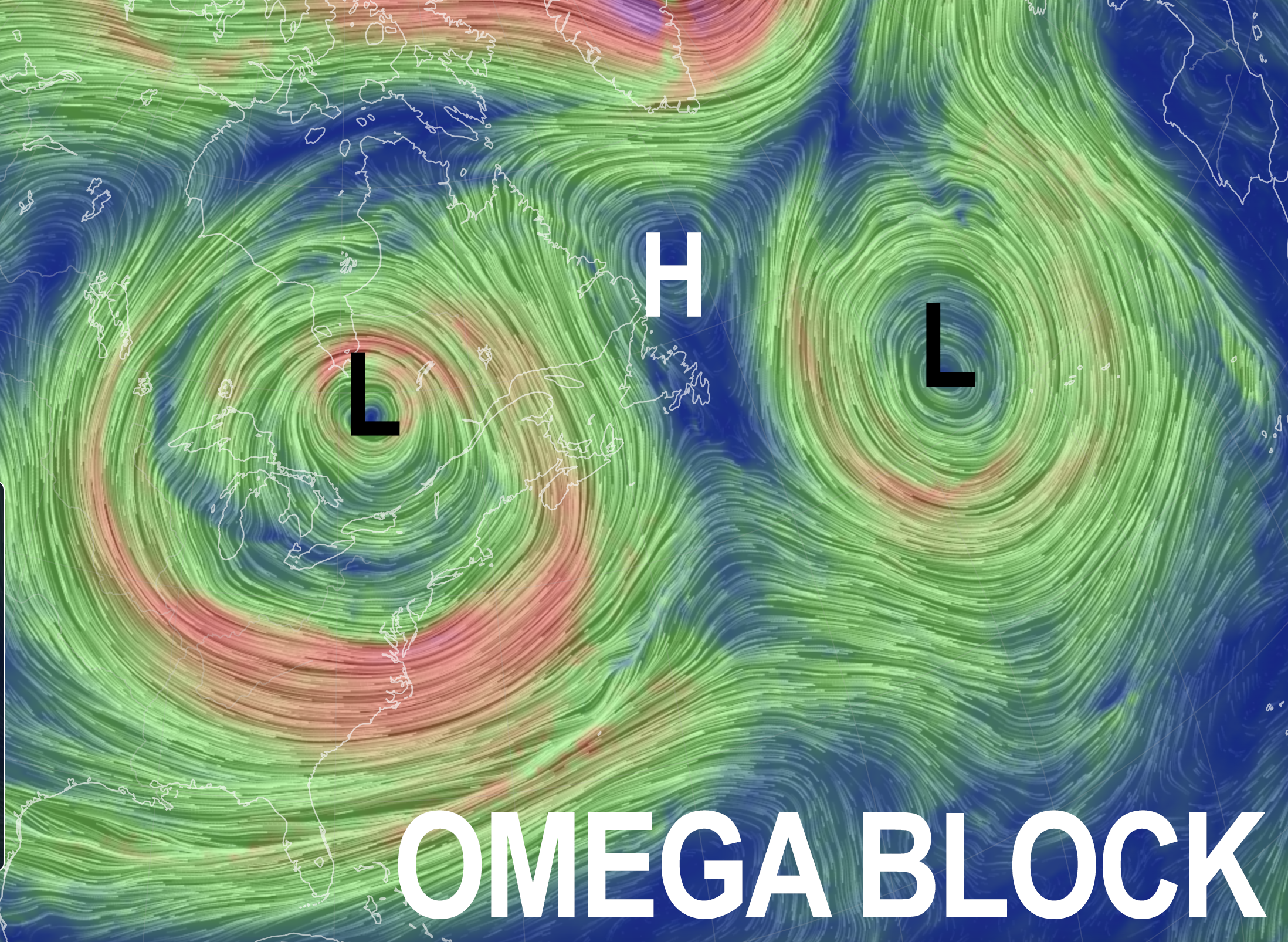
We’ve got a giant upper level low circulating mostly in place, and bringing some snow to parts of Ontario, Canada.
For us, it will simple keep a westerly cooler flow into our region, and especially aloft which will destabilize the lower atmosphere.
This will be enough instability to produce some afternoon cumulus clouds and perhaps a spot shower later today, with a weak impulse moving through our region tomorrow with some more widely scattered showers at that time.
Highs reach the mid 50s to low 60s each day with lows in the mid 30s to low 40s tonight, and upper 30s to low 40s tomorrow night.
We can’t rule out some patchy frost overnight, but it’s doubtful Frost Advisories would be hoisted. Patchy fog is possible, too.
By Wednesday, some drier air moves into the region through Thursday (and possibly the first half of Friday).
This should produce mostly sunny skies and highs hovering more near the lower 60s, so it will be a touch milder mid to late week.
By later Friday as we head into the weekend, I’m afraid I don’t have good news once again.
A storm system looks to eject east of the Rockies and race into the Ohio Valley, likely slowing down as it reaches the Appalachians and spawning a secondary low to develop somewhere along the Mid-Atlantic or southern New England coastline.
This should push a widespread rainfall, and potential rainy nor’easter into the greater WMass region for Saturday and possibly Sunday as well.
Highs would only be in the 50s with lows in the 40s, so this looks like a raw weather weekend shaping up, BUT…. it’s early yet so stay tuned for updates as we get closer.
Once thing seems more clear, and that is that it looks quite cool through much of next week as well, so this new autumnal pattern is likely to have legs.
Have a great day!
>>> BE KIND <<<
“Hello babies. Welcome to Earth. It’s hot in the summer and cold in the winter. It’s round and wet and crowded. On the outside, babies, you’ve got a hundred years here. There’s only one rule that I know of, babies: Goddamn it, you’ve got to be kind.”
–Kurt Vonnegut
