
Good morning everybody, it’s quite chilly again this morning, but the cold mornings are going away for a time. as high pressure slips east and offshore bringing clouds and a few showers early week prior to milder temps and sunnier skies mid to late week, but before we dive into all of the weather details below, let’s check a note from our local weekend sponsor, #YankeeMattressFactory, with their main headquarters in Agawam, MA along with stores located around the valley.
——————–
A NOTE FROM OUR WEEKEND SPONSOR:
DHTWN is sponsored by members, patrons, and Yankee Mattress Factory. Yankee Mattress is employee-owned, and mattresses are handmade locally in Agawam, MA. Several years ago I purchased a Yankee mattress and was very pleased with their quality and the buying experience, which was friendly and low pressure. Starting on September 1st and running through October 31st, Yankee Mattress will be partnering with the American Cancer Society to raise money to support breast cancer research and local services. A portion of each mattress sale will go towards their goal of donating $10,000 towards this cause. Visit the Yankee Mattress store closest to you in Agawam, Springfield, Northampton, or Greenfield, or click for more info.
——————————————-
***DHTWN DAILY WEATHER REPORT***
——————————————-
Good morning folks, our chilly start in the 20s and 30s will provide early morning frost for some, but with departing high pressure over the region, we’ll rise up into the low to mid 60s under sunny skies as southerly flow develops into tonight.
Light southerly breezes are expected with lows bottoming out in the mid to upper 30s, and possibly some low 40s in northern CT as clouds build.
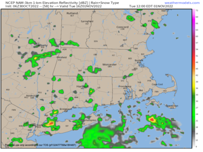
For Monday, after some patchy fog in the morning, expect a partly sunny trending to mostly cloudy day as a broad but fairly flat trough pushes into the Great Lakes region, with not much moisture content.
Highs will reach the low to mid 60s with lows settling down to near 50º with a few showers possible south of the Pike at night.
Tuesday looks mostly cloudy as this weak system pushes through the region, and so a few scattered mostly light showers are expected here and there, with more dry air than anything. Highs will climb into the mid to upper 60s with lows in the upper 40s.
The Wednesday through Friday period should feature plenty of sunshine and highs in the 60s and lows in the 40s as more high pressure works into the region.
Next weekend is our next shot at showers as a frontal boundary approaches the region.
Lastly, if you’re wanting holiday gift options or a calendar for yourself, my 2023 Weather Calendar is one of the WMass region-centric calendars out there. Please support local folks like myself, thank you (info/order link below).
Thank you, and have a great day!
Remember that you can also follow me on Twitter.
AND REMEMBER…
“Hello babies. Welcome to Earth. It’s hot in the summer and cold in the winter. It’s round and wet and crowded. On the outside, babies, you’ve got a hundred years here. There’s only one rule that I know of, babies: Goddamn it, you’ve got to be kind.”
–Kurt Vonnegut