
Good morning folks, Frosty The Frostman did not come to town last night, and while some patchy frost is still expected up in southern VT and a few other spots, it’s mostly a non-issue this morning.
We still have Ian’s skeleton rummaging around the Mid-Atlantic region thinking he’s staying for Halloween, but in actuality, he’ll be getting the boot out of here by Thursday. #goodriddance
For us southwestern New Englanders, we’ve got a few frosty areas possible for tomorrow morning with partly sunny to mostly cloudy skies through mid-week with a few showers south of the Pike at that time, followed by warming into the low 70s by late week and then weekend cool-down episode, but before we jump into the details, let’s check a note from our local and delicious sponsor, #TandemBagelCo, with their newest location in West Springfield, MA.
——————–
A NOTE FROM OUR SPONSOR:
DHTWN Is Sponsored by Members, Patrons & Tandem Bagel Company: No matter the weather, Tandem Bagel is always there for you at several valley locations to make your mornings brighter! With bagels baked fresh daily, house-whipped cream cheese, coffee, and tons of lunch options, Tandem is the perfect quick stop for lunch, breakfast, or a coffee and bagel to go. Find them in Easthampton, Northampton, Hadley, Florence, and West Springfield, or use their super-streamlined online ordering tool by visiting their website.
——————————————-
***DHTWN DAILY WEATHER REPORT***
——————————————-
NWS ALERTS
–Frost Advisories and Freeze Warnings expire this morning… these conditions did not come to pass.
DHTWN REMINDER
–The odds of being a human is 1 in 400 trillion… make it count, even in a small way (see Kurt Vonnegut quote at end of post)
2023 WEATHER WALL CALENDAR INFO/ORDER LINK
DAILY CELESTIAL (STAR):
–OUR STAR ROSE AT: 6:49am this morning
–OUR STAR WILL SET AT: 6:28pm this evening
–TOTAL DAYLIGHT TIME: 11 hours and 39 minutes
DAILY CELESTIAL (MOON):
–OUR MOON WILL SET AT: 11:02pm tonight
–OUR MOON WILL RISE AT: 3:23pm tomorrow afternoon
–MOON SET DIRECTION: Southwest
–MOON RISE DIRECTION: Southeast
–MOON PHASE: Waxing Gibbous (55.2%)
———————-
DAILY TERRESTRIAL (ZoneCast)
ZONE 1 (Northern Region)
Southern VT, Southwest NH, N. Taconics NY
–High Temps: Mid 50s to Low 60s
–Low Temps: Low to Mid 30s, patchy frost possible Tues AM
–Humidity: Low
–Wind: East to northeast light wind, may gust to 20mph SWNH
–Skies: Partly Sunny
–Precipitation: None
ZONE 2 (Central Region)
WMass, N. CMass, N. Litchfield County, C./S. Taconics NY
–High Temps: Upper 50s to Low 60s
–Low Temps: Upper 30s to Low 40s
–Humidity: Low
–Wind: East to northeast light wind, may gust to 20mph CMass
–Skies: Partly Sunny
–Precipitation: None
ZONE 3 (Southern Region)
S. CMass, S. Litchfield County, NC.CT, & NE.CT
–High Temps: Mid 50s to Low 60s
–Low Temps: Low 40s
–Humidity: Low
–Wind: East to northeast light wind, may gust to 25mph eastern CT into southern CMass
–Skies: More clouds than sunshine
–Precipitation: None
———————-
WEATHER REPORT
Good morning everybody, everybody’s a busy body so let’s get down to business with the eyes and brains in our busy bodies below:
–For today we still have Ian’s remnants spinning around east of the Mid-Atlantic coast obliterating the drought down in Jersey
–For us, it’s just sending periods of clouds into our region today, especially the further south you go (more sunny periods in northern MA, SVT and SWNH)
–Highs will reach the upper 50s to low 60s, and northeast winds will continue to gust to 20mph or so today
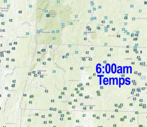
–For tonight, lows will generally sit down into the 35-40º range, but some lower 30s possible SVT with patchy frost in spots in northwest MA, SVT and SWNH
–On Tuesday, it’s more of the same (partly sunny to mostly cloudy, highs upper 50s/low 60s, maybe a shower in N.CT) as an upper low has caught Ian’s remnant low center
–This causes our proximal weather systems to seize up and slow down before it is all flushed out to sea by an incoming massive high pressure system for late week
–Lows Tuesday night in the low to mid 40s, with a few showers possible
–Tuesday night and Wednesday represents our best chance to get some showers into parts of the WMass region as one last pulse is sent northward before the system pulls east and out to sea (OTS)
–Highs Wednesday will reach the low to mid 60s with lows in the 40s under partly sunny to mostly cloudy skies
–High pressure overspreads the region Thursday and Friday with a lovely pair of days, mostly sunny, calmer wind, highs upper 60s to low 70s, enjoy!
–Thursday night lows will be in the 45-50º range but cooler Friday night as a cold front runs through the region
–Then we get a cool weekend to swing through with highs only in the mid 50s with lows in the 30s as Autumn reasserts itself
Have a great day, and please check out my 2023 calendar, it’s a great local-color-filled daily companion, you’ll learn a bunch of cool local weather history, and it’s great for holiday gifts too!
SECURE 2023 CALENDAR ORDER/INFO LINK
Did you know that you can also follow me on Twitter?
AND REMEMBER…
“Hello babies. Welcome to Earth. It’s hot in the summer and cold in the winter. It’s round and wet and crowded. On the outside, babies, you’ve got a hundred years here. There’s only one rule that I know of, babies: Goddamn it, you’ve got to be kind.”
–Kurt Vonnegut