
Good morning everybody, we certainly had a chilly one last night! Temps are still cold, but we’ll enjoy a lovely weekend with some clouds and showers by Monday night into Tuesday with milder temps, and then sunnier skies mid to late week when some folks may crest 70º, but before we dive into all of the weather details below, let’s check a note from our local weekend sponsor, #YankeeMattressFactory, with their main headquarters in Agawam, MA along with stores located around the valley.
——————–
A NOTE FROM OUR WEEKEND SPONSOR:
DHTWN is sponsored by members, patrons, and Yankee Mattress Factory. Yankee Mattress is employee-owned, and mattresses are handmade locally in Agawam, MA. Several years ago I purchased a Yankee mattress and was very pleased with their quality and the buying experience, which was friendly and low pressure. Starting on September 1st and running through October 31st, Yankee Mattress will be partnering with the American Cancer Society to raise money to support breast cancer research and local services. A portion of each mattress sale will go towards their goal of donating $10,000 towards this cause. Visit the Yankee Mattress store closest to you in Agawam, Springfield, Northampton, or Greenfield, or click for more info.
——————————————-
***DHTWN DAILY WEATHER REPORT***
——————————————-
I hope you all have a great weekend, the weather will certainly be supportive of outdoor activities, though you’ll want to bundle up tonight.
Sunshine is expected both days with highs upper 50s to low 60s today, and the low 60s tomorrow with clouds developing at night.
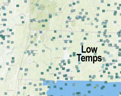
Sandwiched in between is another cold night with low in the upper 20s to low 30s with more frost expected.
Sunday night will feature a new air mass moving into the region, and with it will come milder temps and more clouds. Lows will drop into the low 40s.
The storm system looks like it will be weaker than expected a couple of days ago, so we’re likely to just have a partly sunny morning and trending to a mostly cloudy Monday with a few light scattered showers Monday evening.
The best chance for showers will be south of the Pike with lows in the 40s.
By Tuesday, temps should come further up into the 60s with mostly cloudy skies continuing and lows near 50º.
Mid to late week looks gorgeous with highs in the 60s, and we may even make a run at 70º by Friday before another cold front arrives with more shower chances by early next weekend.
Lastly, today is the 11th anniversary of the Halloween Nor’easter, which is featured in depth in my 2023 Weather Calendar as one of 12 complete storm histories you’ll get, so if you enjoy learning about local weather and its history, this will be up your alley!
Thank you, and have a great day!
Remember that you can also follow me on Twitter.
AND REMEMBER…
“Hello babies. Welcome to Earth. It’s hot in the summer and cold in the winter. It’s round and wet and crowded. On the outside, babies, you’ve got a hundred years here. There’s only one rule that I know of, babies: Goddamn it, you’ve got to be kind.”
–Kurt Vonnegut