[8:23AM SUN: 10/27/24] *NEW* RED FLAG WARNINGS FOR SOUTHWEST NH WITH ELEVATED FIRE-SPREAD CONDITIONS CONTINUING REGION-WIDE FOR THE FORESEEABLE FUTURE… COOL/SUNNY TODAY, AND COOL THROUGH TUESDAY AM… BIG MID WEEK WARM UP, CRESTING 80º ON THURSDAY WITH SHOWERS THURSDAY NIGHT INTO FRIDAY… COOLER WEEKEND FOLLOWS, WITH A MID-UP EARLY NEXT WEEK… MY FINALL 2025 CALENDAR ENDS 2 WEEKS FROM TODAY (LINK BELOW)

2025 DHTWN Weather Wall Calendar packs a lot into one piece:
(Securely Order via Cards, Venmo, PayPal, Check)
~~~~~~~~~~~~~~~~~~~~~~
TABLE OF CONTENTS
* Daily Celestials (Sun/Moon Data)
* Sponsor Section
* Morning Discussion
* TIP: Scroll to your section, or read all
~~~~~~~~~~~~~~~~~~~~~~
YOUR DAILY CELESTIALS
~~~~~~~~~~~~~~~~~~~~~~
STAR:
–OUR STAR ROSE AT: 7:17am this morning
–OUR STAR WILL SET AT: 5:49pm this evening
–TOTAL DAYLIGHT TIME: 10 hours and 32 minutes
MOON:
–OUR MOON WILL SET AT: 3:57pm this afternoon
–MOON SET DIRECTION: West
–OUR MOON WILL RISE AT: 3:26am tomorrow morning
–MOON RISE DIRECTION: East
–MOON PHASE: Waning Crescent (21.0%)
~~~~~~~~~~~~~~~~~~~~~~
>>> A NOTE FROM OUR WEEKEND SPONSOR <<<
Dave Hayes The Weather Nut is Sponsored by Individual Community Members, Patrons, and Gerard, Ghazey & Bates, P.C. GGBPC is a Northampton-based law firm regarded as the voice of pragmatic and well-reasoned estate planning, elder law and tax guidance in Western Massachusetts. The firm specializes in estate planning law, and expertly handles other matters such as Elder Law, Tax Law, as well as Real Estate purchase, sales, and refinance transactions. Contact GGBPC today to see how they can help!
~~~~~~~~~~~~~~~~~~~~~~
YOUR MORNING DISCUSSION
~~~~~~~~~~~~~~~~~~~~~~
Good morning everybody, to start I am going to take a couple days away Monday and Tuesday morning as our weather pretty pedestrian right now and I have some personal stuff to attend to, but I’ll be back with my next update by Tuesday evening.
As for our weather, we’ve got a pair of coldl starts today, and another expected tomorrow (Tuesday morning will be cold, as well).
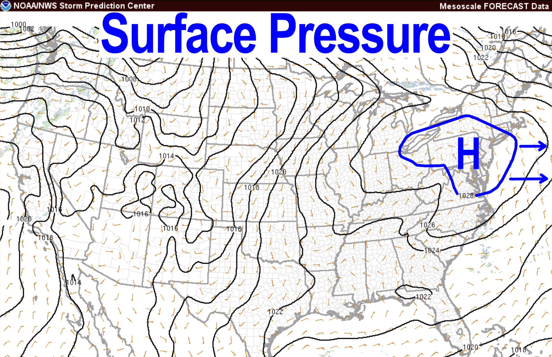
With high pressure moving towards New England but still to our west producing westerly and northwesterly flow, we’ll be on the cool side of the high with temps reaching the upper 40s to mid 50s today under mostly sunny skies.
West winds could gust over 20mph at times, so Red Flag Warnings are up for southwest NH and elevated concern for fire-spread risks continue for the rest of the greater WMass region, so pausing any outdoor burns would be wise.
Lows tonight will dip into the upper 20s to low 30s with an isolated rain or snow shower possible in far northwest MA or southern VT.
For Monday, we rinse and repeat with mostly sunny skies and highs in the mid 40s to mid 50s and a light north wind, prior to low bottoming out to either side of 30º Monday night under mostly clear skies.
After a chilly Tuesday morning, our high pressure system will be tracking south of us and off of the Mid-Atlantic coast, setting up a return southerly flow which will commence on Tuesday and send a warm front our way. Highs will reach the mid to upper 50s under mostly sunny skies, but some clouds should increase late in the day or early evening.
A few showers will be possible Tuesday night as the front pushes through, with lows in the mid 40s or so.
Wednesday and Thursday will feature a full southwest flow and warming temps into the upper 60s to mid 70s Wednesday, and then the 70s to possibly 80º on Thursday under mostly sunny skies.
We will cloud up Thursday night with showers late into Friday morning as another cold front passes through. This one has potential to bring an actual period of showers compared to the last two, but I will update as we get closer.
The following weekend looks lovely and cooler behind the front with highs in the 50s, as our rain dearth and increasing drought conditions continue to develop. With another seesaw of cooler next weekend followed by milder early the next week, we have to look toward the 2nd week of November for any relief potential from this exceedingly dry pattern.
Have a great day and if you’d like to support my work and this community resource that I’ve been operating for 12 years now, simply click / tap the link below to order my 2025 calendar (great for holiday gifts, too)
(Securely Order via Cards, Venmo, PayPal, or Check)
HAIKU OF THE DAY:
Rain dearth, bone dry Earth
Let the nor’easters blossom
Rain, snow, sleet, bring it
“Follow your bliss and the universe will open doors for you where there were only walls.”
― Joseph Campbell
