
__________________________________
2023 CALENDAR SECURE ORDER/INFO LINK
–Serene and gorgeous local WMass photos
–Deep-dives into the Top 12 most remarkable regional storms including their impacts, my personal stories, and the under-the-hood meteorology that allowed them to form
–12 weather-themed haiku
–Featured article on how the Sun drives Earth’s weather, and much more!
Good morning, we’ve got some more showers to move through the region today and this evening which leads to isolated showers Tuesday and Wednesday at times with milder and humid conditions to be followed by a sunnier and cooler by Friday through Sunday period, but before we jump into the details, let’s check a note from our local and delicious sponsor, #TandemBagelCo, with their newest location in West Springfield, MA.
——————–
A NOTE FROM OUR SPONSOR:
DHTWN Is Sponsored by Members, Patrons & Tandem Bagel Company: No matter the weather, Tandem Bagel is always there for you at several valley locations to make your mornings brighter! With bagels baked fresh daily (including Gluten-Free options), house-whipped cream cheese, coffee, and tons of lunch options, Tandem is the perfect quick stop for lunch, breakfast, or a coffee and bagel to go. Find them in Easthampton, Northampton, Hadley, Florence, and West Springfield, or use their super-streamlined online ordering tool by visiting their website.
——————————————-
***DHTWN DAILY WEATHER REPORT***
——————————————-
NWS ALERTS
–None
DHTWN REMINDER
–The odds of being a human is 1 in 400,000 billion… make it count, even in a small way (see Kurt Vonnegut quote at end of post)
DAILY CELESTIAL (STAR):
–OUR STAR ROSE AT: 7:13am this morning
–OUR STAR WILL SET AT: 5:54pm this evening
–TOTAL DAYLIGHT TIME: 10 hours and 41 minutes
DAILY CELESTIAL (MOON):
–OUR MOON WILL SET AT: 5:41pm this afternoon
–OUR MOON WILL RISE AT: 7:19am tomorrow morning
–MOON SET DIRECTION: West
–MOON RISE DIRECTION: East-Southeast
–MOON PHASE: New Moon (1.2%)
———————-
DAILY TERRESTRIAL (ZoneCast)
ZONE 1 (Northern Region)
Southern VT, Southwest NH, N. Taconics NY
–High Temps: Upper 50s to Low 60s
–Low Temps: Low to Mid 50s
–Wind: Light easterly
–Skies: Cloudy
–Precipitation: Scattered showers at times, steadiest in SWNH
ZONE 2 (Central Region)
WMass, N. CMass, N. Litchfield County, C./S. Taconics NY
–High Temps: Upper 50s to Low 60s
–Low Temps: Low to Mid 50s
–Wind: Light easterly
–Skies: Cloudy
–Precipitation: Scattered showers at times, steadiest along and east of the I-91 corridor
ZONE 3 (Southern Region)
S. CMass, S. Litchfield County, NC.CT, & NE.CT
–High Temps: Upper 50s to Low 60s
–Low Temps: Mid to Upper 50s
–Wind: Light easterly
–Skies: Cloudy
–Precipitation: Scattered showers at times, steadiest in Tolland and Windham Counties CT
———————-
WEATHER REPORT
Good morning folks, I hope things go your way today and during this new week. We only have so many of them left in each of our lives, so let’s try and make the best of things, even when they don’t go our way.
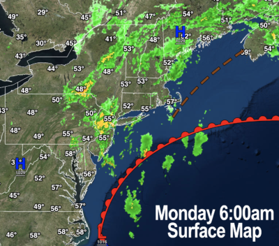
We’ve got a southerly flow ongoing into the region over the next few days, and as such it’s going to be quite mild and even humid through Wednesday (and possibly even Thursday, which is our transition today back to more autumnal conditions).
For today, we start off cloudy and dry, but more showers will work back into the region from south to north, and we can’t rule out a downpour or rumble of thunder by afternoon into evening.
The showers may be more steady along and east of the I-91 corridor by this afternoon, but we’ll see how it plays out. Again, rain could fall heavily in some spots.
Highs will crest into the upper 50s to mid 60s, and lows tonight will drop into the low to mid 50s with patchy fog and a few more showers possible.
For Tuesday we should enter a relative lull with isolated lighter showers at times, dry and cloudy others, but temps will warm into the 65-70º range along with an increase in humidity, with lows dropping into the upper 50s with patchy fog in spots.
Wednesday is also warm, and humid with dewpoints in the low 60s and high temps in the 65-70º range.
More scattered showers are also expected at times, with lows in the low to mid 50s.
Wednesday into Thursday morning will be interesting as we’ll have a storm passing to our northwest while a coastal sub-tropical low retrogrades east to west toward New England.
Rain from the coastal low is likely relegated to EMass, and showers from the NY state low should be mainly light and scattered here, but a cold front from that inland low center will move through sometime on Thursday.
We may squeak one more very mild day out Thursday which should feature increasing sunshine, but then temps plummet at night into the 30s.
Then we are visited by an autumnal air mass with highs in the 55-60º range and with lows in the mid 30s under mostly sunny skies, so a nice weekend looks to be in the offing!
Have a great day, and if you like my work you can support it by buying one or three (for gifts!) of my 2023 calendars… it’s a great local-color-filled daily companion and this year is replete with tons of cool local storm history!
2023 CALENDAR SECURE ORDER/INFO LINK
Did you know that you can also follow me on Twitter?
AND REMEMBER…
“Hello babies. Welcome to Earth. It’s hot in the summer and cold in the winter. It’s round and wet and crowded. On the outside, babies, you’ve got a hundred years here. There’s only one rule that I know of, babies: Goddamn it, you’ve got to be kind.”
–Kurt Vonnegut