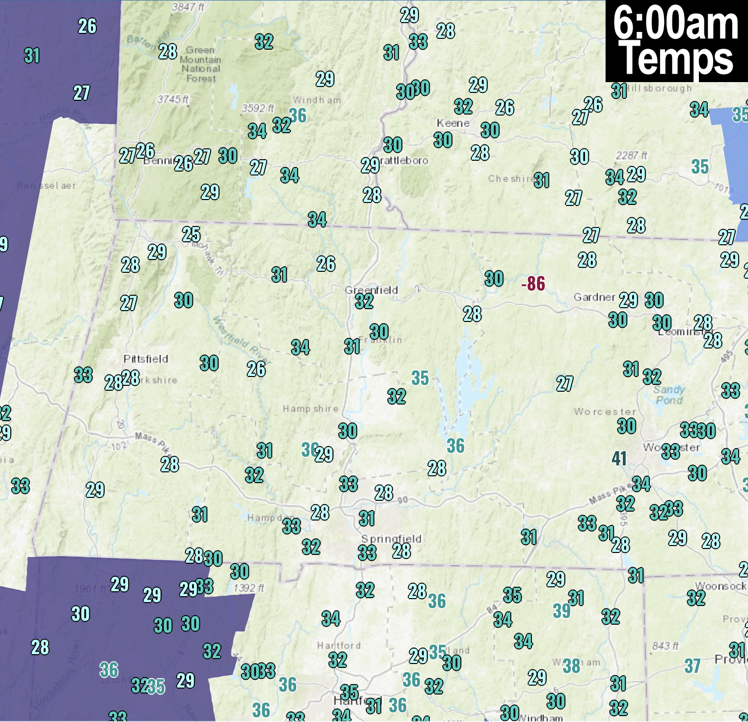
[7:10AM THUR 10/17/24] THIS MORNING SETS THE SHORT-TERM FLOOR FOR COLD TEMPS AS WE’LL RISE INTO THE LOW TO MID 70S BY FIRST HALF OF NEXT WEEK… HIGH PRESSURE TRACKING EAST AND THROUGH NEW ENGLAND ENSURES ABUNDANT SUN AND GRADUALLY WARMING TEMPS… GORGEOUS WEEKEND AHEAD… NEXT CHANCE OF SHOWERS IS EARLY THURSDAY…

TABLE OF CONTENTS
* Daily Celestials (Sun/Moon Data)
* Sponsor Note
* Morning Discussion
* TIP: Scroll below for sections, or read all
~~~~~~~~~~~~~~~~~~~~~~
YOUR DAILY CELESTIALS
~~~~~~~~~~~~~~~~~~~~~~
STAR:
–OUR STAR ROSE AT: 7:05am this morning
–OUR STAR WILL SET AT: 6:04pm this evening
–TOTAL DAYLIGHT TIME: 10 hours and 59 minutes
MOON:
–OUR MOON WILL RISE AT: 6:05pm today
–MOON RISE DIRECTION: East-Northeast
–OUR MOON WILL SET AT: 8:34am tomorrow
–MOON SET DIRECTION: West-Northwest
–MOON PHASE: Waxing Gibbous (93.8%)
~~~~~~~~~~~~~~~~~~~~~~
A NOTE FROM OUR SPONSOR
~~~~~~~~~~~~~~~~~~~~~~
Dave Hayes The Weather Nut is Sponsored by Individual Community Members, Patrons, and Tandem Bagel Company… No matter the weather, Tandem Bagel is always there for you at several valley locations to make your mornings brighter! With *New Pizza Bagels(!)*, along with bagels baked fresh daily (including Gluten-Free options), house-whipped cream cheese, coffee, and tons of lunch options, Tandem is the perfect quick stop for lunch, breakfast, or a coffee and bagel to go.
You can either 1) visit them in Easthampton, Northampton, Hadley, Florence, and/or West Springfield, 2) hire them to cater your next event, or 3) use their super-streamlined online ordering tool by visiting their website and clicking the “Catering” or “Order Online” links at https://www.tandembagelco.com
~~~~~~~~~~~~~~~~~~~~~~
YOUR MORNING DISCUSSION
~~~~~~~~~~~~~~~~~~~~~~
Good morning to you! It is ccccooolllllddd out there this morning, and while most of us have settled into the mid 20s to low 30s, I bet one reader who lives in Chester settled into the low 20s, as that seems to be the cold sink for the WMass region, year to year at this point.
Is this cold going to last?
Nay, I say.
We are warming from here through the middle of next week, albeit gradually, but in about 5 days time we will have risen 50 degrees in temperature from this morning’s lows to the highs on Tuesday and/or Wednesday.
Seasonable highs are in the low to mid 60s this time of year, so we’ll see above average temps by about Sunday through Wednesday, until a weaker cold front moves into our region by Wednesday night into Thursday (timing can change, however).
The bottom line is that a sprawling, large high pressure cell is set to push our upper low currently over the northeast and mid-Atlantic out to sea.
This upper low dipped down and helped strengthen a coastal storm that is just southeast of New England currently, and because of it, areas like northeast CT and southern CMass will see some partial sunshine with clouds at times today, but areas north and west of there should enjoy mostly sunny skies with highs in the mid to upper 50s, and lows in the low to mid 30s with more patchy frost and one more chilly night.
Starting tomorrow/Friday, we’ll crest 60º with highs in the upper 50s to mid 60s and lows in the mid to upper 30s.
By the weekend we’re even warmer with highs well into the 60s on Saturday, and in the mid 60s to low 70s by Sunday, with lows in the mid to upper 30s Saturday night and low 40s Sunday night.
Then by early to mid next week, high pressure will position itself south of New England, and invoke a more west to southwest warming flow, which will send temps into the upper 60s to mid 70s before a cold front brings a few showers and cooler temps into the late week period.
We live in New England, and many of us our lifelong New Englanders, including yours truly, and all I can say is enjoy the atmospheric tranquility for now… it won’t last forever.
Have a great day!.
“Follow your bliss and the universe will open doors for you where there were only walls.”
― Joseph Campbell
