
A NOTE FROM HELENE HOLMES…
“I have loved every weather calendar that you have done, Dave. When I was teaching, it was perfect for my fifth graders to learn more about weather terminology and concepts. I have kept past calendars to reread them. So much info in one place! This is a very professional, well-organized piece of work. I gift it to my son as well to share with his two sons.”
ORDER DAVE’S 2023 WEATHER CALENDAR HERE
———————
DAVE’S WEEKLY NUTSHELL
Good morning folks, it’s cold out there in the 30s and 40s, with chilly Cheshire County NH reporting some upper 20s!
We have lots of fair weather ahead with sunshine and mild temps today and tomorrow followed by more clouds and a few showers over the weekend with record setting warmth possible into a sunnier Monday prior to a seasonable cool down by Tuesday with fair weather through next week, but before we jump into the details, let’s check a note from our local and delicious sponsor, #TandemBagelCo, with their newest location in West Springfield, MA.
——————–
A NOTE FROM OUR SPONSOR:
DHTWN Is Sponsored by Members, Patrons & Tandem Bagel Company: No matter the weather, Tandem Bagel is always there for you at several valley locations to make your mornings brighter! With bagels baked fresh daily (including Gluten-Free options), house-whipped cream cheese, coffee, and tons of lunch options, Tandem is the perfect quick stop for lunch, breakfast, or a coffee and bagel to go. Find them in Easthampton, Northampton, Hadley, Florence, and West Springfield, or use their super-streamlined online ordering tool by visiting their website.
——————————————-
***DHTWN DAILY WEATHER REPORT***
——————————————-
NWS ALERTS
–None
DHTWN REMINDER
–The odds of being a human is 1 in 400,000 billion… make it count, even in a small way (see Kurt Vonnegut quote at end of post)
DAILY CELESTIAL (STAR):
–OUR STAR RISES AT: 7:25am this morning
–OUR STAR WILL SET AT: 5:41pm this evening
–TOTAL DAYLIGHT TIME: 10 hours and 16 minutes
DAILY CELESTIAL (MOON):
–OUR MOON WILL RISE AT: 3:46pm this afternoon
–OUR MOON WILL SET AT: 3:01am tomorrow morning
–MOON RISE DIRECTION: East-Southeast
–MOON SET DIRECTION: West
–MOON PHASE: Waxing Gibbous (73.7%)
———————-
DAILY TERRESTRIAL (ZoneCast)
ZONE 1 (Northern Region)
Southern VT, Southwest NH, N. Taconics NY
–High Temps: Mid to Upper 60s
–Low Temps: Upper 30s to Low 40s
–Wind: Light southwest
–Skies: Mostly sunny
–Precipitation: None
ZONE 2 (Central Region)
WMass, N. CMass, N. Litchfield County, C./S. Taconics NY
–High Temps: Upper 60s to 70º
–Low Temps: Upper 30s to Low 40s
–Wind: Light southwest
–Skies: Mostly sunny
–Precipitation: None
ZONE 3 (Southern Region)
S. CMass, S. Litchfield County, NC.CT, & NE.CT
–High Temps: Upper 60s to 70º
–Low Temps: Low to Mid 40s
–Wind: Light southwest
–Skies: Mostly sunny
–Precipitation: None
———————-
WEATHER REPORT
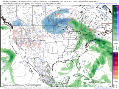
Good morning everybody, our spate of fair and warmer than average temps continues through Monday of next week, so if you’re a winter detester, a snow-mudgeon, or a cold-season Grinch, the next 5 days are ones to savor, before we start stepping down into cooler times ahead.
For today, high pressure from a big 1030mb high that is floating east off of the New England coastline will provide dry conditions, sunny skies, and highs in the 65-70º range for most of us, with lows in the upper 30s to mid 40s with a light southwest wind, and clear skies tonight.
On Friday, after some patchy morning fog, more sunshine is expected as a strong upper ridge builds along the eastern seaboard. Highs will again rise into the mid 60s to low 70s with partly cloudy skies at night and lows near 50º.
By Saturday, low pressure will be forced north of southern New England as per the upper ridge in place, which will send that low center’s warm front towards the region. This means we can expect partly sunny skies with highs in the low to mid 70s with a few showers possible at night, as lows bottom out near 60º.
Sunday will be the cloudiest of the two weekend days, with scattered showers and highs either side of 70º, with showers quitting at night and lows dropping to the mid 50s.
Monday will be our last warm day with highs either side of 70º under mostly sunny skies, which will be followed by a cold front moving through Monday night. Lows will be in the low 40s.
Tuesday into the middle of next week looks much cooler than the days preceding it, and the greater WMass region can expect a return to 50s for highs and 30s for lows through the rest of next week with fair weather and northwest flow. Some showers will be possible by next weekend.
Have a great day, and pick up a few 2023 weather calendars, they’re wicked good (info at Dave’s website link below):
Did you know that you can also follow me on Twitter?
AND REMEMBER…
“Hello babies. Welcome to Earth. It’s hot in the summer and cold in the winter. It’s round and wet and crowded. On the outside, babies, you’ve got a hundred years here. There’s only one rule that I know of, babies: Goddamn it, you’ve got to be kind.”
–Kurt Vonnegut