
———————
LARRY PICARD SHARES HIS LOVE
OF DAVE’S 2023 WEATHER CALENDAR…
“Thoughtful, beautiful, and the essence of what makes western Mass what it is. Dave’s calendar is the perfect wall calendar and supports one of the things we love best about western Massachusetts: Dave Hayes and his accurate, colorful, and entertaining weather reports.”
———————
DAVE’S WEEKLY NUTSHELL
Good morning folks, we’ve got an upper level system over western NY pressing east this morning which will continue to push showers through the WMass region with drying by tonight, to be followed by milder and sunnier conditions mid/late week, warmer conditions over the weekend, and a few showers and a cool down toward the middle of next week, but before we jump into the details, let’s check a note from our local and delicious sponsor, #TandemBagelCo, with their newest location in West Springfield, MA.
——————–
A NOTE FROM OUR SPONSOR:
DHTWN Is Sponsored by Members, Patrons & Tandem Bagel Company: No matter the weather, Tandem Bagel is always there for you at several valley locations to make your mornings brighter! With bagels baked fresh daily (including Gluten-Free options), house-whipped cream cheese, coffee, and tons of lunch options, Tandem is the perfect quick stop for lunch, breakfast, or a coffee and bagel to go. Find them in Easthampton, Northampton, Hadley, Florence, and West Springfield, or use their super-streamlined online ordering tool by visiting their website.
——————————————-
***DHTWN DAILY WEATHER REPORT***
——————————————-
NWS ALERTS
–None
DHTWN REMINDER
–The odds of being a human is 1 in 400,000 billion… make it count, even in a small way (see Kurt Vonnegut quote at end of post)
DAILY CELESTIAL (STAR):
–OUR STAR RISES AT: 7:23am this morning
–OUR STAR WILL SET AT: 5:44pm this evening
–TOTAL DAYLIGHT TIME: 10 hours and 21 minutes
DAILY CELESTIAL (MOON):
–OUR MOON WILL RISE AT: 2:49pm this afternoon
–OUR MOON WILL SET AT: 12:23am tomorrow morning
–MOON RISE DIRECTION: East-Southeast
–MOON SET DIRECTION: West-Southwest
–MOON PHASE: Waxing Gibbous (52.1%)
———————-
DAILY TERRESTRIAL (ZoneCast)
ZONE 1 (Northern Region)
Southern VT, Southwest NH, N. Taconics NY
–High Temps: Low to Mid 60s
–Low Temps: Mid to Upper 40s
–Wind: Light west
–Skies: Mostly cloudy, some sunny breaks late
–Precipitation: Isolated showers at times
ZONE 2 (Central Region)
WMass, N. CMass, N. Litchfield County, C./S. Taconics NY
–High Temps: Low to Mid 60s
–Low Temps: Mid to Upper 40s
–Wind: Light west
–Skies: Mostly cloudy, some sunny breaks late
–Precipitation: Scattered showers at times
ZONE 3 (Southern Region)
S. CMass, S. Litchfield County, NC.CT, & NE.CT
–High Temps: Low to Mid 60s
–Low Temps: Mid to Upper 40s
–Wind: Light west
–Skies: Mostly cloudy, some sunny breaks late
–Precipitation: Scattered showers at times
———————-
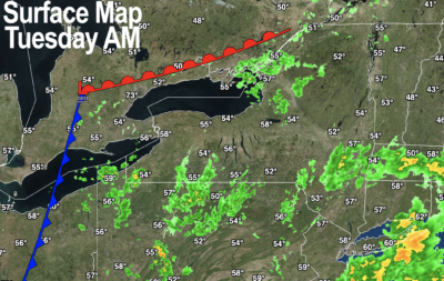
WEATHER REPORT
Good morning everybody, a number of us have wet ground as we head out the door today, thanks to overnight showers for some.
We have a weak upper disturbance that will be working east out of western NY with the thickest cloud deck over us early this morning, which will thin with time today and likely reveal some partly sunny skies by afternoon.
Highs will crest into the low to mid 60s with a light west wind. Tonight lows will drop into the mid to upper 40s as we dry things out and pressures increase with time.
For Wednesday, high pressure continues to move into the region with sunny skies and highs in the low to mid 60s, followed by a chilly night with lows in the low to mid 30s under clear skies, with patchy frost possible in parts of northern MA and SVT/SWNH.
Thursday and Friday continue with sunshine, highs in the 60s, lows in the 40s, and fair weather.
Saturday will feature high pressure tracking off the coast, putting us into stronger southerly flow with highs in the upper 60s to low 70s and lows near 50º.
Sunday looks more party sunny but highs should still be either side of 70º, and this is expected to continue into Monday as well, so a warm, fair stretch of weather lies straight ahead.
By later Monday to Tuesday a frontal boundary will be bringing a chance for some scattered showers, and likely a cool down to more seasonable temps by the middle of next week, but I will keep you updated as we get closer.
Have a great day, and if you’re the type that loves to support local outlets, check out my very giftable 2023 weather wall calendar which is rich with WMass history, education, beauty and is made for to be a practical daily companion that will keep you connected all year long.
Did you know that you can also follow me on Twitter?
AND REMEMBER…
“Hello babies. Welcome to Earth. It’s hot in the summer and cold in the winter. It’s round and wet and crowded. On the outside, babies, you’ve got a hundred years here. There’s only one rule that I know of, babies: Goddamn it, you’ve got to be kind.”
–Kurt Vonnegut