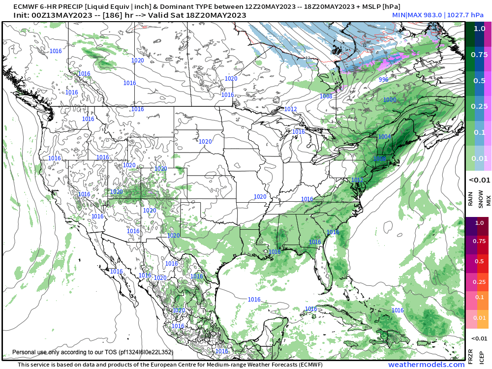
Rain next Saturday?
Prior to that, we have a beautiful sunny weekend ahead, warmer today, cooler tomorrow, and milder next week until mid-week when we do still have a chance for frost formation, but before we jump into the weather and daily details below, let’s check a note from our new weekend sponsor, #RedFireFarm located in Granby, MA.
~~~~~~~~~~~~~~~~~~~~~~
A NOTE FROM OUR WEEKEND SPONSOR:
Dave Hayes The Weather Nut is Sponsored by Individual Community Members, Patrons & Red Fire Farm. The Red Fire Farm store is open daily at 7 Carver Street in Granby, MA, and if you are looking for delicious organic produce, join their Summer CSA farm share. Vibrant greens, luscious heirloom tomatoes, sweet carrots and lots more to enjoy. Shares get free Pick Your Own, kicking off with strawberries in June. Add pastured eggs, local fruit & cheeses, mushrooms, pantry items, bouquets of organic flowers, and more. Weekly pickups at the Granby farm, Montague, Amherst, Forest Park/Springfield, Northampton, & Worcester (plus home delivery available), so click here today and snag your Summer Share!
~~~~~~~~~~~~~~~~~~~~~~~~~~~~~~~~
FRONT ROW SEATS TO THE EARTH AND SUN DANCE
–We continue to enjoy our front row seat to the Earth-and-Sun dance as we stand up, look out, and give thanks to our cosmic connection
–That’s hippie speak for “it’s gonna be sunny today”
–After a warm start this morning (50s and 60s), we’ll enjoy temps well into the 70s as high pressure remains to our south
–A weak, moisture-starved cold front moves through and drops temps into the low to mid 40s tonight under mostly clear skies
–Mother’s Day looks sunny, and cooler, with highs in the 60s
–Lows will drop to either side of 40º, so a bit chilly by Monday morning
–More sunshine for Monday as an upper ridge continues to dominate our weather
–Highs will reach the upper 60s to low 70s with lows either side of 50º
–By Tuesday into Wednesday we have a little fly in the fair weather ointment in the form of a cold frontal passage
–This may bring some showers, and an increase in wind with gusts to 30mph possible
–Temps will be in the 70s Tuesday, but behind the front some folks may not get out of the 50s Wednesday in far northwest MA and SVT/SWNH, with low/mid 60s elsewhere
–It’s that Wednesday night period where if winds die down enough and we clear and dry out, temps could plunge into the mid 30s for some folks and that is cold enough to produce frost
–This is because thermometers are generally 6 feet off of the ground, and the ground surface can cool to freezing, so plant people need to plant Wednesday night into Thursday morning as a potential precautionary period (Triple P Alert)
–Fair weather continues Thursday into Friday, but we may finally have a more robust area of rainfall moving into the region sometime around Friday to Saturday (see attached chart), so stay tuned for updates
–For now, it’s steady on with lots of fair weather and mild to warm temperatures
Have a great day!
BE KIND
“Hello babies. Welcome to Earth. It’s hot in the summer and cold in the winter. It’s round and wet and crowded. On the outside, babies, you’ve got a hundred years here. There’s only one rule that I know of, babies: Goddamn it, you’ve got to be kind.”
–Kurt Vonnegut
