
BECOME A 2023 MEMBER / SUPPORTER BELOW(Options include Cards, PayPal, Venmo, or Check)
———————-
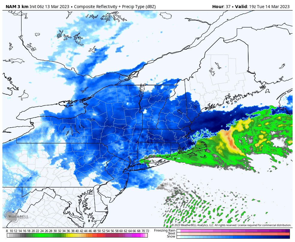
Good morning everybody, this is an incredibly difficult forecast for the central and southern part of the Pioneer Valley from about Hatfield/Whately/Hamp south to Hartford.
I will do my very best to keep you abreast of changes to the forecast, and report what I see developing as time goes on, and will be on the job throughout today, tonight, tomorrow, tomorrow night and Wednesday when the storm wraps up.
Before we jump into all of the details and updates… A NOTE FROM OUR SPONSOR:
Dave Hayes The Weather Nut is Sponsored by Individual Community Members, Patrons & Tandem Bagel Company… No matter the weather, Tandem Bagel is always there for you at several valley locations to make your mornings brighter! With bagels baked fresh daily (including Gluten-Free options), house-whipped cream cheese, coffee, and tons of lunch options, Tandem is the perfect quick stop for lunch, breakfast, or a coffee and bagel to go. Find them in Easthampton, Northampton, Hadley, Florence, and West Springfield, or use their super-streamlined online ordering tool by visiting their website.
~~~~~~~~~~~~~~~~~~~~~~~~~~~~~~~~
TODAY’S WEATHER
This is just the warm advection part of the storm, moisture builds, clouds thicken, showers of valley rain and mountain snow move through the region with highs in the mid 30s to low 40s.
We’ll have a light southeast to east wind, which means we won’t see much accumulation in the high terrain, though fresh coatings up to an inch or so are possible by late afternoon.
TONIGHT
Our coastal low pressure system is already forming off of the NC coast this morning.
It will deepen rapidly and intensify as it tracks northeast.
Our upper low now over southern Lake Michigan will swing east into the eastern Great Lakes region in NY and PA, transitioning to a neutral tilt this afternoon, and then a negative tilt during the overnight as it interacts with our deepening ocean low.
As the upper low starts reaching the coast, stronger banded precipitation will develop south of New England and be ejected northward into the greater WMass region.
Snow will become steadier and heavier in the western hilltowns and Berkshires/northern Litchfields into SVT, with more rain in the valley and points east.
Lows tonight will drop into the low to mid 30s, so temps are marginal at best.
Tomorrow’s highs should hang in this area, low to mid 30s.
———————-
BECOME A 2023 MEMBER / SUPPORTER BELOW(Options include Cards, PayPal, Venmo, or Check)
———————-
TUESDAY IS THE STORM BRUNT
Our upper low and surface low phase more deeply on Tuesday, and the strongest ocean-sourced precipitation shield tracks west off the ocean and into the WMass region as the storms spins into a deep low somewhere near Cape Cod by later in the day into the night.
How well they phase, will help determine the coastal low’s storm track and the steadiness, consistency, and intensity of the precipitation shield throughout the region.
This in turn could create substantial impact differences across the region, especially in the Pioneer Valley from Northampton south to Hartford.
VERY TOUGH CALL IN THE VALLEY
The wind direction is critical in these late-season marginal winter storms, and I think despite the varying model guidance of where exactly the coastal low will track, how deep it will be, if it will stall, if it will loop, etc., we should still have a northeast wind by mid-day into the valley, backing to northerly with time.
This is a cooler wind direction, and I believe if that combines with steady/heavier precipitation, we should be flipping from rain to snow even in the valley by late morning to early afternoon, lasting into Tuesday night before it starts to dissipate and weaken.
This would produce a 3-6″ snowfall, I believe, from Northampton Hartford, and maybe even up to 8″ toward central Hampshire County.
However, if the precipitation shield becomes highly banded, weaker than expected, or the wind persists out of the east-northeast for longer than expected and we get shadowing / subsidence / downsloping into the valley, my low-moderate snowfall forecast could bust lower.
I personally don’t think that’s going to happen, but it’s the weather we’re talking about, and it will do what it does, I am just trying to make as much sense of a complicated set of variables as I can and express that to you to set your expectations as best I can.
MAJOR SNOWSTORM IN THE HILLS/MOUNTAINS
I think this is at least a 6-12″ snowfall everywhere outside in the Pioneer Valley, including the northern valley (Franklin County from about Deerfield/Greenfield north to Brattleboro).
However I do expect higher totals at higher terrain where west-flowing precip will run into colder air, and the mountains and hills will help ring out heavier snowfall as well.
In addition, we sometimes get what are called deformation zones to set up on the northwest or western flank of the cranked up, closed off low pressure system near the coast.
These bands can dump 1-3″ per hour of heavy snow, but no one can ever know where they set up, it’s a nowcasting/reporting thing.
Some areas in the eastern Berkshires, western hilltowns or southern Greens would be most likely to get those heaviest snow amounts of about 1-2 feet, with another maxima of say 10-18″ in northern Worcester County up to eastern Cheshire County NH.
———————-
WHAT HAS YOUR FINANCIAL SUPPORT PRODUCED?
–> Almost 3700 consecutive days (10 years) of interactive, community weather reporting
–> Around 15,000 comprehensive reports sprinkled with humor and gratitude
–> 1500 to 2500 annual work hours year to year (30-50 hours weekly average)
–> In-depth coverage of every weather event and storm for almost 11 years
–> My 2023 Support Goal = 4% of fans (1 in 25) donating any amount
–> 2023 Goal Progress = 46% have stepped forward to date
–> 2023 Member Drive ends 3/26, and I’m well short of my 4% reader goal
–> SecureSupport
———————-
WIND/OUTAGES
Northeast winds are going to crank up to 30-50mph across the region, and where heavy wet snow clings and pastes to trees and lines, snow load and wind will combine to produce outages that are at least scattered, and perhaps with pockets of widespread outages, with the best chance of that in northern Worcester County into eastern Franklin County, the way I see it now.
AMOUNTS
3-6″
Hartford County (except its western highlands, 6-10″ there)
Central Hampshire County (Northampton to Amherst, south)
Central Hampden County (Westfield to Ludlow, south)
6-12″
Central / Eastern Franklin County (some hills 12″+)
Eastern Hampshire (Pelham hills, Ware, N. Belchertown)
Eastern Hampden
Northeast CT (Tolland, Windham)
Southern Worcester County
Southwestern Berkshire County MA
Southern Litchfield County CT
Southwestern Bennington County VT
Eastern Windham County VT
10-20″+
Northern Litchfield County CT
Eastern Berkshires
Western hilltowns (western Franklin, Hampshire, Hampden)
Southern Greens VT (eastern Bennington, western Windham)
Southwest NH
Northern Worcester County highlands
The storm will being to pull away around midnight going into Wednesday, transitioning to snow showers overnight into Wednesday morning, and then our weather is way more pedestrian after that with no winter weather in sight.
I hope you’ll stick with me as I ride this mid-March winter bucking bronco, I will do everything I can to convey changes to the forecast and keep you updated all the way through!
Have a great day, and please stay tuned for updates!
———————-
BECOME A 2023 MEMBER / SUPPORTER BELOW(Options include Cards, PayPal, Venmo, or Check)
———————-