Good morning everybody, I will get back to regularly scheduled programming tomorrow morning, I needed the past two days of music, friends and fun at the Green River Festival, which concludes today. I had such a blast dancing, listening to music, seeing old friends, hanging with my people, and meeting some of you!
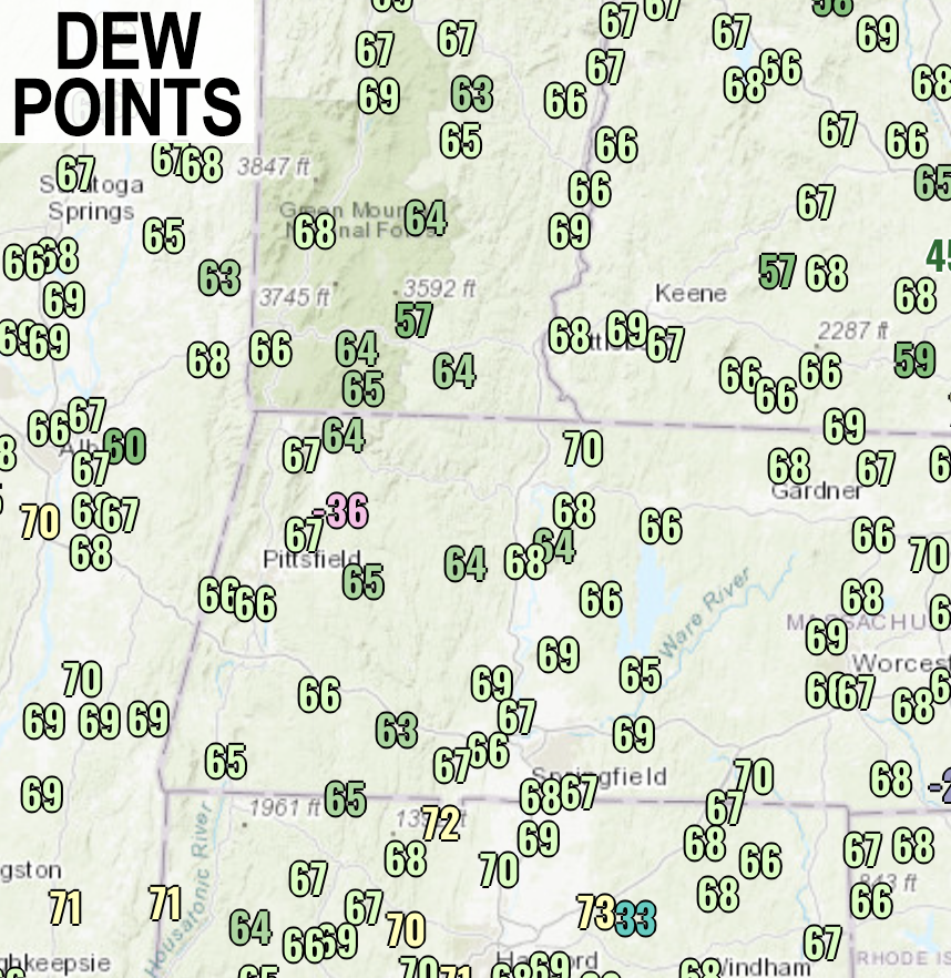
The general story for our weather today and into much of the coming week is a continued humid air mass being re-established through southerly flow, first from a dying upper level system to our west that tracks northeast and away through tomorrow, and a new upper low dropping into the Great Lakes and tracking east through mid to later this coming week.
We’re on the east side of both of these systems, and because air circulates counterclockwise around low pressure, you can put a big “L” over Pennsylvania in your mind’s eye and see southerly air working from south to north into New England, and the southeast U.S. source region this time of year is MUGGY.
This means continued dewpoint temps well into the 60s to low 70s.
For today, we’ll have a legit summer day with highs in the low to mid 80s, and possibly with some upper 80s in a few spots under partly to mostly sunny skies early, with some isolated showers and thunderstorms developing by afternoon.
These could form at any time including around mid day, but it appears the best chance will be after the full heating of the day is allowed to destabilize the atmosphere more, which means more towards later afternoon into early evening.
Heavy rain is really the main threat with any of these, as the air mass is warm deeper into the atmosphere above the surface, so it would be tough to get hail going, but I can’t rule that out totally.
Gusty winds may accompany any stronger cells, but again, torrential rainfall is the main issue with these, and lightning, of course.
For tonight, activity winds down with lows in the mid 60s with patchy fog developing over the region.
Thunderstorm activity that develops this afternoon and evening over the Midwest may hold together enough to produce some morning showers or storms to kick off the work week, but it’s really the afternoon and evening where we’ll have to watch for more organized thunderstorms, a few of which may be strong to severe, so I will update you first thing Monday morning about that potential.
Highs Monday will reach the upper 70s to low 80s with lows in the 60s again with scattered showers and storms possible.
Our Great Lakes upper low then tracks east towards our region Tuesday and Wednesday, as it does, the wind field will get more active which will aid in more shower and thunderstorm development, so the bottom line is we can expect a summery pattern this week of humidity, scattered showers, downpours and thunderstorms mixed with dry periods in between, but a lack of real heat with highs generally in the 75-80º range and lows in the 60s.
By the time we get to late week into the weekend, we may find ourselves in between systems, and while showers can’t be ruled out on any day, the Friday into Saturday/Sunday period may be less active.
I hope you have a great day, and if you’re going to Green River Festival have fun!
