 Good morning everybody, the periscope has been sent skyward, rotated in both circulations vigorously, and yanked back down for safekeeping, and I can say with great assurance that no real heat or humidity is on the way at the moment, though we do have a low chance of severe thunderstorms mid-week, so I will be keeping a blurry eye on that potential.
As for the rest of this report, I am going to break open, bust out, hastily dispense, cast about, and dutifully deliver a dozen-plus double–dashes directly below for your perusing pleasure of this day’s week-head weather narrative:
SUMMAH-RY
–The quick top-view is that we have potential for a roughly 2-day wavelength that could bring periods of showers or rain through here very couple of days into next week
–Today is super gorgeous, isolated shower possible, highs mid 70s to low 80s, partly sunny, light wind, lovely, enjoy!
–Lows in the 50s tonight provide a mild night, followed by partly sunny skies early Monday with clouds building into the regioin
–Highs will be in the 70s, and a warm front and cold frontal combo will be tracking northeast towards us
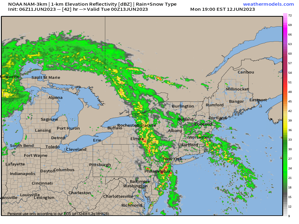
–Showers should arrive late afternoon and pick up in the evening into Tuesday morning (see attached chart) when showers could be heavy at times with a thunder rumble possible with lows in the 50s
–We’re slightly cooler behind the front for Tuesday, BUT if we can clear in the afternoon (I do expect drying then after some morning showers) we could warm toward the upper 70s
–Tuesday night looks dry in the low to mid 50s, but our upper level system lofts a wave through the region Wednesday with more showers, and a stronger wind field
–This with siphoned southerly moisture and instability could provide conditions for strong to severe thunderstorms, so stay tuned for updates on the mid-week period, please
–Thursday looks nicer at this point with partly sunny skies and highs in the upper 60s to mid 70s, but the late-week period is signaling more showers, possibly into next Saturday
–However, this late week period of showery potential pales in comparison to the Monday night into Tuesday heavier rainfall, and the potential strong/severe showery Wednesday weather
Stay tuned and I will refine it as we get closer, but since today is the only day you’ve got if you’re reading these words, be here now and enjoy the day!
