
TABLE OF CONTENTS
* Daily Celestials (Sun/Moon Data)
* Sponsor Note
* Join My Newsletter
(& get my Top12WMassStorms ebook!)
* Morning Discussion
* TIP: Scroll below for sections, or read all
~~~~~~~~~~~~~~~~~~~~~~
YOUR DAILY CELESTIALS
~~~~~~~~~~~~~~~~~~~~~~
STAR:
–OUR STAR ROSE AT: 5:42am this morning
–OUR STAR WILL SET AT: 8:10pm this evening
–TOTAL DAYLIGHT TIME: 14 hours and 28 minutes
MOON:
–OUR MOON WILL SET AT: 4:47pm this afternoon
–MOON SET DIRECTION: Northwest
–OUR MOON WILL RISE AT: 1:26am tomorrow morning
–MOON RISE DIRECTION: Northeast
–MOON PHASE: Waning Crescent (25.2%)
~~~~~~~~~~~~~~~~~~~~~~
A NOTE FROM OUR SPONSOR
~~~~~~~~~~~~~~~~~~~~~~
Dave Hayes The Weather Nut is Sponsored by Individual Community Members, Patrons, and Tandem Bagel Company… No matter the weather, Tandem Bagel is always there for you at several valley locations to make your mornings brighter! With *New Pizza Bagels(!)*, along with bagels baked fresh daily (including Gluten-Free options), house-whipped cream cheese, coffee, and tons of lunch options, Tandem is the perfect quick stop for lunch, breakfast, or a coffee and bagel to go.
You can either 1) visit them in Easthampton, Northampton, Hadley, Florence, and/or West Springfield, 2) hire them to cater your next event, or 3) use their super-streamlined online ordering tool by visiting their website and clicking the “Catering” or “Order Online” links.
~~~~~~~~~~~~~~~~~~~~~~
DAVE’S WEEKLY NEWSLETTER (Top 12 WMass Storms)
DAVE’S MOBILE APP (Late 2024 Release)
~~~~~~~~~~~~~~~~~~~~~~
YOUR MORNING DISCUSSION
~~~~~~~~~~~~~~~~~~~~~~
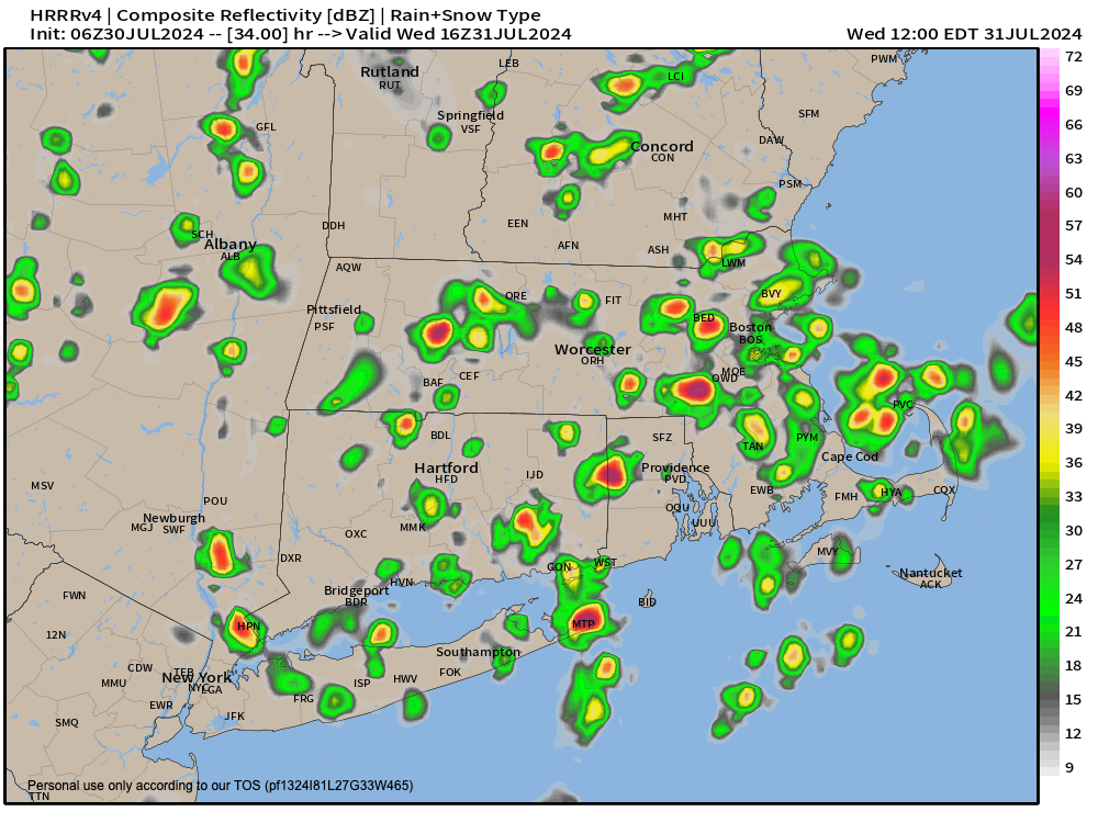
Good morning everybody, through the weekend we have a couple of larger upper level systems that will produce, I believe, the most sky-water-filled days for the largest number of us tomorrow/Wednesday and again on Sunday with showers, downpours and thunderstorms possible.
That doesn’t mean we’re completely dry the rest of the days betwixt and between (though I do think today and later Thursday into earlier Friday are the driest periods), as we are in a summer pattern with high humidity that will be persisting straight through into at least the middle of next week.
Whenever you have this level of humidity around combined with hills nearby, you can always pop a shower or isolated thunderstorm any day of the week.
Getting back to a more sequential look at our weather ahead, for today, our upper level low that brought the periods of rain and a few thunderstorms yesterday is tracking northeast and away from the region.
We’ve got patchy fog in spots, and low clouds, but all of that should burn off with time later this morning, and reveal a partly to mostly sunny and very warm and humid day with highs in the mid to upper 80s and an isolated shower or t-storm possible.
Southerly winds should pick up later this afternoon and into early evening with gusts up to 25mph or so possible. Lows tonight dip into the 65-70º range with increasing clouds.
Another upper low swings through the region and will act on this high moisture content, and help produce scattered and clustered areas of showers, downpours and thunderstorms.
Highs will only reach the upper 70s to low 80s, and while a strong storm or two may pop, severe weather is not expected, with mostly heavy rainers expected. Lows will again drop to the 65-70º range with some showers in spots.
By Thursday, we may see some lingering morning showers, but as that storm pulls away, sunshine should develop and our temps will soar into the mid 80s to low 90s with high humidity, to in comes another round of summer heat to end our week. Lows bottom out to either side of 70º.
By Friday, another hot day shows up with highs either side of 90º and high humidity again with a few showers or t-storm possible later in the day, and showers and storms may increase a bit into Friday night.
By the weekend, I will be watching the progression of another upper level system that likely brings more widespread rainfall by Sunday, but the bottom line is that the whole weekend has an unsettled look to it with plenty of humidity, and enough heat to help drive instability to produce afternoon scattered showers and/or t-storms.
Highs will be in the 80s after heat peaks on Friday, with lows in the 60s to near 70º.
For now, early next week with looks humid and warm, but mostly dry with high pressure building in to the south, as a cold front sets up to swing through by mid-week with more showers and thunderstorms.
After that, we may get another reprieve of drier, and lower-humidity days.
Here’s hoping! Have a great day!
“Follow your bliss and the universe will open doors for you where there were only walls.”
― Joseph Campbell