>>> DAVE’S WEEKLY WEATHER NUTSHELL <<<
--Patchy dense fog lifts later this morning
--High pressure builds in and produces a rain-free, mostly sunny very warm and humid day with highs 85-90º
--Lows in the mid to upper 60s under partly cloudy skies
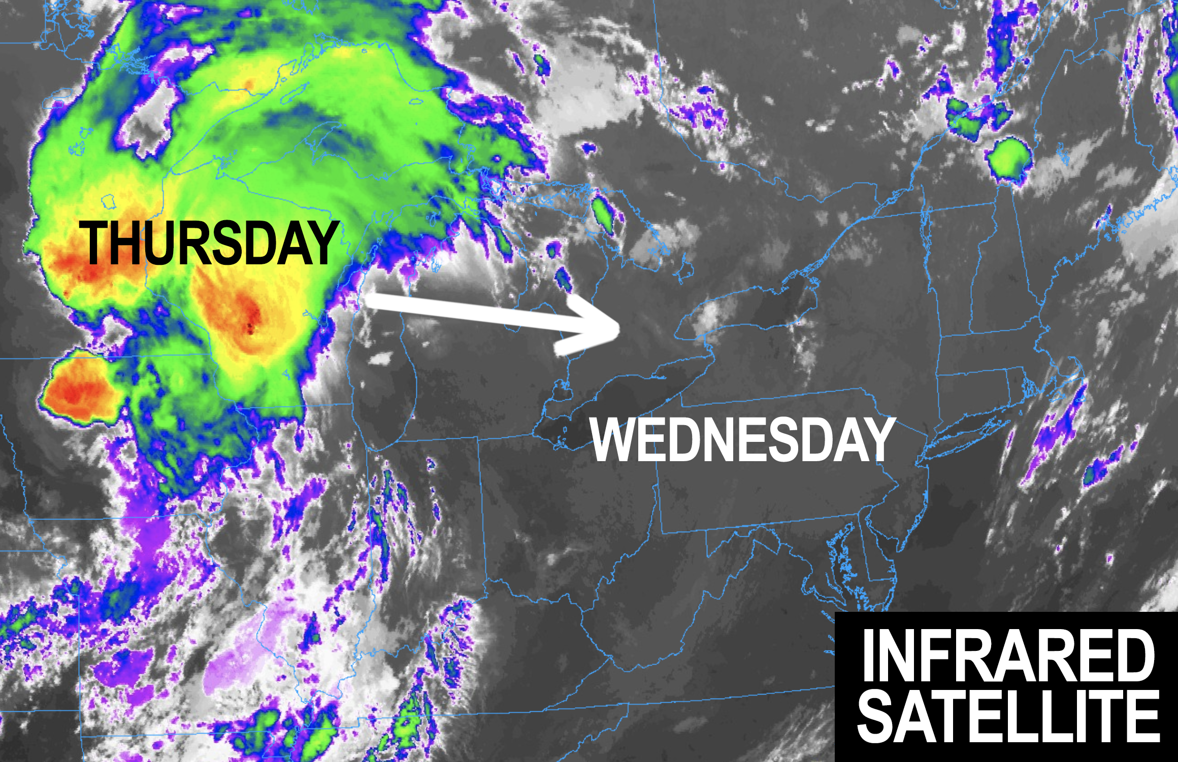
--We watch to see how a Great Lakes thunderstorm complex behaves on approach to the WMass region tomorrow morning
--A few showers are possible early, but assuming we get more sunshine by late morning into early afternoon, severe weather is possible
--Torrential rain, flash flooding, damaging straight line winds, tornadoes, and hail are all possible Thursday P.M.
--Heat Advisories are up for Thursday into Friday, with heat indices 95-99º Thurs, and upper 90s to 104º on Friday
--Friday looks largely rain free, and just sunny, hot and very humid
--Air Quality is likely to be reduced today and Friday
--Saturday sees a cold front move into the region and bring some of the strongest wind shear we've seen in months
--This could produce strong to severe thunderstorms with damaging straight line winds, and it will be hot and humid again on Saturday
--That front sweeps the heat and humidity seaward by Sunday, which is the pick of the weekend, with northwest flow, lower humidity, and lower temps, all of which *should* last into the first half of next week, but before we talk details let's check a note from our local and delicious sponsor, #TandemBagelCo, with their newest location in the Stop & Shop Plaza on King Street in Northampton, MA.
~~~~~~~~~~~~~~~~~~~~~~
>>> A NOTE FROM OUR SPONSOR <<<
Dave Hayes The Weather Nut is Sponsored by Individual Community Members, Patrons & Tandem Bagel Company... No matter the weather, Tandem Bagel is always there for you at several valley locations to make your mornings brighter! With bagels baked fresh daily (including Gluten-Free options), house-whipped cream cheese, coffee, and tons of lunch options, Tandem is the perfect quick stop for lunch, breakfast, or a coffee and bagel to go. Find them in Easthampton, Northampton, Hadley, Florence, and West Springfield, or use their super-streamlined online ordering tool by visiting their website.
>>> MORNING DISCUSSION <<< Good morning everybody, we've got 4 days ahead of hot and humid weather to move through before we (hopefully, and famous last words) look to the potential for 4 days of drier, lower humidity, and peaceful conditions Sunday through Wednesday. A weather nut can dream, after all! We're looking at an "A/B/A/B" pattern of weather days, with A = hot, very humid, rain-free, a bit lower air quality for our Wednesday and Friday (today will be 85-90º, whereas Friday will be upper 80s to mid 90s), and with B = Strong to severe thunderstorms possible with damage from wind and flooding also possible each of those afternoons/evenings. For today, fog lifts and sunshine ensues! Seriously cosmic! With high pressure dominating, southerly flow pumps the heat and humidity, with highs 85-90º and dewpoints exceeding 70º ini spots. It's a great day for a swim, to be sure! Temps tamp down into the 65-70º range tonight, and then we look to the west after midnight. A larger area of thunderstorms that are self-perpetuating called a Mesoscale Convective Complex/System is likely to emanate east out of the Great Lakes, and how well that holds together into the WMass region tomorrow morning will have impacts on our severe weather potential tomorrow afternoon/evening. Thursday begins the Heat Advisory which lasts until Friday for now, but may need extending into Saturday. Depending on how much sunshine and surface heating we see on Thursday, that will help determine how much we'll see our incoming mid-level wave interact with very humid air, attendant stronger wind shear, and instability to produce a broken or in tact squall line of strong to severe thunderstorms with heavy rain by mid to late afternoon, or even in the evening (timing is uncertain still). It should be gusty out of the south and southwest as well with gusts 20-30mph ahead of our incoming wave. These storms could bring straight line damaging wind gusts and even a tornado or two, and as such the SPC has us painted in a Level 2 out of 5 severe storm risk, so please stay tuned for updates. Highs will be in the upper 80s to low 90s Thursday with lows in the upper 60s to low 70s. Friday is hot, humid, hazy, and rain free with highs in the upper 80s to mid 90s and lows in the upper 60s to mid 70s!! This will be the peak of the heat wave. Saturday is going to be hot and humid as well with a strong cold front pushing into the region by afternoon, which will likely set off more strong to severe thunderstorms capable of flash flooding or wind damage in pockets, given that wind shear aloft looks stronger than I have seen in quite a while. Sunday an entirely new air mass is advected into the region with northwest flow and highs in the 70s to low 80s with lower humidity both Sunday and Monday. Lows should be well down into the 50s!! Tuesday and Wednesday look nice at the moment, but we know how that played out late last week when this week was looking very nice at that range, so let's take it with a grain of salt, hope for the best, and I will keep you updated. Have a great day! >>> BE KIND <<< “Hello babies. Welcome to Earth. It's hot in the summer and cold in the winter. It's round and wet and crowded. On the outside, babies, you've got a hundred years here. There's only one rule that I know of, babies: Goddamn it, you've got to be kind.” --Kurt Vonnegut
