DHTWN’S WEEKLY NUTSHELL
–Way more comfortable this morning than we’ve seen in weeks, I feel human again
–A ridge builds in today with mostly sunny skies, lower humidity, and highs low to mid 80s
–Clouds should build northward up to at least the MassPike with lows in the low to mid 60s
–Some morning showers give way to a lull, followed by a more robust area of showers and thunderstorms in the afternoon and evening with a cold front
–Highs will only reach the 75-80º range as humidity increases
–Some isolated flash flooding is possible in southern VT where Flood Watches are up
–Showers end at night with lows in the low 60s
–Saturday may see a few isolated showers, especially in the western hills, but otherwise partly sunny with highs upper 70s to low 80s
–Sunday is the pick of the weekend by far, as humidity lowers substantially with dew points in the 50s under sunny skies with highs in the low to mid 80s and lows either side of 60º
–Monday looks like a slightly warmer repeat of Sunday with plenty of sun followed by a mid-week period where humidity increases and results in afternoon instability showers and a few thunderstorms, but before we talk details let’s check a note from our local and delicious sponsor, #TandemBagelCo, with their newest location in the Stop & Shop Plaza on King Street in Northampton, MA.
~~~~~~~~~~~~~~~~~~~~~~
>>> A NOTE FROM OUR SPONSOR <<<
Dave Hayes The Weather Nut is Sponsored by Individual Community Members, Patrons & Tandem Bagel Company... No matter the weather, Tandem Bagel is always there for you at several valley locations to make your mornings brighter! With bagels baked fresh daily (including Gluten-Free options), house-whipped cream cheese, coffee, and tons of lunch options, Tandem is the perfect quick stop for lunch, breakfast, or a coffee and bagel to go. Find them in Easthampton, Northampton, Hadley, Florence, and West Springfield, or use their super-streamlined online ordering tool by visiting their website.
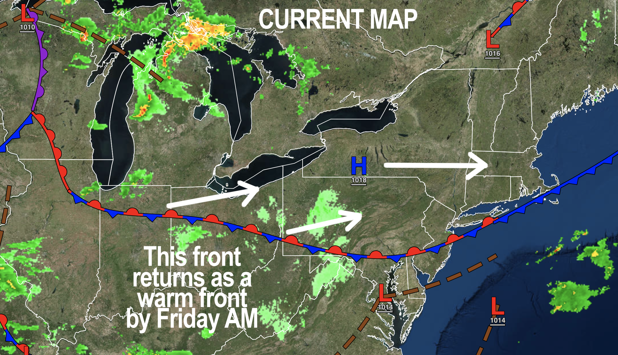
>>> MORNING DISCUSSION <<< Good morning everybody, what a morning, what a morning! I've pep in my step!! All the mushrooms have been harvested off of my body!! The birds are chirping!! The perspiration has dried up!! I know this is too much information so early in the morning!! I'm so excited and I just can't hide it!! Ok, that's a lot of exclamation points to kick things off, but it sure is nice to wake up to decent air quality, cool temps, and lower humidity with the sun coming up. As for today, we can expect more of the same with high pressure building from the west, and producing light and variable wind, sunshine, lower humidity and seasonably warm temps in the low to mid 80s for highs with lows in the low to mid 60s as clouds build overnight. For Friday, we've got a warm front / cold front combo moving into the region, hence the clouds overnight due to the warm front. This will push some showers into the region tomorrow morning, but we should see a lull after that makes it through. Highs will only be in the 75-80º range under mostly cloudy skies, and then we'll look to see the response ahead of our incoming cold front for the afternoon and evening. If we get a few sunny breaks, that could help amp the storms a bit, but with poor mid-level lapse rates (even with stronger wind shear present) they shouldn't get too out of hand. Still, some strong thunderstorms are possible, and waterlogged southern VT could see some isolated flash flooding, with Flood Watches posted up that way for Friday. Showers and storms wind down at night with lows in the low 60s. The Saturday through Monday period looks super lovely at this point, with only a few afternoon instability showers for Saturday expected. Otherwise, it looks mostly sunny through the period, especially for Sunday and Monday with temps in the 80s for highs, and lower humidity, and little to no smoke impact from western wildfires. Mornings should be cool and crisp, and this writer can't wait. By the middle of next week, we see humidity increase again as flow turns more southerly, and that will help produce enough daily instability to generate a few scattered showers and thunderstorms Tuesday and Wednesday afternoon, but these look like more typical summer days with partly to mostly sunny skies for good parts of those days with highs in the 80s and lows in the 60s. By late next week we may see a surge of heat pushing us up and into the low 90s for highs, but no BIG heat is expected, nor are any flooding rains expected next week, so for now, we've taken a very positive turn, which is something for which to be very grateful after the pounding we just took. Remember to support your local farms, either by donating support if needed, or joining a CSA, or buying vegetables at your local farm stands or farmer's markets. WE NEED OUR FARMERS. LOCAL FOOD IS BEST. Have a great day! >>> BE KIND <<< “Hello babies. Welcome to Earth. It's hot in the summer and cold in the winter. It's round and wet and crowded. On the outside, babies, you've got a hundred years here. There's only one rule that I know of, babies: Goddamn it, you've got to be kind.” --Kurt Vonnegut
