Current Weather Map
TABLE OF CONTENTS
* Daily Celestials (Sun/Moon Data)
* Weekly Weather Nutshell
* Morning Discussion
* TIP: Scroll below for sections, or read all
~~~~~~~~~~~~~~~~~~~~~~
YOUR DAILY CELESTIALS
~~~~~~~~~~~~~~~~~~~~~~
STAR:
–OUR STAR ROSE AT: 7:02am this morning
–OUR STAR SETS AT: 5:05pm this evening
–TOTAL DAYLIGHT TIME: 10 hours and 3 minutes
MOON:
–OUR MOON SETS AT: 10:24am this morning
–MOON SET DIRECTION: West-Southwest
–OUR MOON RISES AT: 1:09am tomorrow morning
–MOON RISE DIRECTION: East-Southeast
–MOON PHASE: Waning Gibbous (54.9%)
~~~~~~~~~~~~~~~~~~~~~~
A NOTE FROM OUR SPONSOR
~~~~~~~~~~~~~~~~~~~~~~
Dave Hayes The Weather Nut is Sponsored by Individual Community Members, Patrons, and Tandem Bagel Company… No matter the weather, Tandem Bagel is always there for you at several valley locations to make your mornings brighter! With bagels baked fresh daily (including Gluten-Free options), house-whipped cream cheese, coffee, and tons of lunch options, Tandem is the perfect quick stop for lunch, breakfast, or a coffee and bagel to go. Find them in Easthampton, Northampton, Hadley, Florence, and West Springfield, or use their super-streamlined online ordering tool by visiting their website.
~~~~~~~~~~~~~~~~~~~~~~
YOUR WEEKLY WEATHER NUTSHELL
~~~~~~~~~~~~~~~~~~~~~~
–Upper level trough responsible for days of cloud gloom finally relents and pushes off shore today
–One more day of mostly cloudy conditions, then sunshine increases for days
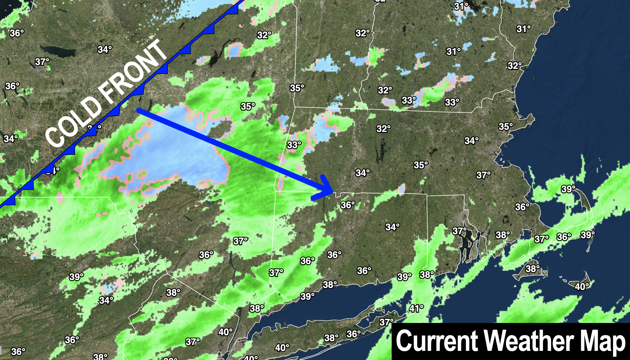
–A weak cold front is pushing through the region today, and bringing some scattered mixed rain and snow showers
–These shouldn’t amount to much, but some folks will get wet, or see a bit of snow
–Highs will rise into the upper 30s to low 40s
–Some afternoon sunny breaks are possible to the west
–Lows tonight behind the front drop to the low to mid 20s
–Eastern Worcester County down into far northeast CT could see a parting burst of snow showers that may dust a few spots
–We begin clearing out overnight and into Saturday with a partly to mostly sunny day expected
–Some clouds may linger in the high terrain west of I-91, but drier air should create sunny periods there in the afternoon
–Highs will reach the low to mid 30s both weekend days with lows in the mid teens to low 20s
–By Sunday we’ll have a full on Sun Day!
–Fair weather continues through much of next week, with maybe a shower Tuesday night into Wednesday with a warm front
–Otherwise, I see a lot of sunshine coming our way as high pressure builds in from the northwest
–Highs look to reside mostly in the 30s Monday through Wednesday, and then bump into the low 40s by late week, with lows in the teens and 20s throughout
–Next chance of any precipitation is with a frontal passage next Saturday, but that’s a long way off, so enjoy the incoming sunshine!
~~~~~~~~~~~~~~~~~~~~~~
YOUR MORNING DISCUSSION
~~~~~~~~~~~~~~~~~~~~~~
Good morning everybody, you’re gonna have to bust out those sunglasses soon enough as we finally collectively put our shoulders to the task and shove this lazy upper low clearly hammered on barley wine or some sugar-rich boozy substance and send it packing for the North Atlantic.
This will help ensure that today is our last mostly cloudy day in terms of the overall greater WMass region.
Your efforts will be rewarded with my famous frittatas which will drop the from the sky this weekend like our morning snow burst of foot-sized flakes the other day! Hold your plates out your windows to catch one or two! #HotSauceNotIncluded
All of this nutty nonsense to say, that we’ll be socked in the clouds today with a few scattered rain or snow showers about the region, which may end with a snow shower burst in eastern CMass this evening.
We may also see some sunny breaks develops in the WMass region later today.
Giant sprawling high pressure will push the moisture out to sea, and sunshine will be increasing in our region starting tomorrow, though it’ll be more of a partly sunny day with cloudy periods west of the I-91 in the hilltowns, Berkshires, and SVT at times.
Sunday is going to be a resplendently sunny day, and sunshine with fair weather should carry into much of next week.
The Nutshell section above handles the temps and other details, but suffice it to say, a big storm-free pocket arrives this weekend and lasts through much of next week.
Skiers will be happy to know that temps will be PLENTY cold for making snow all weekend and all next week long, so get your gear ready.
Have a great day!
>>> BE KIND <<<
“Hello babies. Welcome to Earth. It’s hot in the summer and cold in the winter. It’s round and wet and crowded. On the outside, babies, you’ve got a hundred years here. There’s only one rule that I know of, babies: Goddamn it, you’ve got to be kind.”
–Kurt Vonnegut
