
Good morning everybody, Winter continues to be denied a foothold of any sort in southern New England as a more typical spring pattern with big upper lows over the desert southwest that drive mild Pacific air northeast into New England while keeping the big cold in Canada bottled up north continues.
February is mostly a lost cause this year when it comes to any winter-type pattern getting established or even moving through in a transient fashion, so for ski resorts you’re looking for those nights with lows in the 20s to make snow.
There are some signals for very late February into March when colder air could be working back into the region, but that’s a long way off and not worth discussing until we get closer.
For today, we had some Berkshire and western hilltown snow showers and flurries move through on cold advection flow, and some coatings have been reported overnight, notably by Steve in Plainfield.
Did your ground get dusted? Let me know, please.
Winds also kept up overnight with gusts at 3 airports (Barnes/Westfield, Pittsfield and Harriman/North Adams) reaching 35-40mph.
In terms of wind, it will gust up this morning as temps rise a bit, but we should be throttling wind back into the afternoon with mostly sunny skies and any clouds dissipating.
Highs should reach the low to upper 30s, with lows either side of 20º with light wind and clear skies.
High pressure continues to press east through the Mid-Atlantic and New England region, centered to our south Saturday night into Sunday, which will turn our flow southwest, which is a warming flow.
Highs will climb well into the 40s under mostly sunny skies but high clouds will already be building in during the morning, and will thicken later in the afternoon and evening as a storm pushes off the east coast and stays well south of Nantucket.
This storm could graze northeast CT or southeastern CMass with a few showers, but the greater WMass region should stay dry with cloudy skies overnight and lows in the 25-30º range.
A quick period of northwesterly flow will be preparing to move in behind the departing storm with morning clouds giving way to partly sunny skies and highs in the low 40s.
An area of snow showers will move through Monday night with lows in the upper 20s, and breezy conditions that last into Tuesday under mostly sunny skies with highs in the low to mid 40s and lows in the 20s.
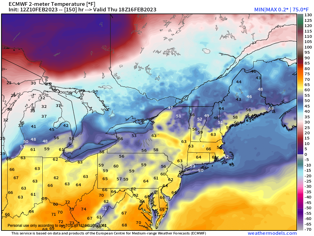
After that, we’re off to the races for warming temperatures Wednesday through Friday with Thursday being the peak temperature spike, likely hitting the low to mid 60s which would break record temps, with highs in the 50s Wednesday and Friday.
Wednesday looks partly sunny as high pressure pulls further away from the region. Clouds will be increasing Thursday and it could get quite windy out of the southwest as a deepening storm tracks northeast through the Great Lakes and up into southeast Canada, dragging a cold front and rain showers through our region late Thursday night into Friday.
That’s the news from Lake Wobegon as Garrison Keillor used to say on Prairie Home Companion… I hope you have a great day!