Current Conditions
–Info or order at link below
–Will ship them today
–Thanks for your support!
——————————-
WEEKLY WEATHER NUTSHELL
We have a couple of rainy systems to work through over the next 7 days with mild temps through Thursday and a late-week cool down, but before we dive into all of the weather details below, let’s check a note from our new local weekend sponsor, #CranberryHillHealingArts located in Amherst, MA.
——————–
A NOTE FROM OUR WEEKEND SPONSOR:
DHTWN is sponsored by members, patrons, and Cranberry Hill Healing Arts. The turning of the seasons can be challenging, and Carolyn Walker of Cranberry Hill Healing Arts in Amherst is there for you. When you are searching for ways to be at peace, seek relaxation, and feel more energetic, let Reiki & Sound Healing guide you on your journey to wholeness. Through energy work and the gentle vibrations of singing bowls, chimes, and chanting, Carolyn crafts a safe and calming space to experience renewal. Learn more and/or book your session today by visiting her website.
——————————————-
***DHTWN DAILY WEATHER REPORT***
——————————————-
Good morning everybody, I hope you have some fun plans for later today and tonight, and if you don’t, a quiet night in is also quite nice, too.
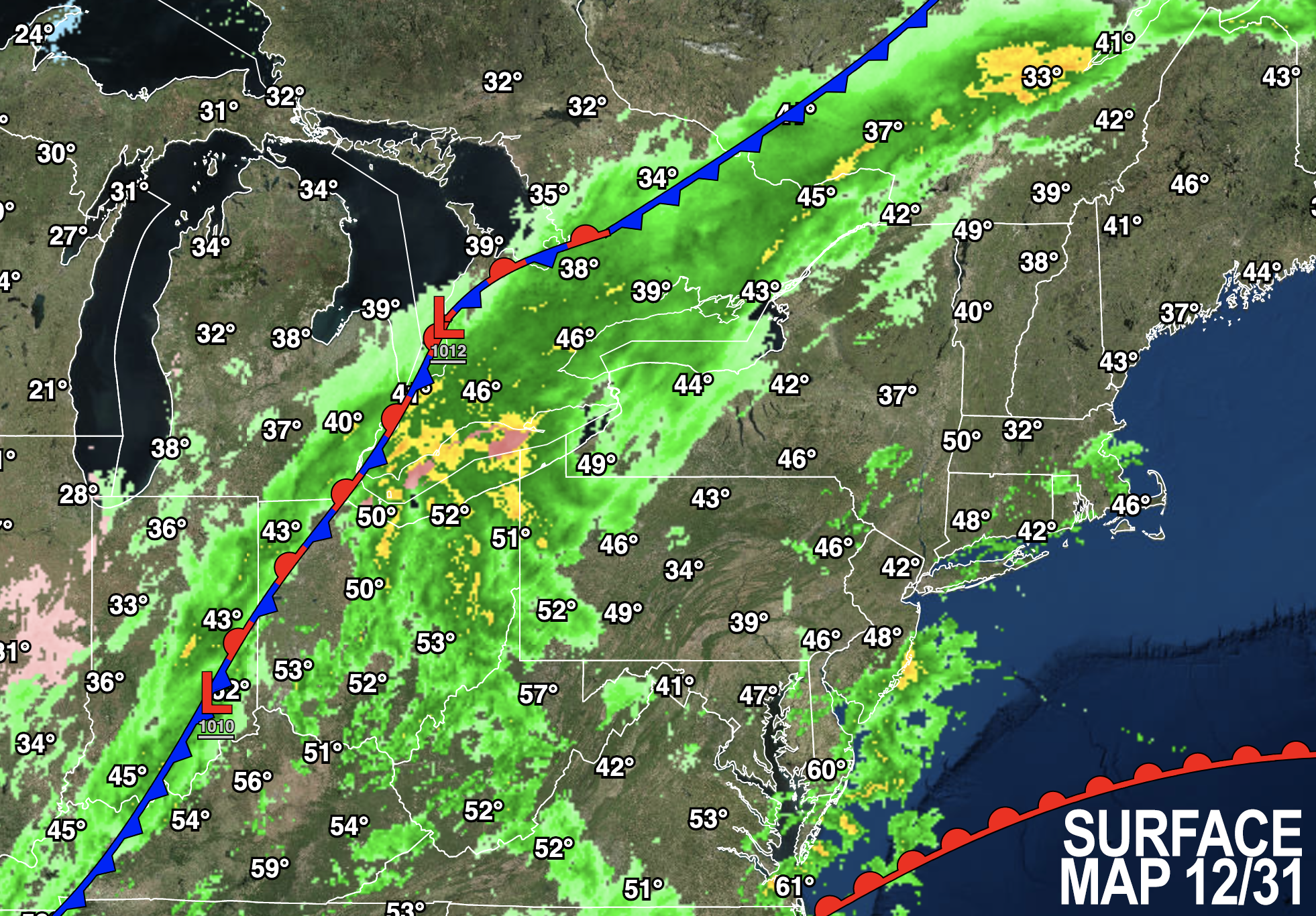
As for our weather, you’re gonna need the rain gear this evening before midnight.
This will not be a washout and in fact, it only appears like we’ll see a quarter inch of rain or so, maybe up to a half inch in some areas east of the I-91 corridor and south of the Rt. 2 corridor, especially in northeast CT up into the Worcester metro region.
A few passing showers are possible by late morning into the mid afternoon, but the main area of showers holds off until later afternoon and this evening, with highs in the low to mid 50s.
Patchy fog will also be an issue for some, and it’s actually pretty dense in northeast CT this morning already.
As mentioned, rain and fog are expected at times tonight, but this frontal system will be trucking right on through, and while some showers are possible until about dawn, we should already be drying by then with a much more clear day coming up for the first day of 2023. Lows will be in the upper 30s to low 40s tonight.
For New Year’s Day, the front will be gone and sunshine will develop with highs in the 40s as a westerly wind kicks up and gusts to 20mph or so at times. Lows will drop into the upper 20s to low 30s, so it will be chilly for New Year’s Night.
Monday represents slackening wind and a restful day atmospherically-speaking with highs in the mid to upper 40s under partly sunny skies with lows in the mid 30s before another system brings more clouds and showers on Tuesday.
Tuesday afternoon through Wednesday night should bring a couple of rounds of showers as another frontal system approaches, with very mild air surging into the greater WMass region ahead of its arrival.
Highs should reach well into the 50s both days, and may reach the low 60s Wednesday with wet conditions.
By Thursday, leftover showers should be winding down, and colder air will be moving in for Thursday night into Friday.
A trailing coastal wave may move toward New England and could bring some wintry weather to parts of our region by late next week with highs only in the mid to upper 30s and lows in the 20s as seasonable winter conditions look to re-take their meteorological throne.
Have a great day, be and travel safe, and Happy New Year! Thanks for being here for another year, I couldn’t have done it with out you in 2022!!
You can also follow me on Twitter.
AND REMEMBER…
“Hello babies. Welcome to Earth. It’s hot in the summer and cold in the winter. It’s round and wet and crowded. On the outside, babies, you’ve got a hundred years here. There’s only one rule that I know of, babies: Goddamn it, you’ve got to be kind.”
–Kurt Vonnegut
