
My 9th Edition, 2023 Weather Wall Calendars are still available if you’d like one for another room of your home, or office, etc.
——————————-
DAVE’S WEEKLY WEATHER NUTSHELL
–Decreasing clouds today means increasing star shine
–A few flurries possible north of Rt. 2 overnight into Wed. AM
–Otherwise, the rest of the week features fair weather with a mix of sun and clouds at times and increasing temps
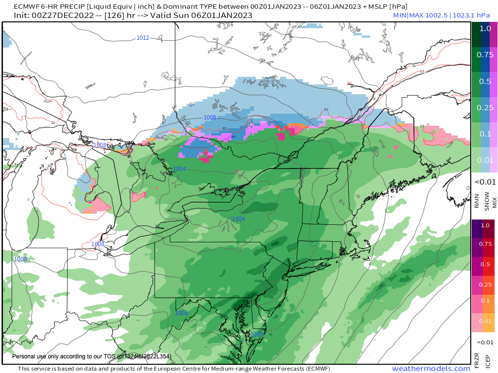
–New Year’s Weekend looks showery, starting on the Eve and extending into the Day, timing to be refined
–Mild weather continues into next week with more rain possible middle of the week
Now then, before we jump into the weather discussion/details below, let’s check a note from our local and delicious sponsor, #TandemBagelCo, with their newest location in West Springfield, MA.
——————–
A NOTE FROM OUR SPONSOR:
DHTWN Is Sponsored by Members, Patrons & Tandem Bagel Company: No matter the weather, Tandem Bagel is always there for you at several valley locations to make your mornings brighter! With bagels baked fresh daily (including Gluten-Free options), house-whipped cream cheese, coffee, and tons of lunch options, Tandem is the perfect quick stop for lunch, breakfast, or a coffee and bagel to go. Find them in Easthampton, Northampton, Hadley, Florence, and West Springfield, or use their super-streamlined online ordering tool by visiting their website.
——————————————-
***DHTWN DAILY WEATHER REPORT***
——————————————-
NWS ALERTS
–None
DHTWN REMINDER
–The odds of being a human is 1 in 400,000 billion… make it count, even in a small way (see Kurt Vonnegut quote at end of post)
DAILY CELESTIAL (STAR):
–OUR STAR ROSE AT: 7:17am this morning
–OUR STAR WILL SET AT: 4:25pm this evening
–TOTAL DAYLIGHT TIME: 9 hours and 8 minutes
NIGHTLY CELESTIAL (MOON):
–OUR MOON WILL SET AT: 9:39pm this evening
–OUR MOON WILL RISE AT: 11:19am tomorrow morning
–MOON SET DIRECTION: West-Southwest
–MOON RISE DIRECTION: East
–MOON PHASE: Waxing Crescent (23.0%)
———————-
DAILY TERRESTRIAL (ZoneCast)
ZONE 1 (Northern Region)
Southern VT, Southwest NH, N. Taconics NY
–High Temps: Upper 20s to Low 30s
–Low Temps: Mid to Upper Teens
–Wind: Light Westerly
–Skies: Developing Sunshine
–Precipitation: A few flurries possible overnight
ZONE 2 (Central Region)
WMass, N. CMass, N. Litchfield County, C./S. Taconics NY
–High Temps: Upper 20s to Low 30s
–Low Temps: Mid to Upper Teens
–Wind: Light Westerly
–Skies: Developing Sunshine
–Precipitation: A few flurries possible north of Rt. 2
ZONE 3 (Southern Region)
S. CMass, S. Litchfield County, NC.CT, & NE.CT
–High Temps: Low to Mid 30s
–Low Temps: Mid to Upper Teens
–Wind: Light Westerly
–Skies: Developing Sunshine
–Precipitation: None
———————-
WHERE’S DAVE?
–I’ve been reporting our weather daily here and at https://www.westernmassweather.com for almost 10 years
–Sign up for my free weekly newsletter here: https://westernmassweather.com/homepage/dhtwn-nutletter-signup/
–Please visit my this FB page via the app or web like selecting a channel you want to tune into if I’m not auto-kissing your screens
–I’m always here daily, so keep stopping by!
———————-
MORNING DISCUSSION
Good morning everybody, after a busy December with 2-3 winter storms we’ve quieted down for the time being, so I’ll just dazzle you with some of my double–dashed weather details, because everyone knows a paired set of hyphens truly makes the world go ’round!
–We have fair weather building into the eastern seaboard which will be pushing the anomalous cold out of here by mid to late week
–Sometimes, what goes down must come up, and so we’ll be seesawing as this huge high pressure cell slides across the southern two-thirds of the U.S. and sets up south and east of us
–This will slowly help to build milder southwesterly flow into the region through the holiday weekend and into next week
–For today, our little wave that brought a few snow showers and flurries last night will exit, and take its clouds with it, so sunshine will develop with highs mostly upper 20s to low 30s with light west wind
–Lows will drop into the teens for one last very chilly night before our pattern shifts
–Clouds increase tonight and another wave will pass north of us, but could produce a few snow showers in northern MA, SVT or SWNH
–Clouds will linger Wednesday with some breaks of sun and highs in the mid to upper 30s with lows in the 20s
–Watch for any black ice early Thursday morning from refreezing
–Thursday is our first day above average for temps in this next mildening period, with highs in the low to mid 40s under mostly sunny skies, with lows either side of 30º
–Friday looks quite nice with partly sunny skies and highs in the mid to upper 40s and lows in the low 30s with clouds increasing
–The weekend look cloudy and showery, with showers arriving sometime on New Year’s Eve and lasting into New Year’s Day
–Highs on the 31st will be in the upper 40s and in the low 50s on the 1st of 2023
–Fair weather moves back in early next week with highs in the 40s, and then we’ll look to another rainy system by mid week
–After that, there are colder signals, so stay tuned for updates
Have a great day, and if you missed the order deadline I still have my 2023 weather calendars with gorgeous and local WMass photos at the link below: I won’t be doing one next year, so get ’em while you can!
Follow me on Twitter while it’s still a thing.
AND REMEMBER…
“Hello babies. Welcome to Earth. It’s hot in the summer and cold in the winter. It’s round and wet and crowded. On the outside, babies, you’ve got a hundred years here. There’s only one rule that I know of, babies: Goddamn it, you’ve got to be kind.”
–Kurt Vonnegut