
Major low pressure northwest the WMass region bring multiple hazards of snow, ice, rain, wind, flood, outages, and refreezing with below zero wind chills
——————————-
DAVE’S WEEKLY WEATHER NUTSHELL
–Clouding up today
–First rain and snow showers arrive by later afternoon
–Rain continues in the valley tonight, south and east
–Burst of snow now expected tonight in the western hilltowns and eastern Berkshires and southern Greens, possibly N. Litchfield hills and N. CMass into SWNH
–Coatings to an inch in lower parts of these regions, 1-4″ of snow higher in elevations, low chance for up to 6″ before change to rain… some sleet or freezing rain possible in transition
–Easterly wind picks up over night and gusts to 40mph
–All precip goes to rain after midnight and falls hard at times, with thunder possible and wind picking up and gusting 35-55mph through Friday morning which is time of heaviest rain and wind
–Temps rise overnight, and crest into the 50s Friday before cold front in afternoon
–Winds veer from east to southeast to south and then southwest behind front (usually a warming wind direction, but not tomorrow!)
–Scattered power outages expected
–Temps crash from 50s into single digits and teens, rapid refreezing where wind didn’t dry up surfaces (i.e. hilltowns / SVT / Berkshires with rain and snow melt could be icy)
–Winds gust 25-45mph behind the front into Friday afternoon and evening with a few snow showers, some coatings possible
–Blustery and frigid Saturday, calmer and still very cold Christmas Day
–Tranquil much of next week with moderating temps
Now then, before we jump into the weather discussion/details below, let’s check a note from our local and delicious sponsor, #TandemBagelCo, with their newest location in West Springfield, MA.
——————–
A NOTE FROM OUR SPONSOR:
DHTWN Is Sponsored by Members, Patrons & Tandem Bagel Company: No matter the weather, Tandem Bagel is always there for you at several valley locations to make your mornings brighter! With bagels baked fresh daily (including Gluten-Free options), house-whipped cream cheese, coffee, and tons of lunch options, Tandem is the perfect quick stop for lunch, breakfast, or a coffee and bagel to go. Find them in Easthampton, Northampton, Hadley, Florence, and West Springfield, or use their super-streamlined online ordering tool by visiting their website.
——————————————-
***DHTWN DAILY WEATHER REPORT***
——————————————-
NWS ALERTS
–Winter Weather Advisory: Northern Berkshires, western hilltowns, Bennington County, and western Windham County VT
–High Wind Warning: Bennington County VT
–High Wind Watch: Cheshire County, NH
–Wind Advisory: All of northern CT, WMass, CMass, SWNH, and Windham County VT
–Flood Watch: Litchfield County, Berkshire County, SVT, SWNH
DHTWN REMINDER
–The odds of being a human is 1 in 400,000 billion… make it count, even in a small way (see Kurt Vonnegut quote at end of post)
DAILY CELESTIAL (STAR):
–OUR STAR ROSE AT: 7:15am this morning
–OUR STAR WILL SET AT: 4:22pm this evening
–TOTAL DAYLIGHT TIME: 9 hours and 7 minutes
NIGHTLY CELESTIAL (MOON):
–OUR MOON WILL SET AT: 3:24pm this afternoon
–OUR MOON WILL RISE AT: 7:49am tomorrow morning
–MOON SET DIRECTION: Southwest
–MOON RISE DIRECTION: Southeast
–MOON PHASE: New Moon (1.4%)
———————-
DAILY TERRESTRIAL (ZoneCast)
ZONE 1 (Northern Region)
Southern VT, Southwest NH, N. Taconics NY
–High Temps: Mid to Upper 30s
–Low Temps: Upper 20s to Mid 30s, rising after midnight
–Wind: Easterly breezes develop this afternoon, gusts increasing 40-60mph overnight into Friday morning then veering out of the south
–Skies: Mostly Cloudy
–Precipitation: Snow showers arrive later afternoon, then snow tonight or snow/rain mix, changing to all rain after midnight (1-4″ snow/ice possible)
ZONE 2 (Central Region)
WMass, N. CMass, N. Litchfield County, C./S. Taconics NY
–High Temps: Upper 30s to Mid 40s
–Low Temps: Mid to Upper 30s, rising after midnight
–Wind: Easterly breezes develop this afternoon, with gusts increasing 35-55mph overnight into Friday morning and then veering out of the south
–Skies: Mostly Cloudy
–Precipitation: Snow or mixed rain/snow showers arrive later afternoon in the Berkshires and western hilltowns with rain showers in the valley, then snow tonight in elevated western areas or snow/rain mix, changing to all rain after midnight (1-4″ snow/ice possible western hilltowns, N. Litchfields, Berkshires)
ZONE 3 (Southern Region)
S. CMass, S. Litchfield County, NC.CT, & NE.CT
–High Temps: Low to Mid 40s
–Low Temps: Mid to Upper 30s, rising after midnight
–Wind: Easterly breezes develop this afternoon, with gusts increasing 35-55mph overnight into Friday morning and veering out of the south
–Skies: Mostly Cloudy
–Precipitation: Rain showers arrive later afternoon, then rain increases overnight
———————-
WHERE’S DAVE?
–I’ve been reporting our weather daily here and at for almost 10 years
–Sign up for my free weekly newsletter here
–Please visit my this FB page via the app or web like selecting a channel you want to tune into if I’m not auto-kissing your screens
–I’m always here daily, so keep stopping by!
———————-
MORNING DISCUSSION
Good morning everybody, it’s Bulletization Mobile (TM) Time (which is BMT for short, because everything has to have an acronym these days, also known as BEHTHAATD for “short”).
So, like Oprah did, I’m giving double–dashes for you! And you! And you! Everyone gets a new set of double-dashes!!
–High pressure departs today to the east
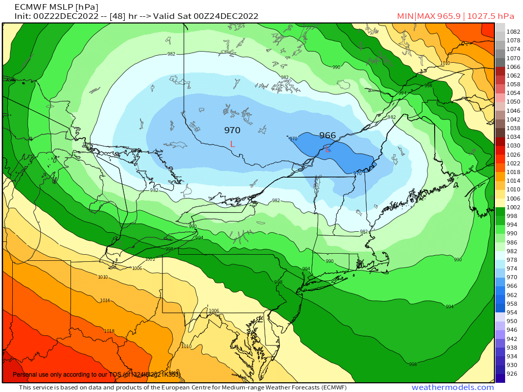
–Low pressure cranks up into the Great Lakes with time
–An upper level trough feeding super cold air into the developing storm moves into the northern Plains and western Great Lakes
–Being well west of us, the storm’s strong warm front pushes into our region overnight
–First rain and snow showers arrive later afternoon today into early evening
–Any rain/snow mix in the high terrain west of the I-91 flips to a burst of snow for the first part of tonight
–In the Pioneer Valley east and south we just get rain showers, turning into a steadier and heavier rain at times overnight
–Northern CMass may see some snow tonight, too, and possibly in the high terrain of eastern Franklin County where a coating to an inch or so is possible
–Further west, 1-4″ is expected of snow and ice before the changeover to rain after midnight (some areas like Mt. Snow or Stratton region may get up to half a foot!)
–Snow changes to rain overnight and then we rain heavy at times and the wind will pick up as temps stop falling and begin rising sometime around midnight
–Thunder is possible
–By early Friday morning, we’re storming around our region with winds gusting 35-55mph out of the east then southeast, heavy rain at times
–Before noon that batch of weather moves through, and then we move into some scattered showers, with gusty winds out of the south
–Then our cold front moves through early afternoon with a final burst of rain showers, heavy at times, changing to snow briefly before the front clears the region to the northeast
–Behind it, some scatted snow showers are possible as temps plunge from the low to mid 50s WAY down into the single digits to low 10s, which is a drop of over 40 degrees in 15 hours!!!
–This is unlikely to cause a “flash freeze” but certainly refreezing will occur in the higher terrain where snow pack was heaviest like the northwest hilltowns, northeast Berkshires into southern VT
–Secondary and tertiary roads could be hazardous to travel on
–Flooding is also possible with heavy rain of 1-3″ and snow melt combined
–Scattered power outages are expected
–Southwest winds behind the front will gust 25-45mph overnight for a blustery night with wind chills below zero in some spots!
–Saturday is fair but cold and blustery with highs in the teens to low 20s with wind chills in the single digits to teens so bundle up!
–Lows will be in the singles
–Christmas Day is sunny as well, less wind, cold, highs 20s lows singles
–Early to mid next week looks fair with more seasonable temps developing with highs getting back into the 30s
Have a great day, I will update later as our storm moves in, and if you missed the order deadline I still have my 2023 weather calendars with WMass photos at the link below: I won’t be doing one next year, so get ’em while you can!
CLICK TO ORDER 2023 CALENDARS
Follow me on Twitter while it’s still a thing.
AND REMEMBER…
“Hello babies. Welcome to Earth. It’s hot in the summer and cold in the winter. It’s round and wet and crowded. On the outside, babies, you’ve got a hundred years here. There’s only one rule that I know of, babies: Goddamn it, you’ve got to be kind.”
–Kurt Vonnegut