I’ve started shipping from my last box of Weather Nut weather calendars:
(Final 2025 edition will sell out, first come first served)
~~~~~~~~~~~~~~~~~~~~~~
TABLE OF CONTENTS
* Daily Celestials (Sun/Moon Data)
* Sponsor Note
* Morning Discussion
* TIP: Scroll below for sections, or read all
~~~~~~~~~~~~~~~~~~~~~~
YOUR DAILY CELESTIALS
~~~~~~~~~~~~~~~~~~~~~~
STAR:
–OUR STAR ROSE AT: 7:09am this morning
–OUR STAR WILL SET AT: 4:18pm this evening
–TOTAL DAYLIGHT TIME: 9 hours and 9 minutes
MOON:
–OUR MOON WILL RISE AT: 1:58pm this afternoon
–MOON RISE DIRECTION: East-Northeast
–OUR MOON WILL SET AT: 5:18am tomorrow morning
–MOON SET DIRECTION: West-Northwest
–MOON PHASE: Waxing Gibbous (89.0%)
~~~~~~~~~~~~~~~~~~~~~~
A NOTE FROM OUR SPONSOR
~~~~~~~~~~~~~~~~~~~~~~
Dave Hayes The Weather Nut is Sponsored by Individual Community Members, Patrons, and Tandem Bagel Company… No matter the weather, Tandem Bagel is always there for you at several valley locations to make your mornings brighter! With *New Pizza Bagels(!)*, along with bagels baked fresh daily (including Gluten-Free options), house-whipped cream cheese, coffee, and tons of lunch options, Tandem is the perfect quick stop for lunch, breakfast, or a coffee and bagel to go.
You can either 1) visit them in Easthampton, Northampton, Hadley, Florence, and/or West Springfield, 2) hire them to cater your next event, or 3) use their super-streamlined online ordering tool by visiting their website and clicking the “Catering” or “Order Online” links.
~~~~~~~~~~~~~~~~~~~~~~
YOUR MORNING DISCUSSION
~~~~~~~~~~~~~~~~~~~~~~
Good morning folks, our storm is a thing of the past, and for as rainy as it was, precipitation amounts were a bit less than expected for some of us, and the big story was the lack of wind due to the low level jet streak forming more to the east than expected. At one point there were 20000 or so outages in southeast MA.
Wind was always going to be east of I-91 as I had mentioned, but we didn’t gust past 40mph even in areas where I thought it would go to 50mph.
If you live in the Berkshires, northwest hills, Taconics or Bennington County VT let me know if you saw any light snow accumulations. I know that Williamstown, MA saw a coating overnight.
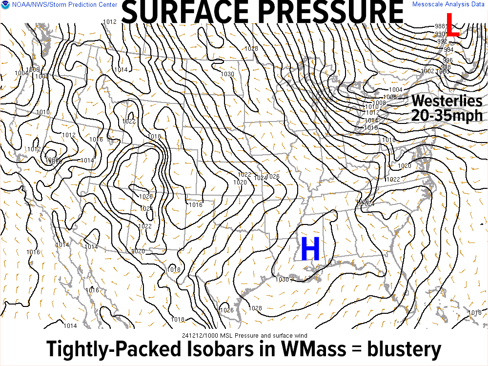
Waking up, it’s a new air mass in town, and it will be blustery with cold advection producing highs in the 30s with westerly winds gusting 20-35mph at times today. Partly to mostly sunny skies should develop, and we’ll see some scattered snow showers with a disturbance moving through by this early afternoon.
For tonight, a lighter west wind continues, and it will be COLD with lows in the mid to upper teens under partly cloudy skies in the hills with more clearing in the valley.
Massive and potent high pressure builds east into the region Friday and Saturday, which will feature mostly sunny skies, lighter winds, and colder temps with highs only in the mid 20s to low 30s both days, and lows in the upper single digits to mid teens both nights under clear skies.
By Sunday, high pressure will continue east through the region, and we’ll start to get on its western flank where a milder flow will begin to develop.
I expect more of a partly sunny to mostly cloudy day with highs coming up into the mid 30s, so still chilly, but not as cold as the previous two days.
By Sunday night into Monday, a disturbance looks to move east out of the Ohio Valley and may push some snow into our region late Sunday night with lows in the 20s.
By Monday, a milder southerly flow will develop and turn any snow over to rain most likely with highs in the 40s. Some light accumulation is possible overnight.
Then we’ll see a second frontal system connected to a low center that will pass to our north move through with more rain showers by Tuesday with highs in the upper 40s to low 50s. Behind that, our seesaw weather continues as we cool back down and start looking toward the late-week period for some winter storm potential. It’s an early signal, but I will keep an eye on it for you.
Have a great day and remember that I do still have a limited supply of 2025 weather calendars available, so if you want one or two, please click the secure link below to order…
“Follow your bliss and the universe will open doors for you where there were only walls.”
― Joseph Campbell
