
Windy today
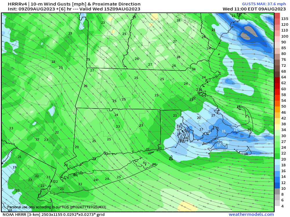
>>> MORNING DISCUSSION <<< Good morning everybody, we've got a lovely day ahead, though it will be a bit windy as the pressure gradient between yesterday's departing system and today's incoming high pressure ridge is a bit steeper than in recent times. This should allow gusts of 15-30mph today, upper range in the high terrain, lower range in the valley. We'll see winds increase as the surface heats with the morning's waxing, which will increase the low level lapse rates (gradient of warming surface to cooler sky) which allows wind to mix more readily to the ground. Highs today will reach the mid 70s to low 80s under partly sunny skies, and wind should slacken later this afternoon into evening, with lows in the 50s to near 60º with lower humidity. For Thursday, we'll start off with a nice morning featuring plenty of sunshine, but as a system tracks in from the west with its low center passing south of New England, we'll see an area of showers and thunderstorms push east through the greater WMass region, arriving by early to mid afternoon and lasting into the early evening. I don't really anticipate any flooding issues, but all it takes is a couple of downpours over the same saturated area to pop a localized warning. Highs tomorrow will be in the mid 70s to low 80s, with lows again in the 50s, as we dry out after midnight. For Friday, a lovely day is on tap, with lower humidity and dewpoints in the 50s, and highs in the 70s, and once again another bit of wind with westerly gusts from 20-30mph developing behind the strengthening coastal storm, which will be strong for summer standards, and again, not a typical summer flow. Does this portend for Winter? We shall see, my friends. After a clear and cool Friday night, we turn to Saturday which looks like we have the potential for severe weather. As it turns out on that I have a long-planned rock show at Luthier's in Easthampton that I'm playing with my old band Colorway and even older pal F. Alex Johnson that night at Luthier's, and so my coverage that afternoon and evening is going to be staggered. I will do my best, but Al is back from overseas, and I haven't seen him in 4 years, so I'm just putting it out there that I will do my best that afternoon/evening, but it won't be wall to wall coverage like I normally do. Anyway, the weather could be potent that afternoon and evening, and I will update on that as we get closer, and we can't even rule out a tornado that afternoon/evening, either. Sunday is DEFINITELY the pick of the weekend, with sunnier skies, lower humidity, highs in the 70s to low 80s, and this should continue into Monday. However, by Monday night into Tuesday humidity looks to increase dramatically once again with yet another system being advected into and through the region thanks to the zonal parade of troughs to our north moving west to east through southern Canada. For now, we are stuck in this every other day, or every day two days of nice, drier, sunnier weather interspersed with days of very unsettled conditions, so stay tuned for updates! Have a great day! >>> BE KIND <<< “Hello babies. Welcome to Earth. It's hot in the summer and cold in the winter. It's round and wet and crowded. On the outside, babies, you've got a hundred years here. There's only one rule that I know of, babies: Goddamn it, you've got to be kind.” --Kurt Vonnegut