
TABLE OF CONTENTS
* Daily Celestials (Sun/Moon Data)
* Sponsor Section
* Morning Discussion
* TIP: Scroll to your section, or read all
~~~~~~~~~~~~~~~~~~~~~~
YOUR DAILY CELESTIALS
~~~~~~~~~~~~~~~~~~~~~~
STAR:
–OUR STAR ROSE AT: 6:15am this morning
–OUR STAR WILL SET AT: 7:24pm this evening
–TOTAL DAYLIGHT TIME: 13 hours and 9 minutes
MOON:
–OUR MOON WILL SET AT: 6:40pm this evening
–MOON SET DIRECTION: West-Northwest
–OUR MOON WILL RISE AT: 4:32am tomorrow morning
–MOON RISE DIRECTION: East-Northeast
–MOON PHASE: Waning Crescent (6.4%)
~~~~~~~~~~~~~~~~~~~~~~
>>> A NOTE FROM OUR WEEKEND SPONSOR <<<
Dave Hayes The Weather Nut is Sponsored by Individual Community Members, Patrons, and Gerard, Ghazey & Bates, P.C. GGBPC is a Northampton-based law firm regarded as the voice of pragmatic and well-reasoned estate planning, elder law and tax guidance in Western Massachusetts. The firm specializes in estate planning law, and expertly handles other matters such as Elder Law, Tax Law, as well as Real Estate purchase, sales, and refinance transactions. Contact GGBPC today to see how they can help!
~~~~~~~~~~~~~~~~~~~~~~
YOUR MORNING DISCUSSION
~~~~~~~~~~~~~~~~~~~~~~
Good morning everybody, I hope you have some fun stuff planned this weekend!
I am heading over to Glendale Ridge Vineyard in Southampton MA this evening to catch Big Yellow Taxi, which is a fabulous Joni Mitchell tribute act! They are performing Joni’s entire Court and Spark album that was released 50 years ago, and since I also have several friends in the band, I am looking forward to a fun time of great music in a lovely spot.
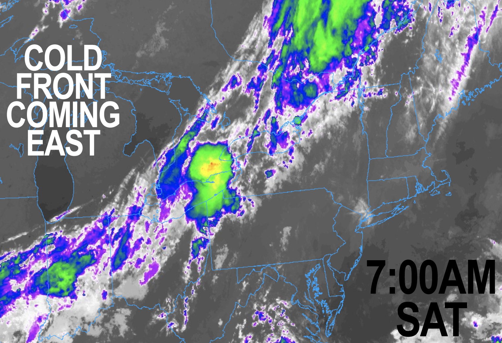
As for our weather, I think it’s going to be mostly supportive of outdoor activities today, though I can’t rule out an isolated shower or two before 9pm.
It will be mostly cloudy as a shortwave slowly runs towards New England, but is partially weakened by some higher pressures aloft. This may also produce some sunny breaks in the cloud deck at times.
Highs will reach the 75-80º range, and humidity will be coming up into the 60s in terms of dewpoints thanks to the back side of high pressure over Nova Scotia producing southerly and southwesterly flow into our region, so a summah feel is on the way.
In addition, the Storm Prediction Center has pulled any low chance for an isolated severe thunderstorm through 7am Sunday morning WEST of our region, which I had expected.
All this to say, it’s mostly after 9pm, and especially overnight into Sunday morning that I expect to see scattered showers and a few thunderstorms working through the region from west to east, with mild lows in the mid to upper 60s, and some patchy fog too.
So, expect a wet start for some on Sunday as a shortwave works through the region ahead of an incoming cold front.
We’ll see a lull develop by mid day, and I think for many that lull persists through the day and through the upcoming week for folks in northern MA, SVT and SWNH.
However, as the actual cold front comes through in the afternoon, areas along and south of the Pike in MA and down into CT/RI could see some additional showers and storms fire, so I will update on that tomorrow morning.
It will be humid on Sunday with highs again in the 75-80º range, with some ini northern areas cresting 80º if enough sunshine develops, which I do expect afternoon sun to develop.
The front sweeps the region, and sweeps the humidity and any shower activity seaward, with lows in the 50s under partly cloudy skies.
Once we reach Labor Day Monday (a day I am taking off, so no report from me on that day), our weather becomes calm, fair and peaceful, which will last through the whole week, which will be dominated by plenty of sunshine.
Highs will be in the mid 60s to low 70s Monday and Tuesday with lows in the 40s, and possibly even the upper 30s for some by early Tuesday morning!
Then Wednesday and Friday will warm a touch with highs in the 70s and lows in the low to miid 50s, with mostly clears skies in the evening.
The next chance for a storm is next Saturday, but let’s just get through this fairly muggy blip over the next 24-36 hours and set sail into a realm of dry, fair weather and light northwest flow.
Sounds good to me. Have a great day!
HAIKU OF THE DAY:
Summer’s back is broke
Southwest-Northwest flows battle
Back and forth we go
“Follow your bliss and the universe will open doors for you where there were only walls.”
― Joseph Campbell