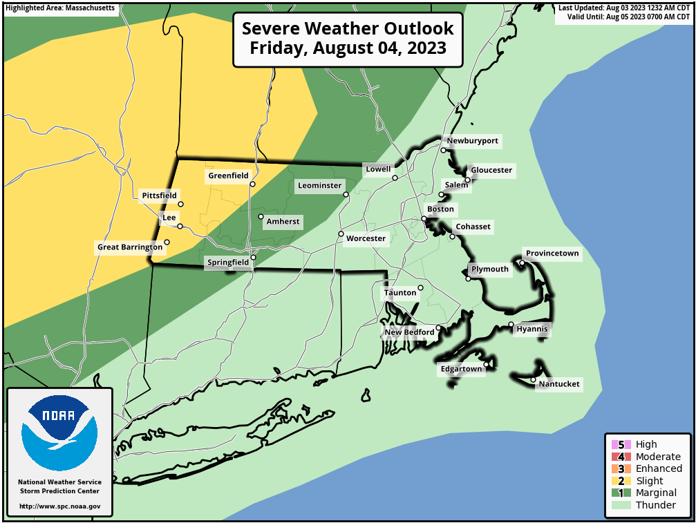
Severe storms possible Friday eve
>>> MORNING DISCUSSION <<< Good morning folks, we've got a great start to the day with early sun to be followed by some more clouds by afternoon with perhaps a spot shower late today or this evening as we round out our recent dry stretch, which has been most welcome! Highs today will reach the upper 70s to low 80s with lows near 60º as humidity increases into Friday thanks to the approach of a warm front that moves through Friday morning. Because of this warm front, we can't rule out a couple of thunder rumbles by early Friday morning. Behind our Friday morning warm frontal passage, we'll enter a pre-cold-frontal environment which will be unsettled and should produce some scattered showers or a thunderstorm during the morning into the afternoon. Highs will reach the mid to upper 70s on Friday, and dewpoints will be in the 60s, so quite a bit more humid than recent days but not oppressive. By afternoon we will see a cold front swinging down from northern NY, tracking southeast toward southwest New England, and this will bring with it clusters of showers, downpours, and thunderstorms, some of which could be strong to severe. It won't be a big "surface heating day", but instead there will be colder air aloft, which will help steepen the mid-level lapse rates (i.e. the gradient between a warmer lower region and colder upper region a couple-three miles up that allows air to rise more freely). This combined with some decent wind shear moving in with the cold front should help produce some strong storms, and we can't rule out isolated damaging wind gusts or large hail, with the main t-storm timeframe being 5-9pm from northwest to southeast. Any showers and storms end by midnight, and we'll see lows drop into the upper 50s to low 60s as we start to dry out. The weekend looks fabulous! Sunshine both days, lower humidity (though not bone dry like Tuesday), and highs either side of 80º with lows in the upper 50s, woo hoo! We could see an isolated shower or two Saturday, but #NoBigWhoop Monday looks to start off sunny and dry, but clouds will increase later in the day as another plume of very muggy air works into the region Monday night into Tuesday with another area of low pressure. This could be a sopping system, so stay tuned for updates, as with the kind of moisture being signaled at this range, we could be talking about some areas of flash flooding for Tuesday, which looks quite wet at the moment. But, things can change as we know, so stay tuned for updates! Enjoy the day! >>> BE KIND <<< “Hello babies. Welcome to Earth. It's hot in the summer and cold in the winter. It's round and wet and crowded. On the outside, babies, you've got a hundred years here. There's only one rule that I know of, babies: Goddamn it, you've got to be kind.” --Kurt Vonnegut
