
TABLE OF CONTENTS
* Daily Celestials (Sun/Moon Data)
* Sponsor Note
* Join My Newsletter
(& get my Top12WMassStorms ebook!)
* Morning Discussion
* TIP: Scroll below for sections, or read all
~~~~~~~~~~~~~~~~~~~~~~
YOUR DAILY CELESTIALS
~~~~~~~~~~~~~~~~~~~~~~
STAR:
–OUR STAR ROSE AT: 6:12am this morning
–OUR STAR WILL SET AT: 7:29pm this evening
–TOTAL DAYLIGHT TIME: 13 hours and 17 minutes
MOON:
–OUR MOON WILL SET AT: 4:46pm this afternoon
–MOON SET DIRECTION: Northwest
–OUR MOON WILL RISE AT: 1:13am tomorrow morning
–MOON RISE DIRECTION: Northeast
–MOON PHASE: Waning Crescent (28.6%)
~~~~~~~~~~~~~~~~~~~~~~
A NOTE FROM OUR SPONSOR
~~~~~~~~~~~~~~~~~~~~~~
Dave Hayes The Weather Nut is Sponsored by Individual Community Members, Patrons, and Tandem Bagel Company… No matter the weather, Tandem Bagel is always there for you at several valley locations to make your mornings brighter! With *New Pizza Bagels(!)*, along with bagels baked fresh daily (including Gluten-Free options), house-whipped cream cheese, coffee, and tons of lunch options, Tandem is the perfect quick stop for lunch, breakfast, or a coffee and bagel to go.
You can either 1) visit them in Easthampton, Northampton, Hadley, Florence, and/or West Springfield, 2) hire them to cater your next event, or 3) use their super-streamlined online ordering tool by visiting their website and clicking the “Catering” or “Order Online” links.
~~~~~~~~~~~~~~~~~~~~~~
DAVE’S WEEKLY NEWSLETTER (Top 12 WMass Storms)
DAVE’S MOBILE APP (Late 2024 Release)
~~~~~~~~~~~~~~~~~~~~~~
YOUR MORNING DISCUSSION
~~~~~~~~~~~~~~~~~~~~~~
Good morning People of the Golden West, as my father used to call it, our star is still fusioning with an Aurora captured last night by Tony Rodriguez up in Goshen, MA (pic attached) and the miracle of life in the Cosmos continues for those of us who still remain. We’ll all set sail into those ethery filaments some day, but I hope for everyone reading this including myself that today is not that day.
For now, there is life to live, so let’s get down to our weather-y business, folks!
(WANING) SUMMAH-RY
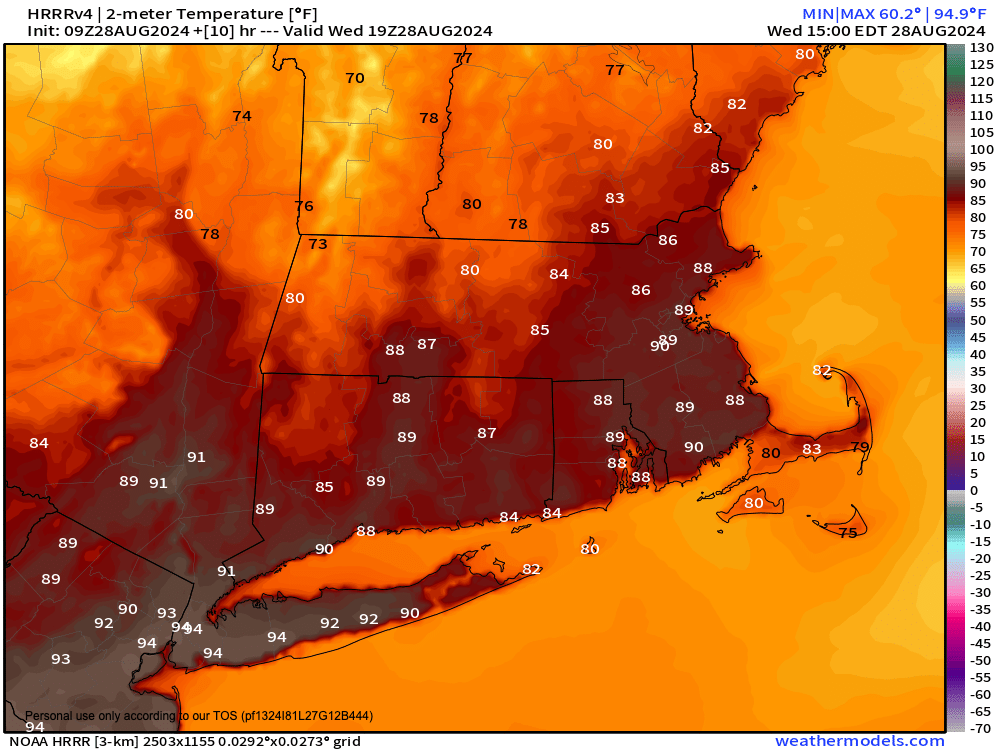
–No fog this morning really, just sunshine and a very warm to hot and humid day ahead
–Temps are already in the mid to upper 60s, and that will set the stage for a climb to 85-90º with high humidity
–An isolated shower or storm is possible, but with an earlier cold frontal passage today, instability won’t have time to develop
–Severe weather is not expected, as it was a day or two ago
–When it’s time (for weather) to change, you’ve got to rearrange, who you are and what you’re gonna be, sha na na na na na (oops sorry, I had a Brady Bunch tick transpire)
–Humidity and temps go down tonight, with lows in the low to mid 50s under partly cloudy skies
–For Thursday and Friday, a Quebec-ian high pressure system drives northerly flow into our region, cooling us into the low to mid 70s for highs, with 50s for lows
–We can expect partly to mostly sunny skies and partly cloudy nights with an isolated shower Thursday night
–By Saturday, we start off dry in the morning, but by mid day or so, some scattered showers are expected as a frontal boundary makes its way into western New England
–Highs will sit in the mid to upper 70s with lows in the low to mid 60s with thunder possible
–Sunday should start off dry in the warm sector as we await another cold front to slide through Sunday night into early Labor Day
–Highs should climb into the upper 70s to mid 80s under partly sunny skies, with more showers expected by later afternoon or at night
–Labor Day looks to be the pick of the long weekend, to be honest, with the front southeast of us, and mostly sunny skies developing into Tuesday as well
–Much drier air arrives with highs in the mid 60s to low 70s and lows in the 40s to low 50s, cooling things down as September arrives
Have a great day!
“Follow your bliss and the universe will open doors for you where there were only walls.”
― Joseph Campbell