
Good morning folks, we have patchy dense fog in parts of the greater WMass region this morning, especially so in eastern Franklin County and southwest NH at Orange, MA and Keene, NH respectively.
We’ll burn it off with time this morning, and will get a very warm to hot and somewhat humid day, with a chance for scattered severe thunderstorms tomorrow with potential for multiple hazards, followed by a nice weekend, a warm-up early next week and more showers and storms around Tuesday prior to drying out and cooling down a week from now, but before we dive into all of the weather details below, let’s check a note from our local and delicious sponsor, #TandemBagelCo, with their newest location in West Springfield, MA.
——————–
A NOTE FROM OUR SPONSOR:
DHTWN Is Sponsored by Members, Patrons & Tandem Bagel Company: No matter the weather, Tandem Bagel is always there for you at several valley locations to make your mornings brighter! With bagels baked fresh daily, house-whipped cream cheese, coffee, and tons of lunch options, Tandem is the perfect quick stop for lunch, breakfast, or a coffee and bagel to go. Find them in Easthampton, Northampton, Hadley, Florence (and now West Springfield!), or use their super-streamlined online ordering tool by visiting their website: https://www.tandembagelco.com
——————————————-
***DHTWN DAILY WEATHER REPORT***
——————————————-
NWS ALERTS
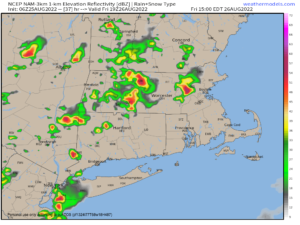
–None but patchy dense fog is observed in spots this morning, be slow with travel.
DHTWN REMINDER
–The odds of being a human is 1 in 400 trillion… make it count, even in a small way (see Kurt Vonnegut quote at end of post)
DAILY CELESTIAL (STAR):
–OUR STAR ROSE AT: 6:08am this morning
–OUR STAR WILL SET AT: 7:35pm this evening
–TOTAL DAYLIGHT TIME: 13 hours and 27 minutes
DAILY CELESTIAL (MOON):
–OUR MOON WILL SET AT: 7:16pm this evening
–OUR MOON WILL RISE AT: 5:05am tomorrow morning
–MOON SET DIRECTION: West-Northwest
–MOON RISE DIRECTION: East-Northeast
–MOON PHASE: Waning Crescent 3.7%
———————-
DAILY TERRESTRIAL (ZoneCast)
ZONE 1 (Northern Region)
Southern VT, Southwest NH, N. Taconics NY
–High Temps: Low to Mid 80s
–Low Temps: Low 60s
–Humidity: Dewpoints in the Low to Mid 60s, fairly humid
–Wind: Light west to northwest wind
–Skies: Patchy fog early, then mostly sunny skies
–Precipitation: Isolated showers possible later
ZONE 2 (Central Region)
WMass, N. CMass, N. Litchfield County, C./S. Taconics NY
–High Temps: Mid to Upper 80s
–Low Temps: Low to Mid 60s
–Humidity: Dewpoints in the Low to Mid 60s, fairly humid
–Wind: Light west to northwest wind
–Skies: Patchy fog early, then mostly sunny skies
–Precipitation: Isolated showers possible later
ZONE 3 (Southern Region)
S. CMass, S. Litchfield County, NC.CT, & NE.CT
–High Temps: Mid 80s to Low 90s
–Low Temps: Mid to Upper 60s
–Humidity: Dewpoints in the Low to Mid 60s, fairly humid
–Wind: Light west to northwest wind
–Skies: Patchy fog early, then mostly sunny skies
–Precipitation: Isolated showers possible later
———————-
WEATHER REPORT
Good morning everybody, we’re still hurtling through the Cosmos, in case you forgot… quite the carnival ride!
In terms of Earth’s surface, we’ve got some patchy dense fog out there in spots, and that will dissipate with time.
In the bigger picture, we have a broad mid-level trough over eastern Canada into the Great Lakes and northeastern U.S. regions, with a surface low out in the western Midwest and broad westerly flow into New England.
This low will track east-northeast today, tonight and tomorrow through northern Maine and drag a pretty potent cold front with it, which arrives Friday.
High pressure to our south will keep a southwest warming flow into the region today and tomorrow, which will push increasing humidity and moisture into our region.
For today, this will translate into a very warm and somewhat humid Thursday with highs in the mid 80s to low 90s with highs in the low to mid 80s up in SVT under mostly sunny skies. An isolated shower or two is possible across the greater WMass region this afternoon.
Lows will drop into the low to upper 60s from north to south under partly cloudy skies as humidity increases overnight into Friday.
This humidity/moisture increase, combined with an expected hot day tomorrow (which will add to instability) along with an incoming front with strong lift and mid-level wind providing ample wind shear, should produce an increased chance for scattered strong to severe thunderstorms tomorrow afternoon, visiting and impacting some of us anywhere between 2-9pm.
We’ll start off mostly sunny, but clouds will increase toward mid day, with more of a partly sunny afternoon developing.
Again, it’s a matter of haves and have-nots: some get plain showers, some will see a downpour, some may get hammered with strong to severe storms with strong wind and/or hail, some will get little to nothing… that’s what “scattered” means, and “isolated” means even less activity impacting less towns/cities/neighborhoods.
Having said, that the concern for any storms that do become severe is the potential for larger hail, strong to damaging straight line winds, and possibly a tornado, in addition to some localized street flooding due to torrential rain.
———————
LAST CALL TO WMASS REGIONAL PHOTOGRAPHERS FOR MY 2023 WEATHER WALL CALENDAR…My friend, if you’ve submitted in past years, or fancy yourself a fine photographer of the greater WMass region’s natural beauty (WMass, CMass, S.VT, SW.NH, or northern CT), please click the secure link to my website below to get the details on how you can be seen by over 1000 of your neighbors and be included in my 9th consecutive (and likely last) local/regional weather wall calendar.
The deadline for submission is 9/3/2022, and I really hope you’ll send some photos for consideration!
CLICK SECURE LINK
———————
Highs Friday will reach the mid 80s to low 90s again, and any activity should be out of here by 9 or 10pm, with lows in the low to mid 60s.
PLEASE NOTE: Stay tuned for updates all day tomorrow regarding this potential severe weather threat.
The weekend looks great, with a chance for an isolated shower or storm bubbling up each day, but most stay dry.
Mostly sunny skies are expected with highs in the upper 70s to mid 80s each day with lows near 60º under partly cloudy skies, with light winds.
On Monday, we will start to warm as we get a high pressure system to our south to flex one more time, and amplify southerly flow into the WMass region.
Highs will be well into the 80s with mostly sunny skies with lows in the low to mid 60s, and then we’ll look to the Tuesday timeframe, when we should heat back up toward the low 90s with a strong cold front approaching.
This should bring more scattered strong to severe thunderstorms sometime during the Tuesday/Wednesday timeframe, with an early-autumnal cool down expected by late next week with highs in the 70s and lows in the 50s, along with much drier air.
After all, it is September next week, folks, and Meteorological Autumn begins a week from today, so we’re in late Summer now, heading towards Autumn.
I hope you have a great day!
Did you know that you can also follow me on Twitter?
AND REMEMBER…
“Hello babies. Welcome to Earth. It’s hot in the summer and cold in the winter. It’s round and wet and crowded. On the outside, babies, you’ve got a hundred years here. There’s only one rule that I know of, babies: Goddamn it, you’ve got to be kind.”
–Kurt Vonnegut