
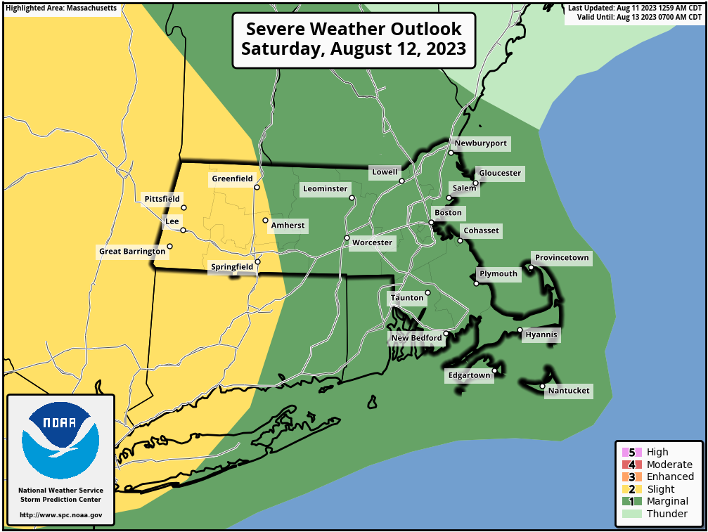
Severe Weather Possible Sat. PM
>>> MORNING DISCUSSION <<< Good morning everybody, our parade of southern Canadian lows drawing warm/cold front combos through our region continues for at least two more rounds, including tomorrow night into early Sunday morning, and again late Monday night through Tuesday. Both of these timeframes hold the potential to produce strong to severe thunderstorms, with Tuesday showing the most potential, but we can't snooze on tomorrow night either. As for today, a whole plate full of loveliness is on the way on which we'll sup, as sun, lowering humidity, and breezy conditions will produce a lovely day with highs in the mid 70s to low 80s, so get out and enjoy! Lows tonight will drop to the mid 50s and wind slackens and skies remain mostly clear. For Saturday, we could see some wildfire smoke move through in the morning, so our sunshine may be a bit hazy to start the day. Highs will reach the low to mid 80s (with lows in the 60s), but clouds and humidity will be increasing during the afternoon with a few showers possible. Later in the afternoon, a frontal boundary will be approaching our region. Wind shear, moisture and instability should be enough to produce at least some broken lines of showers and thunderstorms during the evening into the overnight hours, but the potential is there for storms to become strong to severe, and the more likely threat being heavy rain and localized straight line wind damage from strong gusts, so stay tuned for updates. Showers could continue into Sunday morning before this system pulls east of our region, and later on Sunday we'll see some improvements after a mostly cloudy morning. Highs will reach to either side of 80º as sunshine breaks out later in the day, and lows will drop into the 50s. This fair weather should carry into Monday, which looks very nice, sunny, dry and with highs in the 75-80º range, with lows in the low to mid 60s as showers move in late at night. Tuesday could feature a high wind shear and high moisture day, and if the timing of a frontal boundary moves through during peak heating, we could develop strong to severe weather in our region, capable of flash flooding, strong wind gusts and hail, so please stay tuned for updates on both tomorrow's potential and Tuesday's as well. After that, we could enter into a slightly more extended 3-day stretch of fair weather with abundant sunshine and seasonably warm temps Wednesday through Friday. Right now, it's a fantasy, but let's hope it comes true! Have a great day! >>> BE KIND <<< “Hello babies. Welcome to Earth. It's hot in the summer and cold in the winter. It's round and wet and crowded. On the outside, babies, you've got a hundred years here. There's only one rule that I know of, babies: Goddamn it, you've got to be kind.” --Kurt Vonnegut