
~~~~~~~~~~~~~~~~~~~~~~
TABLE OF CONTENTS
* Daily Celestials (Sun/Moon Data)
* Weekly Weather Nutshell
* Morning Discussion
* TIP: Scroll below for sections, or read all
~~~~~~~~~~~~~~~~~~~~~~
YOUR DAILY CELESTIALS
~~~~~~~~~~~~~~~~~~~~~~
STAR:
–OUR STAR ROSE AT: 5:53am this morning
–OUR STAR SETS AT: 7:43pm this evening
–TOTAL DAYLIGHT TIME: 13 hours and 50 minutes
MOON:
–OUR MOON RISES AT: 9:55pm tonight
–MOON RISE DIRECTION: Southeast
–OUR MOON SETS AT: 6:258am tomorrow morning
–MOON SET DIRECTION: Southwest
–MOON PHASE: Waning Gibbous (97.9%)
~~~~~~~~~~~~~~~~~~~~~~
A NOTE FROM OUR SPONSOR
~~~~~~~~~~~~~~~~~~~~~~
Dave Hayes The Weather Nut is Sponsored by Individual Community Members, Patrons, and Tandem Bagel Company… No matter the weather, Tandem Bagel is always there for you at several valley locations to make your mornings brighter! With *New Pizza Bagels(!)*, along with bagels baked fresh daily (including Gluten-Free options), house-whipped cream cheese, coffee, and tons of lunch options, Tandem is the perfect quick stop for lunch, breakfast, or a coffee and bagel to go. Find them in Easthampton, Northampton, Hadley, Florence, and West Springfield, or use their super-streamlined online ordering tool by visiting their website.
~~~~~~~~~~~~~~~~~~~~~~
YOUR WEEKLY WEATHER NUTSHELL
~~~~~~~~~~~~~~~~~~~~~~
–Quite cold this morning in the 20s and 30s, with some upper teens in SVT
–Temps rebound into the low to mid 50s under sunny skies and light northwest flow
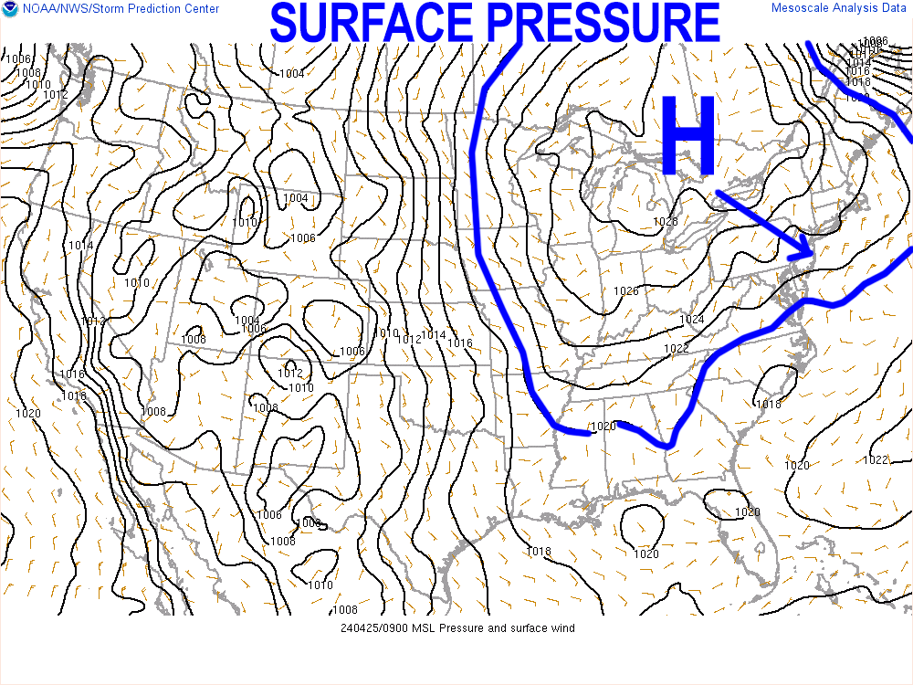
–Giant high pressure builds southeast from Canada, bringing 3 days of sunshine and mostly clear nights
–Freeze Watches are back up for tonight as lows should again dip into the 20s to low 30s, with some upper teens possible
–Upper 50s to low 60s for highs and mostly sunny skies for Friday and Saturday, with Friday night lows near freezing with patchy frost possible.
–Clouds increase by afternoon after Saturday’s sunny start as a warm front approaches
–Lows bottom out in the low 40s, with scattered showers moving in and clearing out by Sunday morning
–Sunday should turn partly sunny by afternoon after a mostly cloudy start, with highs in the mid to upper 60s, lows in the 50s
–Monday looks WARM, with highs well into the 70s under partly sunny skies before a series of fronts look to bring more showers by Tuesday into the middle of the week, continued milder
~~~~~~~~~~~~~~~~~~~~~~
YOUR MORNING DISCUSSION
~~~~~~~~~~~~~~~~~~~~~~
Good morning folks, I hope your plants, fruit trees and other green and flowering life forms survived this morning’s dip below freezing, let me know what you’re seeing out there.
We have another similar night ahead into early Friday morning with very cold temps expected in the 20s to low 30s, with potential for some upper teens in far northern MA, on up into SVT, so rinse and repeat the protection protocols for tonight if you’re plant beings survived.
Massive high pressure brings the sunshine during the day and clear skies at night, clarifying and revealing the great cosmic window to the Universe, so soak up the cosmic energy, galactic citizens of the Milky Way!
Highs are coolest day, sitting in the 50s, with cold lows in the 20s to low 30s tonight, and some upper teens possible in northernmost areas.
Highs climb into the upper 50s to low 60s for Friday and Saturday (may reach the mid 60s to start the weekend, actually).
By Saturday afternoon, clouds build with a warm front approaching the region thanks to high pressure setting south of us and pumping the first solid batch of warmer Springtime air into New England starting Sunday and lasting into next week.
We’ll get some showers Saturday night with said warm front, but it doesn’t look like much rain at all, maybe a quarter inch tops.
Showers should abate sometime Sunday morning which is mostly cloudy, but trends to partly sunny with highs in the mid to upper 60s, and possibly low 70s if we get a bigger period of sunshine early enough in the afternoon. Lows will be in the low 50s.
Monday looks quite warm with highs in the 70s under partly sunny skies!
However, a pair of cold fronts may be clouding us back up by the Tuesday through Thursday period with periods of scattered showers. It doesn’t look like washout right now, but I will parse things out for you as we get closer.
For now, it’s a big green-light for an abundance of yellow-white light.
Enjoy and have a great day!
>>> BE KIND <<<
“Hello babies. Welcome to Earth. It’s hot in the summer and cold in the winter. It’s round and wet and crowded. On the outside, babies, you’ve got a hundred years here. There’s only one rule that I know of, babies: Goddamn it, you’ve got to be kind.”
–Kurt Vonnegut