Good morning folks, we’ve got mild temps out there this morning and while some partial sunshine is expected early clouds will be building with time as we enter into a more unsettled period as the weekend continues into early next week due to a surface coastal low, and upper level low to our west, and an incoming cold front for Monday night, but before we jump into the weather and daily details below, let’s check a note from our new weekend sponsor, #RedFireFarm located in Granby, MA.
~~~~~~~~~~~~~~~~~~~~~~
A NOTE FROM OUR SPONSOR:
Dave Hayes The Weather Nut is Sponsored by Individual Community Members, Patrons & Red Fire Farm. The Red Fire Farm store is open daily at 7 Carver Street in Granby, MA, and if you are looking for delicious organic produce, join their Summer CSA farm share. Vibrant greens, luscious heirloom tomatoes, sweet carrots and lots more to enjoy. Shares get free Pick Your Own, kicking off with strawberries in June. Add pastured eggs, local fruit & cheeses, mushrooms, pantry items, bouquets of organic flowers, and more. Weekly pickups at the Granby farm, Montague, Amherst, Forest Park/Springfield, Northampton, & Worcester (plus home delivery available), so click here to snag your Summer Share!
~~~~~~~~~~~~~~~~~~~~~~~~~~~~~~~~
DOUBLE–DASH–DELIVERY–SYSTEM
2023–E–D–I–T–I–O–N
–Good morning folks, it’s going to be warm today, but nothing like we saw yesterday which broke records for high temps that in some cases crested into the mid 90s
–Any partial sunshine should wane with time and be replaced by increasing high and mid clouds, and eventually lower clouds later into the afternoon and overnight period
–Highs will come up well into the 70s, and we’ll have to be alert that an isolated shower or thunderstorm is possible this afternoon
–Lows tonight will be in the 50s as surface low pressure south of us tracks northeast, and an upper level low track east toward New England from New York state
–The coastal system may throw a few energy lobes north into the greater WMass region with some showers or even a rumble of thunder overnight into the very early morning hours of Sunday
–That activity wanes a bit, but we will still see mostly cloudy skies for Sunday with some patchy drizzle or patchy fog possible
–Highs will reach the low to mid 60s with lows near 50º as some more scattered showers move through with drizzle possible
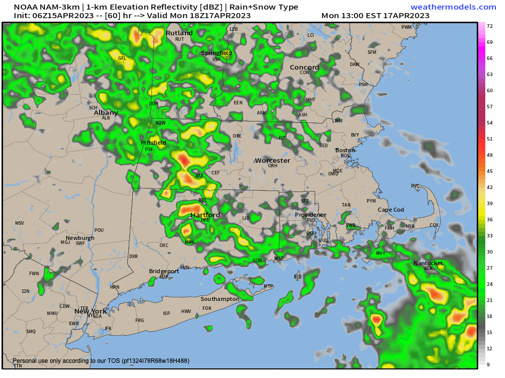
–On Monday, we will be watching for a cold front to move through the region sometime during the late afternoon and evening timeframe
–Earlier on, it should be mostly cloudy with a few isolated showers, with highs rising into the upper 50s to low 60s
–It’s that late afternoon and evening timeframe when heavier and more steady showers and rainfall should push into the region
–We can’t rule out a rumble of thunder, and some showers may be heavy, with lows in the low to mid 40s
–By Tuesday the upper level system will be moving through, setting off some high-terrain showers
–Otherwise, skies should be partly sunny with highs only in the 50s with lows in the low to mid 30s
–Wednesday will be the coolest day/night pair in the upcoming period with highs in the upper 40s to mid 50s with full sunshine and breezy conditions
–The late week period looks to feature fair weather with warming temps well into the 60s up through Friday
Have a great day!
BE KIND
“Hello babies. Welcome to Earth. It’s hot in the summer and cold in the winter. It’s round and wet and crowded. On the outside, babies, you’ve got a hundred years here. There’s only one rule that I know of, babies: Goddamn it, you’ve got to be kind.”
–Kurt Vonnegut
