August 29, 2011
MY STORY
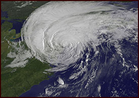
Hurricane Irene was truly and physically a giant storm. At one point, it covered the entirety of the east coast. There is one way in which we got very lucky here in Western Massachusetts, and that had to do with wind impacts.
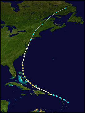
Because the storm hugged the coast, it caused the hurricane to be downgraded to a Tropical Storm before it reached our area. In addition, it passed over Western Massachusetts, putting us out of the way of the strongest winds, which are to the north and east of the low center. As I remember, Irene was downgraded to a Tropical Storm with sustained winds of 65mph by the time it crossed over New York City.
However, being on the northern and northwest side of this storm allowed enormous quantities of rain to fall on Western Massachusetts and all the way up into Vermont. Had this not happened, we could have had another Hurricane of 1938 (a/k/a The Long Island Express) on our hands in Western Massachusetts, and wind damage would have been severe and widespread.
However, the real damage from Irene came from the historic flooding that impacted the Connecticut River Valley from CT, through Western Mass, and especially up into Vermont. The flooding of the Deerfield River caused serious problems in Shelburne Falls, and even flooded the historic Deerfield Inn.
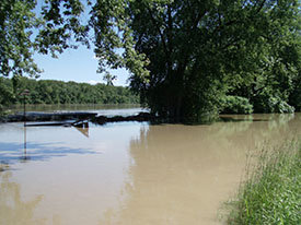
I ventured out into the storm after I realized that the winds were not as strong as forecast, but little did I know just how much flooding was going to result from all the hilltown runoff in Williamsburg, where I was living at the time. I went out and took many photos, some of which I’ve included on this page, and some videos. There’s some profanity, to give you fair warning, as I was truly astounded at the severity of the flash floods underway in Burgy.
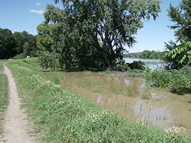
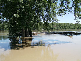
I guess the biggest impact for me personally was seeing firsthand just how close the entire town of Hatfield and City of Northampton came to completely flooding out. I was working in the center of Hatfield at the time, and would take walks on the Connecticut River dike every day at lunch. It was a welcome break in the midst of a stressful work day, with stunning views of the Pioneer Valley of Western Massachusetts. Anyways, I drove to the river the day the storm moved through Western Mass, and took some video footage. But the next day (or maybe 2 days later, can’t remember) I took the same walk, and literally could not believe what I was seeing.
Needless to say, we here in Western Mass got very lucky that the flooding, which was terrible enough as it was (especially in Franklin County) was not even worse.
STORM FACTS
Lowest Barometric Pressure
942 millibars/27.82 inches
Damage Estimates
$16.6 Billion
Highest Rainfall Totals
As much as 8 inches in portions of VT
Masslive.com local coverage of Irene
NOAA’s Hurricane Irene Page
Wiki Page
