OVER 10,000 SOLD SINCE 2015:
(Click to Order via Card, Venmo, PayPal, Check)
~~~~~~~~~~~~~~~~~~~~~~
TABLE OF CONTENTS
* Daily Celestials (Sun/Moon Data)
* Sponsor Section
* Morning Discussion
* TIP: Scroll to your section, or read all
~~~~~~~~~~~~~~~~~~~~~~
YOUR DAILY CELESTIALS
~~~~~~~~~~~~~~~~~~~~~~
STAR:
–OUR STAR ROSE AT: 6:26am this morning
–OUR STAR WILL SET AT: 4:40pm this evening
–TOTAL DAYLIGHT TIME: 10 hours and 14 minutes
MOON:
–OUR MOON WILL RISE AT: 8:44am this morning
–MOON RISE DIRECTION: Southeast
–OUR MOON WILL SET AT: 5:34pm this evening
–MOON SET DIRECTION: Southwest
–MOON PHASE: Waxing Crescent (3.8%)
~~~~~~~~~~~~~~~~~~~~~~
>>> A NOTE FROM OUR WEEKEND SPONSOR <<<
Dave Hayes The Weather Nut is Sponsored by Individual Community Members, Patrons, and Gerard, Ghazey & Bates, P.C. GGBPC is a Northampton-based law firm regarded as the voice of pragmatic and well-reasoned estate planning, elder law and tax guidance in Western Massachusetts. The firm specializes in estate planning law, and expertly handles other matters such as Elder Law, Tax Law, as well as Real Estate purchase, sales, and refinance transactions. Contact GGBPC today to see how they can help!
~~~~~~~~~~~~~~~~~~~~~~
YOUR MORNING DISCUSSION
~~~~~~~~~~~~~~~~~~~~~~
Good morning everybody, the good news regarding WMass/CMass fires this morning is that the Spencer fire has been handled. There was a small 3-acre fire in Chester, MA that was also handled yesterday.
For the Northampton and Monson fires, please click the links below to follow those pages for updates:
NORTHAMPTON FIRE DEPT
https://www.facebook.com/NorthamptonFireRescue
MONSON FIRE DEPT
https://www.facebook.com/MonsonfireMA
Folks, as of now, we are in a constant state of fire-spread risk in the greater WMass region.
We need to have an awareness about this, and until further notice, any time you do an outdoor brush pile burn, or do a rustic cook out, or have a campfire, or flick your cigarettes, you could be responsible for starting a fire that spreads, so don’t do those things for at least the next week.
I understand we can’t stop everyone from acting in a careless manner, but fire crews have been stretched, so do your best.
We can’t pretend that in the absence of Red Flag Warnings that ground fires won’t spread, or even spread quickly.
In addition, we are going to see winds pick back up Tuesday, Tuesday night and Wednesday, gusting 20-35mph out of the south and southeast, so with dry conditions Red Flag Warnings will likely be hoisted again by the NWS.
These are serious warnings, as we can see by now.
———————–
PAULINE CLARKE’S DAVE HAYES CALENDAR REVIEW
“The photos alone are worth the price of the calendar, but what makes it special are the informative bits of weather information, the inclusion of the moon phases, and the brief descriptive haikus. I’m hooked. Yours is the only calendar I buy.”
CLICK TO ORDER (SALE ENDS 11/10):
———————–
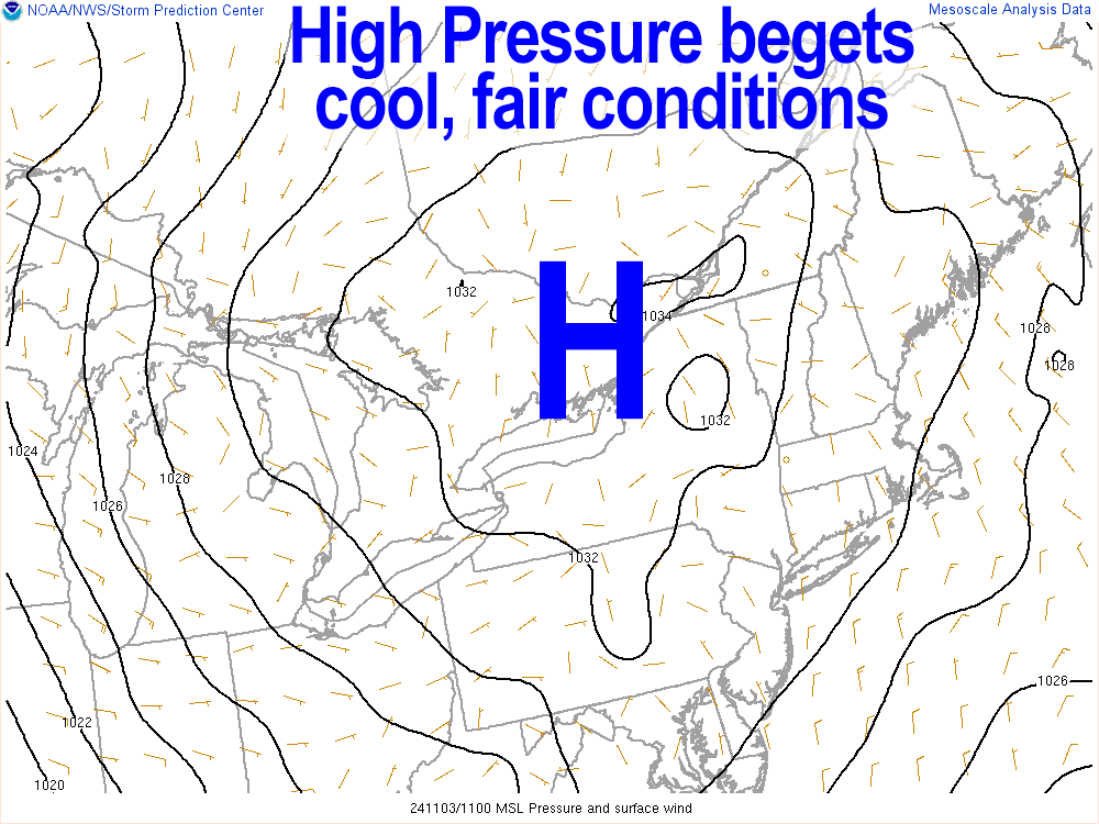
As for our weather, the next two days are fair, calm and cool with highs in the upper 40s to mid 50s with lows in the 20s to near 30º. Skies will be mostly sunny today and mostly clear tonight, but clouds will filter in Monday into Monday night as warmer air works its way into the region by Tuesday.
Fair weather is expected all week long with partly sunny skies expected Tuesday with highs in the upper 60s to low 70s with lows in the 50s under partly cloudy skies at night.
In addition, high pressure diving southeast and well east of Boston will combine with an incoming weak shortwave and low-level jet passing to our north which will join with warming temps to mix gusty winds down Tuesday into Wednesday, promoting fire spread.
Highs by Wednesday will reach the mid to upper 70s and more high temp records may be set on that day.
A cold front will move through by Thursday/Friday dropping temps down only into the 60s for highs, which is still substantially above average, but mostly sunny skies are expected.
By next weekend, Saturday should feature fair weather, but there are some signals of an actual rain storm by late Sunday into Sunday night, so hopefully we will get it because we need sky water to land on the surface urgently at this point.
Have a great day and please help support my work here by picking up a calendar for you or two for your friends/family at the link is below, thank you!
2025 Weather Wall Calendar
(Securely Order via Cards, Venmo, PayPal, or Check)
HAIKU OF THE DAY:
More wind gusts await
Keep crews in your well wishes
They walk toward fear
“Follow your bliss and the universe will open doors for you where there were only walls.”
― Joseph Campbell
