[7:12AM FRI 10/25/24] SEASONABLE/SUNNY TODAY BUT POTENTIAL FOR RED FLAG WARNINGS ON SATURDAY GIVEN DRY AIR AND INCREASED WIND… COLDER AIR ARRIVES SATURDAY NIGHT INTO TUESDAY MORNING WITH FAIR WEATHER… ANOTHER WARM UP REDUX MID TO LATE NEXT WEEK, THEN SOME SHOWERS… WARM HALLOWEEN… STORM POTENTIAL SIGNALS FOR LATE FIRST OR EARLY SECOND WEEK IN NOVEMBER… THANK YOU FOR YOUR 2025 CALENDAR ORDERS, I’M GRATEFUL FOR YOUR SUPPORT (SALE ENDS NOV. 10TH)…

Get more when you Order Dave’s 2025 Weather Wall Calendar:
~ An Affordable and Universal Holiday Gift Solution
~ 12 Lovely Local Photos + Cover
~ Lots of Interesting Weather Lessons
~ 12 of my Best Weather-Themed Haiku
~ Calendar Grids Chock-full of Celestial Data, Holidays, Top WMass Storms & More
~ A Community-Oriented & Contemplative Daily Companion
~ A Useful & Practical Organizer
~~~~~~~~~~~~~~~~~~~~~~
TABLE OF CONTENTS
* Daily Celestials (Sun/Moon Data)
* Sponsor Note
* Morning Discussion
* TIP: Scroll below for sections, or read all
~~~~~~~~~~~~~~~~~~~~~~
YOUR DAILY CELESTIALS
~~~~~~~~~~~~~~~~~~~~~~
STAR:
–OUR STAR ROSE AT: 7:15am this morning
–OUR STAR WILL SET AT: 5:52pm this evening
–TOTAL DAYLIGHT TIME: 10 hours and 37 minutes
MOON:
–OUR MOON WILL SET AT: 3:15pm this afternoon
–MOON SET DIRECTION: West-Northwest
–OUR MOON WILL RISE AT: 1:21am tomorrow morning
–MOON RISE DIRECTION: East-Northeast
–MOON PHASE: Waning Crescent (39.0%)
~~~~~~~~~~~~~~~~~~~~~~
A NOTE FROM OUR SPONSOR
~~~~~~~~~~~~~~~~~~~~~~
Dave Hayes The Weather Nut is Sponsored by Individual Community Members, Patrons, and Tandem Bagel Company… No matter the weather, Tandem Bagel is always there for you at several valley locations to make your mornings brighter! With *New Pizza Bagels(!)*, along with bagels baked fresh daily (including Gluten-Free options), house-whipped cream cheese, coffee, and tons of lunch options, Tandem is the perfect quick stop for lunch, breakfast, or a coffee and bagel to go.
You can either 1) visit them in Easthampton, Northampton, Hadley, Florence, and/or West Springfield, 2) hire them to cater your next event, or 3) use their super-streamlined online ordering tool by visiting their website and clicking the “Catering” or “Order Online” links at https://www.tandembagelco.com
~~~~~~~~~~~~~~~~~~~~~~
DHTWN ANNOUNCEMENTS
~~~~~~~~~~~~~~~~~~~~~~
2025 DHTWN Weather Wall Calendar *Sale Ends 11/10*
(Click/Order via Cards, Venmo, PayPal, Check)
~~~~~~~~~~~~~~~~~~~~~~
YOUR MORNING DISCUSSION
~~~~~~~~~~~~~~~~~~~~~~
Good morning folks, we have a chilly start out there with temps “freezing to 40” for the most part, but there are some upper 20s noted as well. Let me know what you saw for lows overnight or current temps.
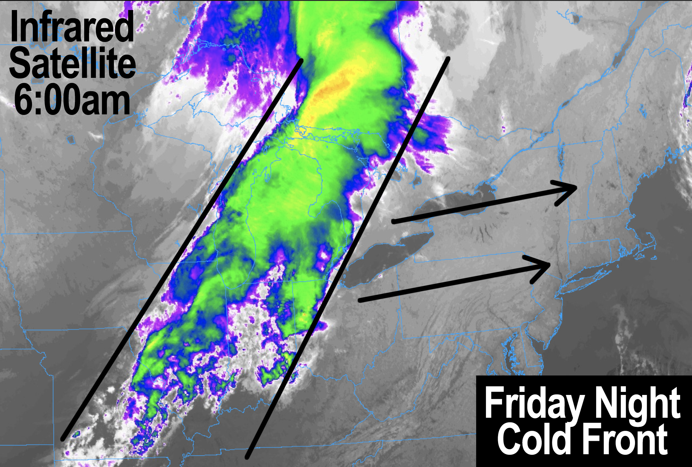
Going forward, high pressure builds through New England today with sunshine and highs in the low 50s to low 60s with a light wind. Lows tonight will drop to the low 40s as clouds increase with a weakening cold front pressing east through NY and PA overnight.
This front will pass through early Saturday and bring a few light showers, but most will stay dry as the stronger dynamics are more north into northern New England.
The impact it WILL have is freshening the west and northwest wind on Saturday into the evening with gusts of 20-35mph at times, along with increasing sunshine and decreasing temps.
This higher wind and persistent dry surface may end up causing the NWS to hoist Red Flag Warnings, as we are essentially in a continuous potential for fire spread conditions at this point (including today, so don’t be a dummy). When you add the wind component, we could see other events like the Berlin CT fire.
Saturday highs will be similar today as colder air lags the front, so expect low 50s to low 60s, but Saturday night looks colder with lows in the mid 20s to mid 30s under mostly clear skies, with breezy conditions earlier on.
Sunday and Monday is the coldest part of this next cool down as our seesaw weather continues, which is known to happen in the Autumn as waning warmth, and waxing cold battle for prominence in New England.
Highs Sunday and Monday should sit down into the mid 40s to mid 50s with lows in the mid 20s to low 30s under sunny/clear skies.
High pressure will crest overhead during this time, and then pullout to sea and south of us starting Tuesday which is our transition to our next warm up, with sunny skies and highs in the mid 50s to low 60s.
However, it is the Wednesday through Friday noon timeframe when we’ll warm right back up again with sunshine and highs in the mid 60s to low 70s Wednesday, and then well into the 70s Thursday and possibly Friday, depending on when a cold front arrives end of next week with some showers possible as we roll into November.
There are signals that are softly creeping into my awareness that point that could turn into a cooler and stormier pattern change toward the November 5-10th timeframe, but it’s just something to which I’ll pay attention.
Have a great day, and please remember my calendar as you think about your holiday gift shopping, or for yourself (order link below):
(Securely Order via Cards, Venmo, PayPal, Check)
“Follow your bliss and the universe will open doors for you where there were only walls.”
― Joseph Campbell
