TABLE OF CONTENTS
* Daily Celestials (Sun/Moon Data)
* Sponsor Section
* Morning Discussion
* TIP: Scroll to your section, or read all
~~~~~~~~~~~~~~~~~~~~~~
YOUR DAILY CELESTIALS
~~~~~~~~~~~~~~~~~~~~~~
STAR:
–OUR STAR ROSE AT: 6:45am this morning
–OUR STAR WILL SET AT: 6:34pm this evening
–TOTAL DAYLIGHT TIME: 11 hours and 49 minutes
MOON:
–OUR MOON WILL SET AT: 5:31pm this afternoon
–MOON SET DIRECTION: West-Northwest
–OUR MOON WILL RISE AT: 4:32am tomorrow morning
–MOON RISE DIRECTION: East-Northeast
–MOON PHASE: Waning Crescent (9.7%)
~~~~~~~~~~~~~~~~~~~~~~
>>> A NOTE FROM OUR WEEKEND SPONSOR <<<
Dave Hayes The Weather Nut is Sponsored by Individual Community Members, Patrons, and Gerard, Ghazey & Bates, P.C. GGBPC is a Northampton-based law firm regarded as the voice of pragmatic and well-reasoned estate planning, elder law and tax guidance in Western Massachusetts. The firm specializes in estate planning law, and expertly handles other matters such as Elder Law, Tax Law, as well as Real Estate purchase, sales, and refinance transactions. Contact GGBPC today to see how they can help!
~~~~~~~~~~~~~~~~~~~~~~
YOUR MORNING DISCUSSION
~~~~~~~~~~~~~~~~~~~~~~
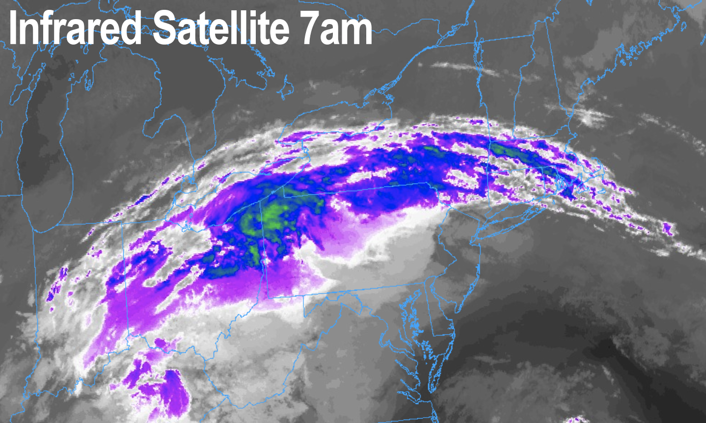
Good morning folks, we’ve got a cloud deck overhead connected to Helene’s remnants, but there’s dry air mixed in at the lower levels with dewpoints in the 50s, so no showers are expected today save for a spot shower in a few spots.
With the cloud cover, highs should hang in the mid 60s to low 70s today, with lows tonight in the upper 40s to low 50s with patchy fog possible late.
For Monday, we should see a bit more cloudiness in areas like CMass and northeast CT that are closer to the coast, whereas WMass, SVT/SWNH and northwest CT should see more of a partly sunny day with highs in the upper 60s to low 70s there, and more like mid to upper 60s east into CMass and NE.CT. Lows will dip to the low 50s.
For Tuesday, we’ll have similar high temps and after a partly sunny start, clouds will increase by afternoon as a weakening cold front will be approaching the region.
By evening into the first part of Wednesday, some scattered showers are expected, most numerous in far northwest MA (northern Berkshires, west county) up into SVT and the adjacent Taconics, with lighter activity into the rest of the greater WMass region.
Wednesday looks cooler with highs in the mid to upper 60s under plenty of clouds.
By Thursday into early Saturday, we should see high pressure build back into the region with more sunshine and warm temps in the upper 60s to mid 70s.
There is a chance for another area of showers to work into the region next weekend, but that’s a long way off, and right now, it’s peace in the valley as far as I can tell.
After what transpired and is still transpiring in the southeast U.S., we have a galactic-level amount to be thankful for whenever we have a peaceful weather day like today and much of the upcoming week.
I hope you have a great day…
HAIKU OF THE DAY:
It’s extreme somewhere
Here? Calm, peaceful, temperate
No-Big-Whoop Weather
“Follow your bliss and the universe will open doors for you where there were only walls.”
― Joseph Campbell
