
TABLE OF CONTENTS
* Daily Celestials (Sun/Moon Data)
* Sponsor Note
* Join My Newsletter (& get my Top12WMassStorms ebook!)
* Morning Discussion
* TIP: Scroll below for sections, or read all
~~~~~~~~~~~~~~~~~~~~~~
YOUR DAILY CELESTIALS
~~~~~~~~~~~~~~~~~~~~~~
STAR:
–OUR STAR ROSE AT: 5:20am this morning
–OUR STAR SETS AT: 8:29pm this evening
–TOTAL DAYLIGHT TIME: 15 hours and 9 minutes
MOON:
–OUR MOON SETS AT: 8:53pm tonight
–MOON SET DIRECTION: Northwest
–OUR MOON RISES AT: 5:33am tomorrow morning
–MOON RISE DIRECTION: Northeast
–MOON PHASE: New Moon (0.5%)
~~~~~~~~~~~~~~~~~~~~~~
A NOTE FROM OUR SPONSOR
~~~~~~~~~~~~~~~~~~~~~~
Dave Hayes The Weather Nut is Sponsored by Individual Community Members, Patrons, and Tandem Bagel Company… No matter the weather, Tandem Bagel is always there for you at several valley locations to make your mornings brighter! With *New Pizza Bagels(!)*, along with bagels baked fresh daily (including Gluten-Free options), house-whipped cream cheese, coffee, and tons of lunch options, Tandem is the perfect quick stop for lunch, breakfast, or a coffee and bagel to go.
You can either A) visit them in Easthampton, Northampton, Hadley, Florence, and/or West Springfield, B) hire them to cater your next event, or C) use their super-streamlined online ordering tool by visiting their website and clicking the “Catering” or “Order Online” links.
~~~~~~~~~~~~~~~~~~~~~~
GET DAVE’S TOP 12 MOST POTENT STORMS
IN WMASS HISTORY (Plus 3 honorable mentions)
Grab my detailed (and free) 70-page local storm book filled with storm histories, personal stories, and impacts/facts when you sign up for my free weekly newsletter called “The Nutletter” by clicking this link to my secure website.
~~~~~~~~~~~~~~~~~~~~~~
YOUR MORNING DISCUSSION
~~~~~~~~~~~~~~~~~~~~~~
Good morning everybody, well it’s that time again where Dave becomes a soup ingredient in need of sous chef to prep him and dice him into the soup du jour.
I’ve done this before, I promise I won’t put up a fuss.
In other words, Jane stop this crazy thing! #Jetsons
It is so humid outside, and just going to increase into tonight and tomorrow with dewpoints cresting intot he mid 70s, and possibly the upper 70s for a few folks.
In humidity speak, that’s WICKED MUGGY.
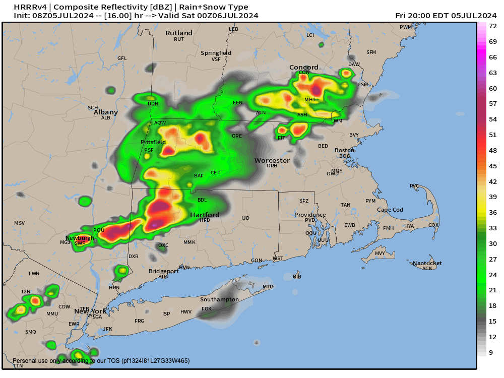
For today, we’re mostly cloudy with some sunny breaks, which will help produce some instability as highs are expected to rise into the 80s, with some upper 80s possible. Our copious moisture with enough instability will be enough to produce periods of scattered showers, downpours and even a few thunderstorms.
Heavy rain and street flooding / lowered visibility is the main hazard with which we’ll have to contend, most likely.
I am also noting a weak mid-level wave over PA that in east-northeast flow will likely float into southern and central New England and may organize a cluster of showers and downpours which pushes through northwest CT and the Berkshires into the WMass region and northern CT area between say 4-9pm.
Lows tonight drop to the mid 60s to low 70s with a few showers or a storm possible, along with patchy fog.
We may see a period of Saturday morning showers and downpours, but the bottom line is tomorrow will be a very humid repeat of today, with times where it’s not doing anything, and times when it’s a light or moderate shower for some, and times when it’s raining torrentially, with or without a thunderstorm.
Highs on Saturday are a copy of today, well into the 80s, and lows either side of 70º as a not-cold front comes through the region with some final showers possible at night.
Sunday and Monday represent a big improvement, though an isolated shower or storm is possible for Sunday as high pressure builds into the region.
Highs on Sunday with developing periods of sunshine should reach the 85-90º range, with lows in the mid 60s as humidity tamps down a bit, but not by a lot.
Monday and Tuesday look hot and humid with sunny Monday highs in the upper 80s to low 90s, and similar for Tuesday as clouds start to build back into the region.
A fairly potent low will be tracking to our north by Tuesday into Wednesday, and it doesn’t look all that fast-moving at the moment.
This should introduce showers back into the greater WMass region for Tuesday afternoon/night and certainly into Wednesday with highs into the 80s by middle of next week.
Showers will be winding down by Thursday the way it looks now.
What seems most certain in the coming week is that high humidity levels will be persisting, so collect your perspiration, desalinize it, and use it to water your gardens — another friendly and (not) useful tip by your local weather nut.
Have a great day!
>>> BE KIND <<<
“Hello babies. Welcome to Earth. It’s hot in the summer and cold in the winter. It’s round and wet and crowded. On the outside, babies, you’ve got a hundred years here. There’s only one rule that I know of, babies: Goddamn it, you’ve got to be kind.”
–Kurt Vonnegut