
~~~~~~~~~~~~~~~~~~~~~~
TABLE OF CONTENTS
* Daily Celestials (Sun/Moon Data)
* Sponsor Note
* Join My Newsletter (& get my Top12WMassStorms ebook!)
* Morning Discussion
* TIP: Scroll below for sections, or read all
~~~~~~~~~~~~~~~~~~~~~~
YOUR DAILY CELESTIALS
~~~~~~~~~~~~~~~~~~~~~~
STAR:
–OUR STAR ROSE AT: 5:19am this morning
–OUR STAR SETS AT: 8:29pm this evening
–TOTAL DAYLIGHT TIME: 15 hours and 10 minutes
MOON:
–OUR MOON SETS AT: 6:56pm this afternoon
–MOON SET DIRECTION: Northwest
–OUR MOON RISES AT: 3:31am tomorrow morning
–MOON RISE DIRECTION: Northeast
–MOON PHASE: Waning Crescent (7.4%)
~~~~~~~~~~~~~~~~~~~~~~
A NOTE FROM OUR SPONSOR
~~~~~~~~~~~~~~~~~~~~~~
Dave Hayes The Weather Nut is Sponsored by Individual Community Members, Patrons, and Tandem Bagel Company… No matter the weather, Tandem Bagel is always there for you at several valley locations to make your mornings brighter! With *New Pizza Bagels(!)*, along with bagels baked fresh daily (including Gluten-Free options), house-whipped cream cheese, coffee, and tons of lunch options, Tandem is the perfect quick stop for lunch, breakfast, or a coffee and bagel to go.
You can either A) visit them in Easthampton, Northampton, Hadley, Florence, and/or West Springfield, B) hire them to cater your next event, or C) use their super-streamlined online ordering tool by visiting their website and clicking the “Catering” or “Order Online” links.
~~~~~~~~~~~~~~~~~~~~~~
GET DAVE’S TOP 12 MOST POTENT STORMS
IN WMASS HISTORY (Plus 3 honorable mentions)
Grab my detailed (and free) 70-page local storm book filled with storm histories, personal stories, and impacts/facts when you sign up for my free weekly newsletter called “The Nutletter” by clicking this link to my secure website.
~~~~~~~~~~~~~~~~~~~~~~
YOUR MORNING DISCUSSION
~~~~~~~~~~~~~~~~~~~~~~
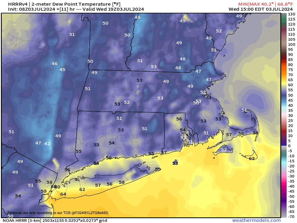
Good morning everybody, we are enjoying a crisp and cool early July morning with low humidity and temps in the 50s.
Sign me up all year long for this!
As for the rest of the day, expect mostly sunny skies with high pressure just off of New England’s coast and highs in the low to mid 80s.
Humidity will begin to creep up tonight with lows in the low to mid 60s, and clouds should become more numerous with a few showers possible by Thursday morning.
These should be transient, and the 4th should be mostly dry until later in the afternoon, with high reaching the low to mid 80s.
While the surface atmosphere should be fairly stable, we will have increased humidity and a frontal boundary tracking into the region, so I believe some scattered showers will develop by late afternoon and evening, so something to be aware of for any holiday plans.
In other words, I don’t think everyone gets wet from showers, but there will be some wettening activities scattered about.
Humidity continues overnight with lows in the mid 60s, as we get ready for more humidity on Friday, with a spike in humidity on Saturday.
Friday should feature highs in the mid to upper 80s with a few scattered showers possible later in the day, maybe a thunderstorm, and lows will dip into the mid to upper 60s with a few showers at night.
Saturday into Saturday night is when I think we’ll see more substantial wet weather.
It will become very humid with dewpoints rising well into the 70s, so the atmosphere is going to be loaded with moisture from surface to sky.
We’ll also see a shortwave track east out of the eastern Great Lakes and send some energy into New England.
This combination should produce showers with some downpours that are more numerous in coverage, especially by later in the afternoon, and overnight Saturday.
Highs will reach the low to mid 80s with lows 65-70º and continued humid.
Sunday, at the moment, looks like the weekend pick with partial sunshine and very warm to borderline hot highs in the 85-90º range.
Humid conditions continue next week, though hopefully a bit less humid into the early week period with sunshine on Monday and highs in the 80s.
However, I continue to see soaking signals for the mid week period next week, so I will continue to monitor that, and hopefully it will dissipate with time, but I’m keeping an eye on it.
If it continues to show up, I’ll start discussing the hows and the whys, but until then, enjoy this gorgeous star-facing time period, otherwise known as a day!
>>> BE KIND <<<
“Hello babies. Welcome to Earth. It’s hot in the summer and cold in the winter. It’s round and wet and crowded. On the outside, babies, you’ve got a hundred years here. There’s only one rule that I know of, babies: Goddamn it, you’ve got to be kind.”
–Kurt Vonnegut