
~~~~~~~~~~~~~~~~~~~~~~
TABLE OF CONTENTS
* Daily Celestials (Sun/Moon Data)
* Sponsor Note
* Join My Newsletter (& get my Top12WMassStorms ebook!)
* Morning Discussion
* TIP: Scroll below for sections, or read all
~~~~~~~~~~~~~~~~~~~~~~
YOUR DAILY CELESTIALS
~~~~~~~~~~~~~~~~~~~~~~
STAR:
–OUR STAR ROSE AT: 5:16am this morning
–OUR STAR SETS AT: 8:30pm this evening
–TOTAL DAYLIGHT TIME: 15 hours and 14 minutes
*Peak Light*
MOON:
–OUR MOON SETS AT: 11:28am this morning
–MOON SET DIRECTION: West-Southwest
–OUR MOON RISES AT: 12:24am tomorrow morning
–MOON RISE DIRECTION: East-Southeast
–MOON PHASE: Waning Gibbous (66.7%)
~~~~~~~~~~~~~~~~~~~~~~
A NOTE FROM OUR SPONSOR
~~~~~~~~~~~~~~~~~~~~~~
Dave Hayes The Weather Nut is Sponsored by Individual Community Members, Patrons, and Tandem Bagel Company… No matter the weather, Tandem Bagel is always there for you at several valley locations to make your mornings brighter! With *New Pizza Bagels(!)*, along with bagels baked fresh daily (including Gluten-Free options), house-whipped cream cheese, coffee, and tons of lunch options, Tandem is the perfect quick stop for lunch, breakfast, or a coffee and bagel to go.
You can either A) visit them in Easthampton, Northampton, Hadley, Florence, and/or West Springfield, B) hire them to cater your next event, or C) use their super-streamlined online ordering tool by visiting their website and clicking the “Catering” or “Order Online” links.
~~~~~~~~~~~~~~~~~~~~~~
GET DAVE’S TOP 12 MOST POTENT STORMS
IN WMASS HISTORY (Plus 3 honorable mentions)
Grab my detailed (and free) 70-page local storm book filled with storm histories, personal stories, and impacts/facts when you sign up for my free weekly newsletter called “The Nutletter” by clicking this link to my secure website.
~~~~~~~~~~~~~~~~~~~~~~
YOUR MORNING DISCUSSION
~~~~~~~~~~~~~~~~~~~~~~
Good morning everybody, that line of storms last night was truly awful and nasty, as soon as it entered Litchfield County CT and tracked east all the way through northern CT it was a big wind bag and produced a 77mph gust at Bradley Airport, and produced numerous damage reportts throughout northern CT, with 35000 folks still without power down that way.
Hampden County and southern Worcester County saw more of the flash flooding impacts ahead of that line with heavy rain due to cells training over that area, but those areas also saw the northern gusty fringe of that severe storm line last night as well.
Thankfully that has blown out to sea at this point, and we will see improvements today with clouds early, and other than few spots showers, we should see cooler, drier air work into the greater WMass region.
Increasing sunshine should develop with highs climbing into the mid 70s to low 80s with a west wind gusting to 20mph at times.
Dewpoints will crash tonight, and so will temps with lows in the mid 40s to low 50s under clear skies, quite chilly for late June!
For Friday, a perfect day ends the week with high pressure building through the region producing sunny skies with highs in the mid to upper 70s and lows in the low to mid 50s under partly cloudy skies.
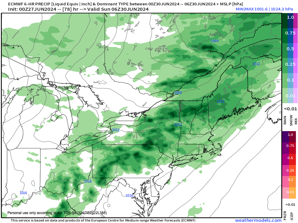
Saturday will be similarly cool with highs in the mid to upper 70s, and while we may start off partly sunny, clouds will build ahead of another slow-moving cold front that will be approaching the region, set to increase our humidity and soak our hills and dales later Saturday night into and through much of Sunday.
Clouds thicken into Saturday evening, and first showers should arrive before midnight sometime, with lows in the low to mid 60s as humidity continues to come up.
Thunderstorms are also expected, but at the moment don’t appear to be wind producers as much as they will contribute to heavy rainfall and potential for street flooding.
By the time we get to Sunday, it’s looking like a showery day with warmer highs up into the low to mid 80s behind a warm front, and ahead of the incoming cold front.
Showers should end by Sunday evening or so, and then drier and lower humidity air will once again be ushered into our region to kick off the work week, with Sunday night lows in the 50s.
Monday through Wednesday, for now, looks lovely with highs 75-80º Monday, upper 70s to low 80s Tuesday, and low to mid 80s by Wednesday with plenty of sunshine and low humidity through Tuesday.
Once we get to Wednesday we may see a warm front approach the region with some showers late in the day, but we’ll see a solid kick off to the work week with pleasant conditions.
Have a great day!
>>> BE KIND <<<
“Hello babies. Welcome to Earth. It’s hot in the summer and cold in the winter. It’s round and wet and crowded. On the outside, babies, you’ve got a hundred years here. There’s only one rule that I know of, babies: Goddamn it, you’ve got to be kind.”
–Kurt Vonnegut