~~~~~~~~~~~~~~~~~~~~~~
TABLE OF CONTENTS
* Daily Celestials (Sun/Moon Data)
* Weekly Weather Nutshell
* Morning Discussion
* TIP: Scroll below for sections, or read all
~~~~~~~~~~~~~~~~~~~~~~
YOUR DAILY CELESTIALS
~~~~~~~~~~~~~~~~~~~~~~
STAR:
–OUR STAR ROSE AT: 5:36am this morning
–OUR STAR SETS AT: 7:57pm this evening
–TOTAL DAYLIGHT TIME: 14 hours and 21 minutes
MOON:
–OUR MOON SETS AT: 10:22pm this evening
–MOON SET DIRECTION: Northwest
–OUR MOON RISES AT: 7:00am tomorrow morning
–MOON RISE DIRECTION: Northeast
–MOON PHASE: Waxing Crescent (2.4%)
~~~~~~~~~~~~~~~~~~~~~~
A NOTE FROM OUR SPONSOR
~~~~~~~~~~~~~~~~~~~~~~
Dave Hayes The Weather Nut is Sponsored by Individual Community Members, Patrons, and Tandem Bagel Company… No matter the weather, Tandem Bagel is always there for you at several valley locations to make your mornings brighter! With *New Pizza Bagels(!)*, along with bagels baked fresh daily (including Gluten-Free options), house-whipped cream cheese, coffee, and tons of lunch options, Tandem is the perfect quick stop for lunch, breakfast, or a coffee and bagel to go.
You can either A) visit them in Easthampton, Northampton, Hadley, Florence, and/or West Springfield, B) hire them to cater your next event, or C) use their super-streamlined online ordering tool by visiting their website and clicking the “Catering” or “Order Online” links.
~~~~~~~~~~~~~~~~~~~~~~
YOUR WEEKLY WEATHER NUTSHELL
~~~~~~~~~~~~~~~~~~~~~~
–Today is the calm after yesterday’s storms
–With a system to our west and our front to the east we’re between active weather
–We will see some partly sunny periods, but should see more clouds than sun with highs around the low to mid 60s, with some upper 60s possible if we get extended sunny breaks later
–A system track east toward the Mid-Atlantic coast tonight into Friday, passing south of us
–This should keep steadiest showers south of us, but after an isolated shower this evening, a steadier period of showers moves in after midnight into Friday morning before tapering off
–Lows will drop into the mid 40s tonight
–Highs tomorrow only reach the mid 50s to low 60s, which is a touch milder than originally thought
–This is due to the first of a pair of upper lows swinging into New England which will turn our wind to the east through the weekend, cooling us down a bit
–Friday looks mostly cloudy, though a few sunny breaks are possible in the afternoon, with lows in the low to mid 40s
–Saturday looks drier at the moment with a trend towards partly sunny skies and highs in the mid 50s to low 60s and lows in the low to mid 40s with clouds increasing and a shower possible
–Another wave wrapping around the upper low may bring a period of showers on Sunday with similar temps
–By early week, we should see the upper low track east and away, allowing for temps to surge well into the 60s by Monday, and to either side of 70º by Tuesday, with a chance for rain by Wednesday
–At least things are trending in a drier, slightly milder direction
–Thanks for all the reports yesterday!
~~~~~~~~~~~~~~~~~~~~~~
YOUR MORNING DISCUSSION
~~~~~~~~~~~~~~~~~~~~~~
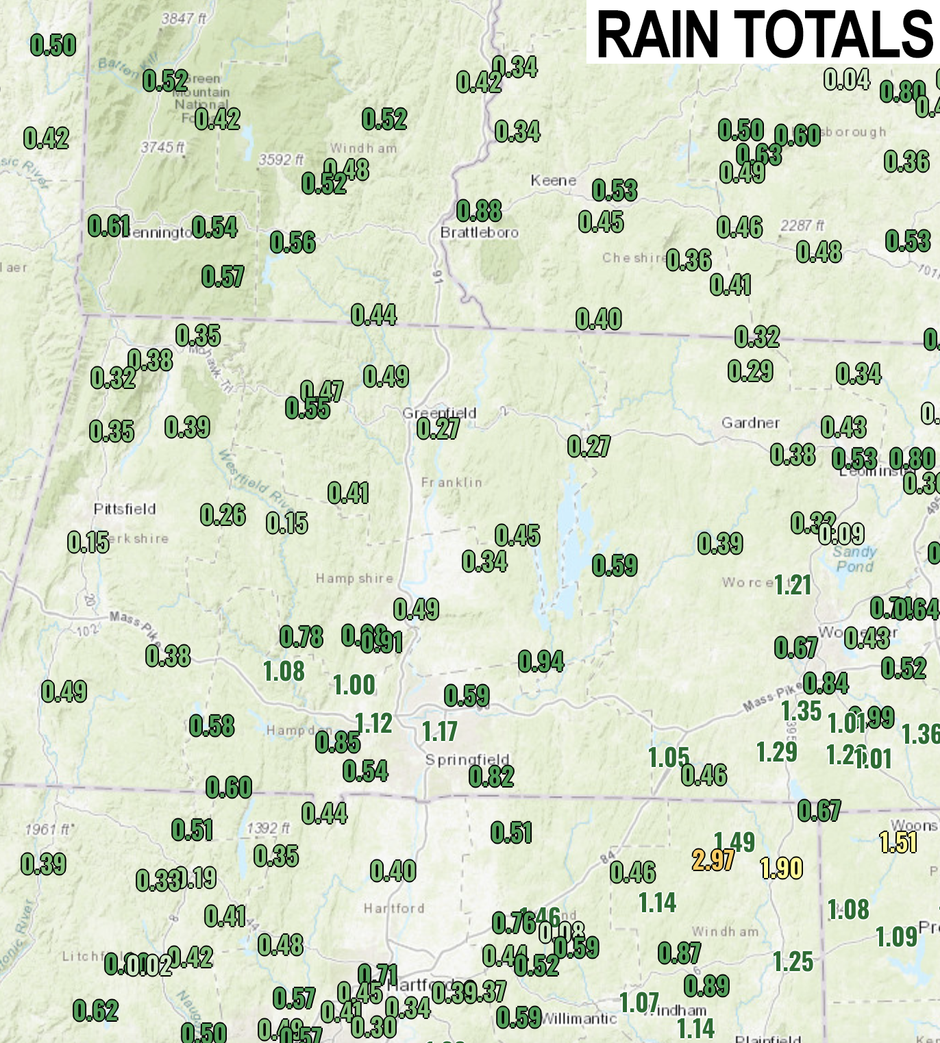
Good morning everybody, thanks for all of the storm reports, pics and vids yesterday!
The hail was impressive and those steeper mid-level lapse rates really allowed the development of strong updrafts to reach higher into the clouds where the freezing layer was and keep sending the lighter stones back up to accrete more ice around them to the tune of 1.00-1.75″ diameter hail stones in Hampden County and northeast CT! That’s big!
Those size stones can also injure you, so it’s good to get inside when these types of cells are moving through a region.
As far as our sensible weather going forward, it’s a bit of a messy mix of showers, cooler temps, and clouds, but overall we’re trending a bit drier and a touch milder than how it looked a day or two ago.
The Nutshell section covers these details, but the bottom line is that aside from a period of showers early tomorrow morning, and another period of showers on Sunday, we’ll generally see a mix of clouds and sun with cooler temps Friday through Sunday as an upper low works in overhead.
We will generally be more cloudy than sunny, but periods of partial sun (later today, and Saturday, for example) will develop as well.
We will warm up by early to mid next week as the upper low departs to the east, with another shot of rain on Wednesday, but aside from our isolated severe t-storms yesterday, I don’t see any severe weather in the next 7 days, so that’s good news.
I hope you have a great day!
>>> BE KIND <<<
“Hello babies. Welcome to Earth. It’s hot in the summer and cold in the winter. It’s round and wet and crowded. On the outside, babies, you’ve got a hundred years here. There’s only one rule that I know of, babies: Goddamn it, you’ve got to be kind.”
–Kurt Vonnegut
