~~~~~~~~~~~~~~~~~~~~~~
TABLE OF CONTENTS
* Daily Celestials (Sun/Moon Data)
* Weekly Weather Nutshell
* Morning Discussion
* TIP: Scroll below for sections, or read all
~~~~~~~~~~~~~~~~~~~~~~
YOUR DAILY CELESTIALS
~~~~~~~~~~~~~~~~~~~~~~
STAR:
–OUR STAR ROSE AT: 5:46am this morning
–OUR STAR SETS AT: 7:48pm this evening
–TOTAL DAYLIGHT TIME: 14 hours and 2 minutes
MOON:
–OUR MOON SETS AT: 10:44am this morning
–MOON SET DIRECTION: Southwest
–OUR MOON RISES AT: 2:31am tomorrow morning
–MOON RISE DIRECTION: Southeast
–MOON PHASE: Waning Gibbous (61.5%)
~~~~~~~~~~~~~~~~~~~~~~
A NOTE FROM OUR SPONSOR
~~~~~~~~~~~~~~~~~~~~~~
Dave Hayes The Weather Nut is Sponsored by Individual Community Members, Patrons, and Tandem Bagel Company… No matter the weather, Tandem Bagel is always there for you at several valley locations to make your mornings brighter! With *New Pizza Bagels(!)*, along with bagels baked fresh daily (including Gluten-Free options), house-whipped cream cheese, coffee, and tons of lunch options, Tandem is the perfect quick stop for lunch, breakfast, or a coffee and bagel to go.
You can either A) visit them in Easthampton, Northampton, Hadley, Florence, and/or West Springfield, B) hire them to cater your next event, or C) use their super-streamlined online ordering tool by visiting their website and clicking the “Catering” or “Order Online”.
~~~~~~~~~~~~~~~~~~~~~~
YOUR WEEKLY WEATHER NUTSHELL
~~~~~~~~~~~~~~~~~~~~~~
–Showers were expected, but apologies to the poor dogs overnight along and north of the Rt. 2 corridor who got freaked by the unexpected thunder
–SVT and far northwest MA may hear a few more rumbles oof thunder either side of 8am-9am
–Final shower round clears, and we end up with a mostly cloudy day, with perhaps a few sunny breaks by afternoon
–Highs reach the upper 50s to low 60s, and lows will drop into the upper 40s
–In addition, a wave works through the region tonight bringing a period of moderate to perhaps heavier rainfall after 7pm, departing sometime in the early pre-dawn hours
–Wednesday should start off cloudy as Tuesday night’s low drives a cold front back into parts of E/CMass with cooler temps in the 50s to low 60s for CMass developing
–However, some sunny periods should develop as drier air moves in from the west and breaks up the cloud deck a bit
–Assuming this transpires, highs will reach well into the 60s
–Lows will drop to the mid to upper 40s with a spot shower or some patchy fog possible
–Yet another weaker wave will head into New England which could bring some scattered showers by Thursday afternoon which looks quite mild in the 65-70º range with lows near 50º
–By Friday and Saturday, we should move into a mostly dry period with brief ridging coming through (though there will still be clouds around)
–Friday looks party sunny, but mostly cloudy for Saturday as a larger frontal boundary starts approaching the region, set to pass through on Sunday
–Both days will on the more seasonable side for early May, with highs in the upper 50s to mid 60s
–Clouds thicken up Saturday night with a few showers moving into the Berkshires
–By Sunday, we should all be seeing some rainfall as a larger cold front swings into and through the region, set to sweep this messy morass of back-and-forth frontal activity out to sea
~~~~~~~~~~~~~~~~~~~~~~
YOUR MORNING DISCUSSION
~~~~~~~~~~~~~~~~~~~~~~
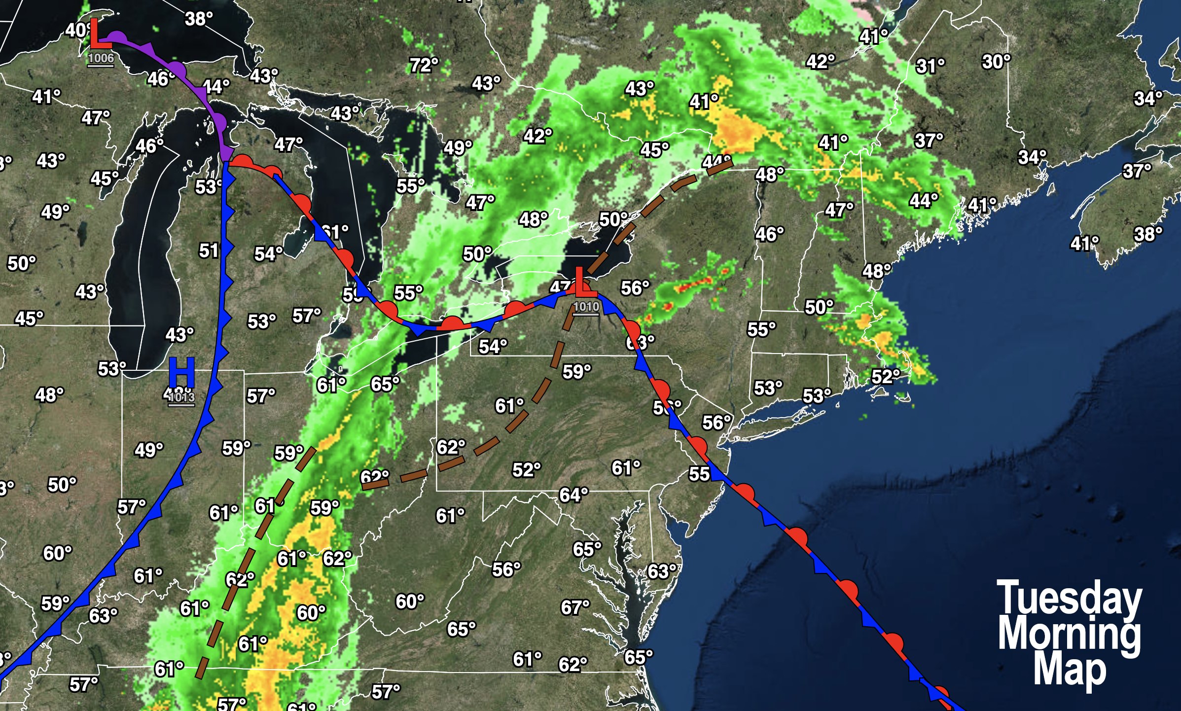
Good morning folks, the Nutshell above covers most of what’s happening with our upcoming weather, though I’d be lying if I said I feel super confident about the outlook.
These slow-moving back-door cold fronts that can return as warm fronts as they interact with subtle, weaker waves of low pressure at various height levels can cause lots of unexpected results in terms of temperatures and precipitation.
As mentioned, southern VT should see some more showers this morning, with thunder embedded and even some small hail possible with an area of elevated convection tracking east-northeast out of the northern Capital Region of NY this morning.
More rain will push into the greater WMass region tonight, mostly after sunset and ending before tomorrow morning.
Wednesday afternoon will likely bloom into a partly sunny, very mild afternoon after a cloudy start with highs well into the 60s.
Thursday is warmer with southwest flow ahead of another weak system that brings somoe scattered showers, and induces another back door cold front to pull through Friday into Saturday cooling us down into the upper 50s to mid 60s with a few showers on Thrusday to be followed by drier conditions Friday into the first part of Saturday.
#RunOnSentenceAwardFor2024 #DontHateMeBecauseImProneToVerbosity
The big frontal boundary pushes showers into our region by late Saturday night through Sunday, and then sweeps these lollygagginous fronts outta here by early next week.
Have a great day!
>>> BE KIND <<<
“Hello babies. Welcome to Earth. It’s hot in the summer and cold in the winter. It’s round and wet and crowded. On the outside, babies, you’ve got a hundred years here. There’s only one rule that I know of, babies: Goddamn it, you’ve got to be kind.”
–Kurt Vonnegut
