WE’RE ABOUT 2/3RDS TO THE
4% READER SUPPORT GOAL (1 WEEK LEFT)
You get a hyper-local and regionally relevant weather outlet supported by the community, for the community.
–> SecureClick: https://westernmassweather.com/support-network/
~~~~~~~~~~~~~~~~~~~~~~
TABLE OF CONTENTS
* Daily Celestials (Sun/Moon Data)
* Weekly Weather Nutshell
* Morning Discussion
* TIP: Scroll below for sections, or read all
~~~~~~~~~~~~~~~~~~~~~~
YOUR DAILY CELESTIALS
~~~~~~~~~~~~~~~~~~~~~~
STAR:
–OUR STAR ROSE AT: 6:57am this morning
–OUR STAR WILL SET AT: 6:59pm this evening
–TOTAL DAYLIGHT TIME: 12 hours and 2 minutes
MOON:
–OUR MOON WILL RISE AT: 11:24am this morning
–MOON RISE DIRECTION: Northeast
–OUR MOON WILL SET AT: 3:52am tomorrow morning
–MOON SET DIRECTION: Northwest
–MOON PHASE: Waxing Gibbous (53.5%)
~~~~~~~~~~~~~~~~~~~~~~
>>> A NOTE FROM OUR SPONSOR <<<
Dave Hayes The Weather Nut is Sponsored by Individual Community Members, Patrons, and Gerard, Ghazey & Bates, P.C. GGBPC is a Northampton-based law firm regarded as the voice of pragmatic and well-reasoned estate planning, elder law and tax guidance in Western Massachusetts. The firm specializes in estate planning law, and expertly handles other matters such as Elder Law, Tax Law, as well as Real Estate purchase, sales, and refinance transactions. Contact GGBPC today to see how they can help!
~~~~~~~~~~~~~~~~~~~~~~
YOUR WEEKLY WEATHER NUTSHELL
~~~~~~~~~~~~~~~~~~~~~~
–Soak up some 50s between and betwixt any pop-up showers this afternoon, folks, as 40s are coming back to town for high temps for the foreseeable future
–We have a wave of cold front associated showers moving east through the region this morning (buh bye brief blue sky)
–Behind these showers much colder air moves in aloft
–This will produce steeper lapse rates and cause some pop-up isolated type showers for this afternoon in spots
–Some showers may contain graupel (soft hail, or ice-encased snowflakes), with some actual snowflakes mixed in late day in the high terrain
–Highs reach the mid 40s to mid 50s and then fall later
–West winds will gust 20-30mph later today
–Activity winds down tonight as stability increases with lows in the upper 20s to low 30s
–On Monday, highs will climb well into the 40s, but that’s about it
–As temps come up with sit underneath cold air aloft, lapse rates come up again, and mostly the high terrain west of the I-91 corridor should see some instability snow or mixed showers pop again
–West winds should gust up to 20mph or so again as well, with lows near 30º
–Tuesday looks partly sunny with a few pop up showers of rain or snow possible with highs in the mid 30s to mid 40s, and lows in the 20s
–By Wednesday, a disturbance will be swinging around the base of the broad upper trough that is delivering seasonable to below seasonable cold to the WMass region this coming week
–This will bring a better chance for more widespread rain and snow showers into the night with highs in the low to mid 40s and lows in the low to mid 20s, with some light accumulations possible at elevation
–Thursday looks COLD with highs only in the 30s along with a few snow showers possible, before we land into a sunnier Friday with similar temps
–We moderate temps a touch next weekend, but that may also come with a coastal storm potential
–With the way this Winter has gone, the northern and southern streams probably won’t phase, but if they do, we cannot rule out a late-season winter storm for some in the WMass region, so stay tuned!
~~~~~~~~~~~~~~~~~~~~~~
YOUR MORNING DISCUSSION
~~~~~~~~~~~~~~~~~~~~~~
Good morning folks, I’m feeling a bit low this morning, so there won’t be much of a discussion, as I’ve tried to outline details above in thee Nutshell section.
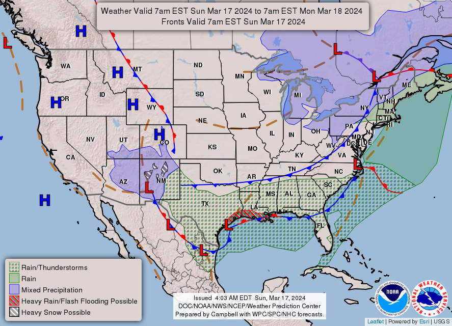
The bottom line is that things are trending colder into the upcoming week as a large upper level trough sits over southern Canada and far northeastern U.S.
These troughs act like giant gyres (Giant Gyres is my new band name, by the way, album coming out soon… do they make albums anymore?).
And so what happens is they send smaller disturbances called shortwaves around their southern and southeastern flanks and through New England with smaller disturbances that bring periods of rain or snow showers and breezy conditions.
Wednesday this week looks like the most substantial of these waves, though it won’t be a big storm at all, just an increased chance for rain and snow showers and it will bring a reinforcing shot of colder air for the late week period.
I’ll keep an eye on that weekend storm potential as well, but you can color me skeptical at this point. Still, I will monitor it!
Have a great day and if you haven’t already, or haven’t in a while, I hope you can chip in to support my reporting so I can continue through 2024… even $5 helps, thank you…
SECURELY BECOME A 2024
DHTWN SUPPORTER TODAY
(Options include Cards, PayPal, Venmo, Check)
Click–> https://westernmassweather.com/support-network/
>>> BE KIND <<<
“Hello babies. Welcome to Earth. It’s hot in the summer and cold in the winter. It’s round and wet and crowded. On the outside, babies, you’ve got a hundred years here. There’s only one rule that I know of, babies: Goddamn it, you’ve got to be kind.”
–Kurt Vonnegut
