
>>> YOUR DAILY CELESTIALS <<<
STAR:
–OUR STAR ROSE AT: 6:15am this morning
–OUR STAR WILL SET AT: 7:24pm this evening
–TOTAL DAYLIGHT TIME: 13 hours and 9 minutes
MOON:
–OUR MOON WILL RISE AT 8:31pm this evening
–MOON RISE DIRECTION: East
–OUR MOON WILL SET AT: 9:16am tomorrow morning
–MOON SET DIRECTION: West
–MOON PHASE: Waning Gibbous (97.0%)
~~~~~~~~~~~~~~~~~~~~~~
>>> DAVE’S WEEKLY WEATHER NUTSHELL <<<
–Chilly start leads to a seasonably warm finish with highs in the mid to upper 70s under plenty of sun
–Skies likely become hazy late afternoon and this eve as wildfire smoke works through the region, so sunsets may be colorful
–Lows tonight will dip down again into the 45-50º range under clear skies
–Warmer Saturday, highs mid 70s to low 80s, sunny, lows 50s. comfy humidity
–Sunday is more humid, warmer still, highs upper 70s to mid 80s, a few clouds possible with some isolated showers, otherwise dry
–Monday through Wednesday is very warm to almost hot with highs 85-90º through the stretch, with low potential for a low-end heat wave somewhere in the Springfield to Hartford corridor
–Plenty of sunshine throughout, and dry, and humid, with potential for showers/storms by late next week, but before we talk details let’s check a note from our local and delicious sponsor, #TandemBagelCo, with their newest location in the Stop & Shop Plaza on King Street in Northampton, MA.
~~~~~~~~~~~~~~~~~~~~~~
>>> A NOTE FROM OUR SPONSOR <<<
Dave Hayes The Weather Nut is Sponsored by Individual Community Members, Patrons & Tandem Bagel Company… No matter the weather, Tandem Bagel is always there for you at several valley locations to make your mornings brighter! With bagels baked fresh daily (including Gluten-Free options), house-whipped cream cheese, coffee, and tons of lunch options, Tandem is the perfect quick stop for lunch, breakfast, or a coffee and bagel to go. Find them in Easthampton, Northampton, Hadley, Florence, and West Springfield, or use their super-streamlined online ordering tool by visiting their website.
>>> MORNING DISCUSSION <<<
Good morning everybody, well I’ve been working ALL SUMMER LONG trying to produce these weather conditions for you, and it’s been VERY arduous, and in fact, if I’m being honest, I lost 4 toes, two fingers, an eighth of my nose, 793 hairs off of my scalp, and possibly a piece of my foot (I’ll get back to you about that), but I made it happen, and I hope you appreciate it!! ;-p
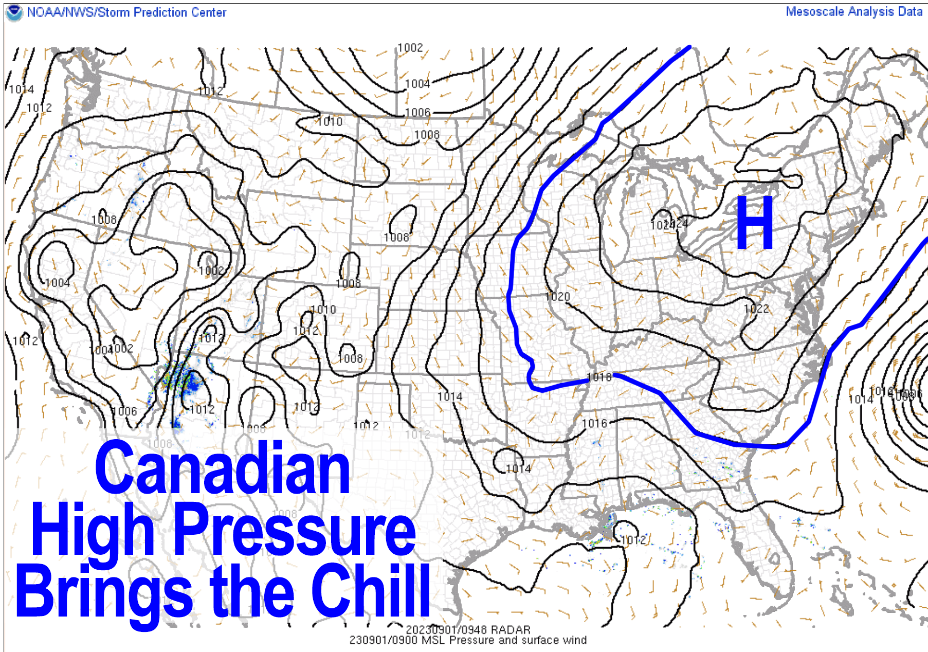
As it turns out, we’ve got a giant sprawling high pressure system floating eastward into New England today which has brought the chill (and a bit of fog in northwest MA and SVT which burns off soon) which will last into tonight as well before southerly flow develops this weekend.
Highs today will reach the upper 60s to mid 70s, with some upper 70s possible in southern areas (Hampden County, northern CT) under sunny skies.
We do have wildfire smoke from out west floating overhead later this afternoon, tonight and tomorrow morning, so the sunset and sunrise may be hazy. Lows tonight will dip into the 45-50º range with low humidity.
Saturday is our last low humidity day with more sunshine and highs in the 70s to low 80s with light wind and lows in the 50s.
By Sunday, humidity will be increasing as high pressure positions itself well east-southeast of New England and with clockwise motion around its center, southwesterly flow will bring in more humidity and warmer temps, with highs in the upper 70s to mid 80s on Sunday and dewpoints cresting 60º. We may see an isolated shower or two as well, but it’s a low chance as of now.
The Monday through Wednesday period is the hottest of this stretch, as we get a late-summer surge (it’s still summer, folks), with highs well into the 80s, with a few spots hitting the low 90s possible. We can’t rule out isolated heat waves for some towns, but it’s hard to get worked up about this, as it’s a transient burst of warmth within a summer that has seen not-as-hot temps as past summers, despite all the earlier flooding and bouts of severe weather.
By late in the week, we have to watch the remnants of Idalia as they may try to reform into a weak tropical system and retrograde back toward New England, but that’s a low potential outcome.
It’s more likely that we see another frontal boundary sweep in and bring some showers/storms to cool us back down by either that following weekend or as late as early the following week, which likely sweeps any Idalia-ness back out to sea and away from New England.
All in all, it’s steady as we go with plenty of sun, morning chill today and tomorrow, and then late summer warmth into the middle of next week. Enjoy and have a great day!
>>> BE KIND <<<
“Hello babies. Welcome to Earth. It’s hot in the summer and cold in the winter. It’s round and wet and crowded. On the outside, babies, you’ve got a hundred years here. There’s only one rule that I know of, babies: Goddamn it, you’ve got to be kind.”
–Kurt Vonnegut