>>> YOUR DAILY CELESTIALS <<<
STAR:
–OUR STAR ROSE AT: 6:11am this morning
–OUR STAR WILL SET AT: 7:31pm this evening
–TOTAL DAYLIGHT TIME: 13 hours and 20 minutes
MOON:
–OUR MOON WILL RISE AT 6:33pm this afternoon
–MOON RISE DIRECTION: East-Southeast
–OUR MOON WILL SET AT: 3:52am tomorrow morning
–MOON SET DIRECTION: West-Southwest
–MOON PHASE: Waxing Gibbous (89.7%)
~~~~~~~~~~~~~~~~~~~~~~
>>> DAVE’S WEEKLY WEATHER NUTSHELL <<<
–Patchy fog and low clouds should break up a bit into a partly sunny set up for today
–Highs reach the mid to upper 70s, with tolerable humidity (dewpoints in the low 60s)
–Lows tonight dip into the upper 50s to low 60s with patchy fog late
–Tuesday clouds up as a trough comes in from the west, and northern extent of moisture from Hurricane Franklin interacts
–Highs again reach the mid to upper 70s, and a few isolated showers are possible in the afternoon
–Humidity starts to come up Tuesday night with patchy fog and lows in the low to mid 60s
–Showers will also develop in at least part of the region Tuesday evening and night, and another period of showers is expected Wednesday
–Quite humid Wednesday before a cold front moves through the region, bringing breezy conditions Wednesday into early Thursday
–Fair weather may potentially rule the roost Thursday through Labor Day Weekend, but before we talk details let’s check a note from our local and delicious sponsor, #TandemBagelCo, with their newest location in the Stop & Shop Plaza on King Street in Northampton, MA.
~~~~~~~~~~~~~~~~~~~~~~
>>> A NOTE FROM OUR SPONSOR <<<
Dave Hayes The Weather Nut is Sponsored by Individual Community Members, Patrons & Tandem Bagel Company… No matter the weather, Tandem Bagel is always there for you at several valley locations to make your mornings brighter! With bagels baked fresh daily (including Gluten-Free options), house-whipped cream cheese, coffee, and tons of lunch options, Tandem is the perfect quick stop for lunch, breakfast, or a coffee and bagel to go. Find them in Easthampton, Northampton, Hadley, Florence, and West Springfield, or use their super-streamlined online ordering tool by visiting their website.
>>> MORNING DISCUSSION <<<
Good morning everybody, thankfully there isn’t a ton to talk about in the weather department in terms of late-summer severe weather, as we’ve already more than enough to handle and endure this Summer.
Of course, at this time of year we start looking south toward the tropics for tropical storms and hurricanes, and such systems are taking shape now with Hurricane Franklin and Tropical Storm Idalia.
For now, both storms look to stay well southeast of New England, though some mid to late week swell and/or rip current potential does exist, so be mindful of your local statements down on the south and southeast coasts of New England and Long Island if you are heading that way this week.
For us here in the greater WMass region, it’s really #NoBigWhoop weather, with one period of inclemency followed by the potential for a real multi-day dry period.
Of course, we’ve had enough cooler air aloft and humidity at the surface this summer to produce instability and prevent truly 100% dry days, but a Nut can dream, can’t he?
Yes, yes he CAN dream, and will continue to hold hope for a haymaking bonanza late week through the weekend.
As mentioned, over the next 24 hours it should be mostly dry with only a spot shower possible with highs in the mid to upper 70s today and tomorrow with lows either side of 60º tonight (partly sunny later today, patchy fog tonight, and mostly cloudy tomorrow for sky cover).
By Tuesday afternoon some scattered showers are possible, but it looks like best dynamics and interaction with the northern moisture from Franklin is in far southeast New England.
We have a better chance for showers Tuesday night and again Wednesday as a trough pushes east into the region, and swings a cold front through the region.
So Tuesday night into Wednesday late afternoon looks like the best chance for at least a couple of periods of showery weather, followed by wind veering out of the northwest and gusting up to 25mph or so Wednesday night into Thursday morning as much drier air advects into the region out of Canada.
This is the air flow that will shove Franklin and Idalia well out to sea, as it looks now.
Whooo hoooo!!!! I’m ready… make it happen, Atmosphere!
Thursday and Friday both look lovely with mostly sunny skies with highs in the low 70s each day, and lows in the low to mid 50s.
High pressure builds east-southeast into New England and then off of the coastline by Saturday or Sunday, which puts us in a return southwesterly flow, which will warm us up for the second half of the Labor Day Weekend.
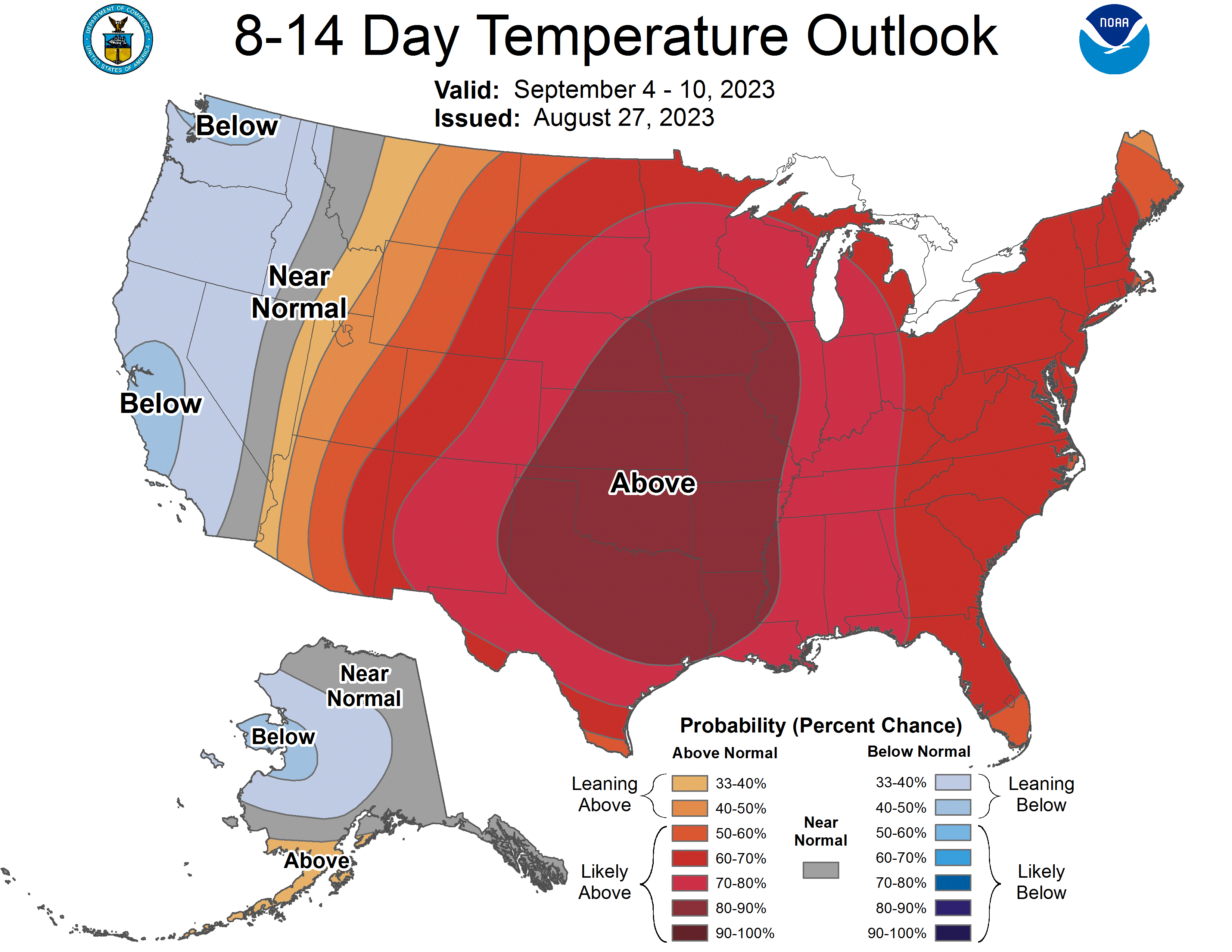
Highs by Sunday and Monday should be cresting into the low 80s, and next week looks quite warm, with highs potentially in the low to mid 80s with moderate amounts of humidity in place for a truly late summer feel.
However, at the moment, I don’t see any big frontal passages or storms, so let’s hope it stays that way…. we deserve a multi-day run of sunshine! #RUNSHINE
Have a great day!
>>> BE KIND <<<
“Hello babies. Welcome to Earth. It’s hot in the summer and cold in the winter. It’s round and wet and crowded. On the outside, babies, you’ve got a hundred years here. There’s only one rule that I know of, babies: Goddamn it, you’ve got to be kind.”
–Kurt Vonnegut
