 Good morning everybody, the big news today is monitoring the Connecticut River as it receives and carries flood water runoff from upstream in Vermont and western New Hampshire and carries down through the Pioneer Valley of WMass towards the Atlantic Ocean, and the resulting flooding that is expected, which looks worst between Montague and Holyoke, including Northampton and The Oxbow.
This is obviously very bad news for many, and some could experience major crop losses, so I know I’ll be kicking some extra money to my farmers this year, hopefully you will too, as we are so blessed to have the farmers we have in this river valley in which we find ourselves. They will need our help going forward, and we need healthy whole foods.
As for our weather, we’ll see a pair of sunny summer days today and tomorrow with less humidity today, and more tomorrow with evening/overnight scattered showers ahead of a big moisture increase expected for later Thursday into Friday when yet another shortwave will bring periods of showers and thunderstorms into our region that could revisit us over the weekend and into early next week, but before we get into a summary below, let’s check a note from our local and delicious sponsor, #TandemBagelCo, with their newest location in the Stop & Shop Plaza on King Street in Northampton, MA.
~~~~~~~~~~~~~~~~~~~
>>> A NOTE FROM OUR SPONSOR <<<
Dave Hayes The Weather Nut is Sponsored by Individual Community Members, Patrons & Tandem Bagel Company... No matter the weather, Tandem Bagel is always there for you at several valley locations to make your mornings brighter! With bagels baked fresh daily (including Gluten-Free options), house-whipped cream cheese, coffee, and tons of lunch options, Tandem is the perfect quick stop for lunch, breakfast, or a coffee and bagel to go. Find them in Easthampton, Northampton, Hadley, Florence, and West Springfield, or use their super-streamlined online ordering tool by visiting their website.
~~~~~~~~~~~~~~~~~~~
DISCUSSION
Good morning everybody, I will start by saying if anyone has anymore news about what is transpiring in Vermont this morning in terms of the U.S. Army Corps of Engineers warning that was issued last night, as well as any other issues up that way, please post information below in the comments. I know that the City of Montpelier is under water, and has major problems it is dealing with in what will be the second worst flood in recorded history, only to be outdone by a great flood in 1927 during which the Winooski River crested to 27 feet (today’s is 22.7 feet, but is still a major flood).
As we know, all of this water ends up shedding into the Connecticut River and this has already put our river into minor flood stage at Montague and Northampton, and is expected to increase to moderate flood stage by about 6pm in Montague today, and by about midnight in Northampton and Holyoke tonight, and tomorrow morning down in northern CT. Springfield is not expected to flood.
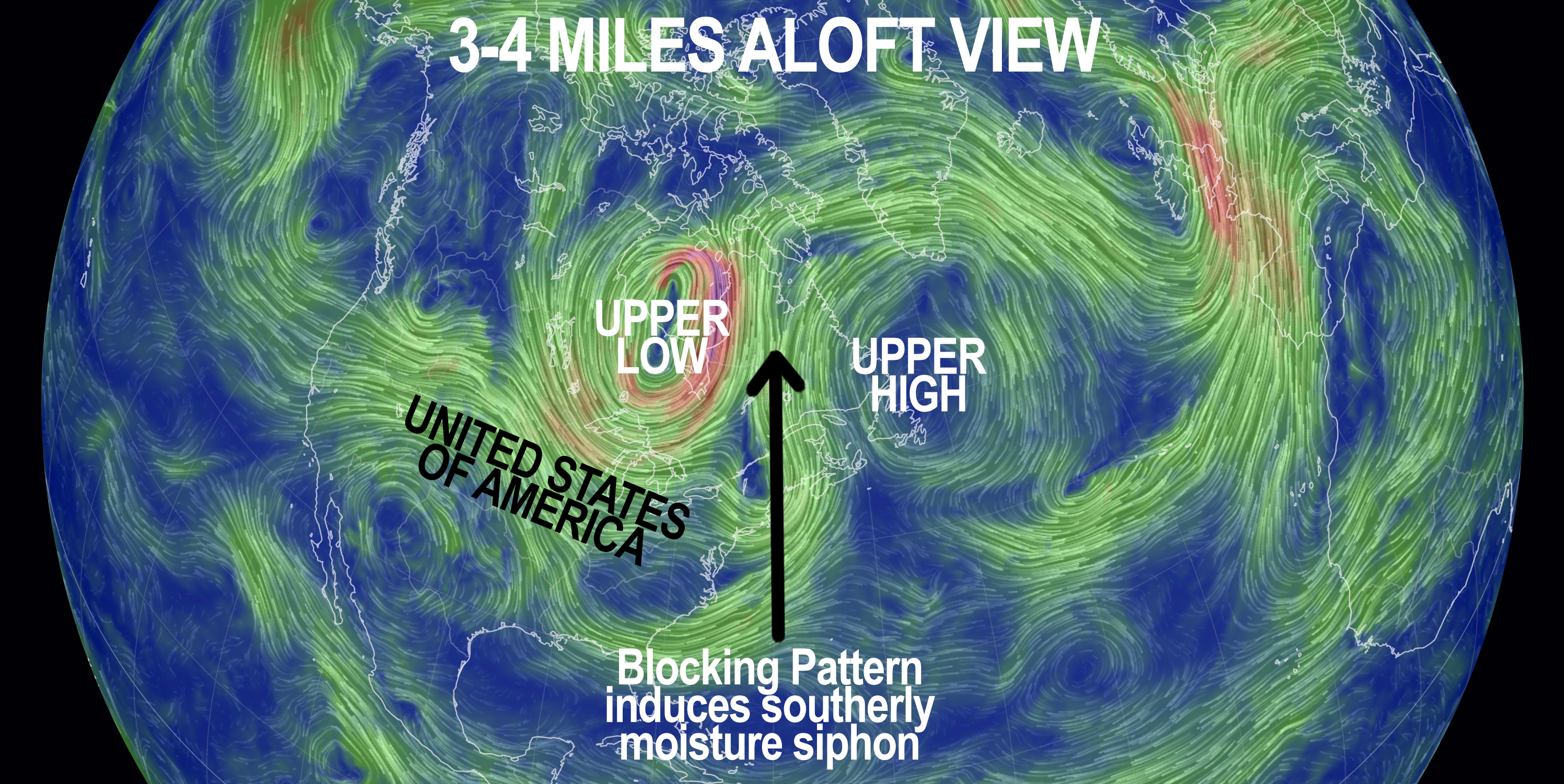
As for our weather, we have drier air being funneled in behind this highly anomalous low pressure system that is still raining on parts of northern VT this morning and pulling northeast and away into Atlantic Canada.
This will produce a couple of summery sunnier days today, with some morning clouds and then fair weather clouds later with highs well into the 80s today, and slightly lowered humidity.
An isolated shower is possible and lows will drop to the low to mid 60s under mostly clear skies.
For Wednesday, humidity and heat increased and highs should reach the upper 80s to low 90s under mostly sunny skies. However, we could see an area of scattered showers push into the region by late in the day and/or overnight into early Thursday morning. Lows will dip into the mid to upper 60s and it will be humid.
On Thursday, clouds will increase along with moisture, as another shortwave in the mid-levels ripples our way.
Highs will reach the mid to upper 80s with increased humidity, and scattered showers and thunderstorms will be possible as wind shear increases overhead by afternoon and evening.
Some storms may become strong to even marginally severe, and wane at night with lows in the mid to upper 60s.
Friday looks like another showery day at this point with some sunny breaks and highs in the low to mid 80s. Thunderstorms are possible as well.
The weekend is looking mixed at this point with warm temps in the 80s, but potential for scattered showers and thunderstorms as we continue with a very humid air mass that should continue into early next week.
The next chance we could see for a reprieve in these conditions is by mid to late next week, so for now, we’re in the soup, but at least I don’t see any major widespread rainfalls like we just experienced in the near future.
Be well, Dave.
