Good morning everybody, I was at the Green River Festival last night and it was a total blast, aside from one small batch of showers, it was dry, breezy and lovely with tons of great music!
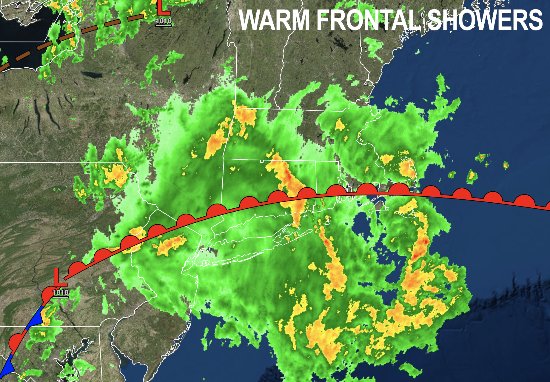
If you’re heading there today, we’re already seeing that it’ll be a wet start which was expected, and rain intensity will vary this morning depending throughout the region.
These showers are associated with a warm front that is pushing north into the region, and will allow temps to really surge Sunday, rising into the mid 80s especially if we get some sunny breaks which I expect we will.
Getting back to today, highs will reach the mid 70s to low 80s and while some areas will pour this morning, other areas will see steadier light to moderate rainfall. All of this activity should move through the region by early afternoon, hopefully out of here by 1-2pm-ish
Once this first round clears the region, we could still see some isolated to scattered showers or thunderstorms later this afternoon and evening, but severe weather is not expected if any storms do form in the region, and some of us will stay mostly dry as any activity should be isolated if it does form.
The main issue with any showers or storms that do form today or tomorrow is that the wind field aloft is fairly weak, so these cells would be slow-movers, and as such could drench the ground where they do fall.
Muggy conditions will continue through the day and night, and the entire weekend for that matter.
Lows tonight will drop only into the mid 60s so it will be a mild, sticky night with patchy fog forming in spots as the dew points and air temps shake hands.
Personally, I think the thunderstorm risk is greater for Sunday than today. Greatest likelihood of impact timing would be tomorrow afternoon any time from about 3-4pm onward.
This belief is predicated on the expectation for some sunny periods tomorrow mixing with a very humid air mass that could trigger thunderstorm development, though any storms would be scattered in coverage, not widespread.
Highs Sunday will reach the upper 70s to mid 80s, and the main threat with any storms that do form would be torrential rainfall and localized street flooding.
Again, I think the best chance for storms or downpours tomorrow is 3-9pm, waning with the setting sun. Lows will be in the mid 60s again, also with patchy fog.
As the upper low associated with this system tracks out of the region, another upper low drops into the Great Lakes and heads east to take its place, yippeee!!!
Monday looks like scattered showers are pretty likely with highs mid 70s to low 80s, but it’s the Tuesday to Wednesday timeframe that holds the larger potential for strong to severe thunderstorms with wind and hail and frequent lightning.
I will update as we get closer, to try and refine timings and impacts, but for now that is the period next week I am keeping my eye on.
Highs will be in the 70s to near 80º through the week, and lows near 60º with humid conditions throughout the potential for at least scattered afternoon showers in that late-week period.
The overall trend is for less wet weather as we get towards next weekend, but we’ll have to keep two eyes on Tropical Storm Cindy as the track of that system brings it east of the Bahamas, which means it could get swept up to New England and cause issues for the following weekend, so I will keep track of all of it and report to you.
Have a great day!
